Jeremy Perez
Supporter
chaseable, map
Thanks for that diagram Skip!
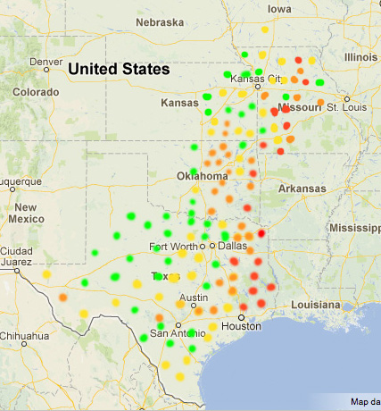
Last year when I was looking at some setups that might tempt me east of I-35, I hit Google Earth and started browsing locations using Street View to sample the terrain at ground level. I worked up a map to give me a sense of what I could expect if I wanted to drift into those areas and plotted a marker at each area viewed. It's something I've been meaning to jump in and start taking more samples, and also adding contours for where gridded roads give way to sparse & cobwebbed.
Green = Perfect
Yellow = Very good but with some vegetation & terrain influences
Orange = Increasing vegetation & terrain, but still opportunities for vantages
Red = suicidal tendencies


