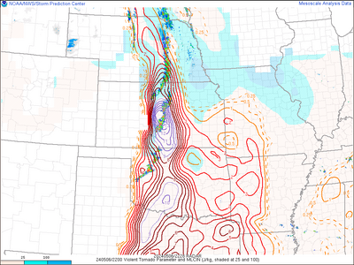
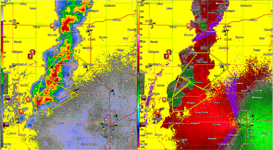
During the last tornado outbreak the cb-WoFS website was in and out throughout, presumably due to extremely high visitor count and server hits/requests. I wouldn't be at all surprised if a similar behavior is noted today. Don't depend on the site being available.
-
While Stormtrack has discontinued its hosting of SpotterNetwork support on the forums, keep in mind that support for SpotterNetwork issues is available by emailing [email protected].
You are using an out of date browser. It may not display this or other websites correctly.
You should upgrade or use an alternative browser.
You should upgrade or use an alternative browser.
2024-05-06 EVENT: TX/OK/KS/NE
- Thread starter Dan Robinson
- Start date
Dan Robinson
EF5
Arrived in Medicine Lodge, Kansas about an hour ago. I'm about 90% committed to the dryline storms rather than the indicated lead activity farther east. I fear that the latter may not become established in time. I also held off pursuing the storms that initiated at DDC as 1.) a good chance I'd not make it even with a straight shot north at them and 2.) initiation looks imminent farther south. I don't see any one area in and just outside of the high risk that looks more favored over another. I do think southern Kansas may have more daylight activity than farther south, which is why I chose to target here. Slightly concerned about storms lining out up here, but so far that doesn't seem to be occurring.
I just found an even more ridiculous cherry picked sounding near Tecumseh, OK for 03Z.
STP of 23.9 is flat out insane.

I note that sounding is contaminated though and may have been taken too close to convection, a low, etc. I speculate that is why there are parameters basically outside of reality.
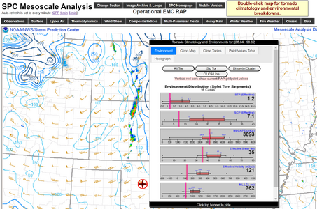
I like the SPC RAP mesoanalysis and surface observations tools once on the morning of storms and tend to ignore most medium range model outputs, maybe a glance at a few CAMs. Current RAP hourly shows much more sane helicity, among other things, in the area. Trending toward 200-300m2/s2 by 21-00Z. SigTor is ~5-6 in some areas.
Not downplaying the event, much of the area is already statistically primed for SigTor according to many data sources, including the RAP hourly.
RAP Hourly SigTor statistical assessment @ 3PM CDT
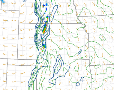
I was going to add that moisture convergence hints at convection soon on TX panhandle/OK border but radar shows it is already starting. Good luck to all who are out, the chaos has begun.
RAP Hourly Surface Moisture Convergence @3PM CDT
Mark Gressman Jr
Supporter
18z NAM3K is still showing tail-end charley further south than the RAP and HRRR. 0-1km takes off with the low level jet around 00z, and STP and helicity tracks are pegged. The 23z forecast sounding for south of Norman shows 3,900 CAPE and 350 0-1km helicity without convective contamination. Not sure if the temp discrepancy at 700mb, or the position of upper support is the reason for the disagreement with the other CAMs, but if that verifies, that's where I'd wanna be.... even with the close proximity to OKC.
Jamie H
EF3
KWTV in OKC will be broadcast on Tyler Media if anyone is looking for radio coverage while chasing.
 tylermedia.com
Radio – Tyler Media
 tylermedia.com
Mike Smith
EF5
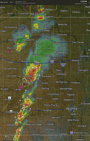
First tornado warning of the day for a radar indicated tornado near Larned, KS.
Personally, I think the storm near Great Bend has even better tornado likelihood.
Personally, I think the storm near Great Bend has even better tornado likelihood.
Jesse Risley
Staff member
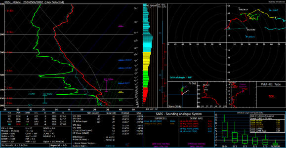
NSSL 20Z sounding at I-40 and Hwy 281 S of Geary shows a pretty stalwart cap further south. The storms out in western Oklahoma are still west of the primary moisture gradient so they'll need some time to mature as they work east. In the immediate term, the primary tornado risk will probably remain over west central Kansas until the Oklahoma storms work into better moisture and/ or see some erosion of the convective inhibition.
Attachments
Mike Smith
EF5
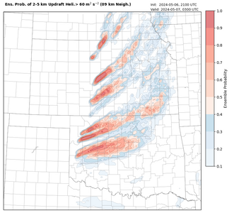
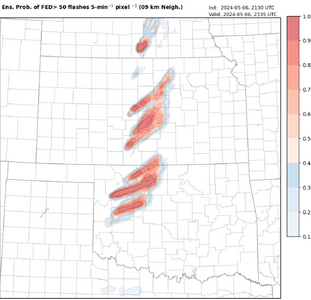
21Z WoFS seems to finally be narrowing in on a solution for the rest of the afternoon and early evening. Very nice depiction of the gradual loss of predictability with the probability plumes gradually diffusing in space with eastward extent.
Attachments
Jason N
EF5
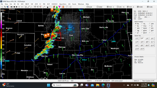
that's exactly what I have been looking at and I think you're right based on current radar picture/presentation. I was looking at the 9km 50 strokes, gives a similar visual.21Z WoFS seems to finally be narrowing in on a solution for the rest of the afternoon and early evening. Very nice depiction of the gradual loss of predictability with the probability plumes gradually diffusing in space with eastward extent.
Jesse Risley
Staff member
Dan Robinson
EF5
Activity northeast of Pratt is lining out, looks like garbage at 5:45pm.
Jason N
EF5
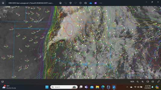
I am kind of wondering if the clouds to the east of the CI locations kept SFC temps a little lower than what the Models forecasted, perhaps stunting the environment a bit compared to the forecast?? just seems like the CAPE environment is rich but its surprising to see how long its taking, the shear component is keeping the radar presentation active for sure, guess the LLJ needs just a bit more looking at hodo's, but to me the mid upper level nose of the jet and trough should be in its best position now and in the next 1-2hrs.

Brian McKibben
EF3
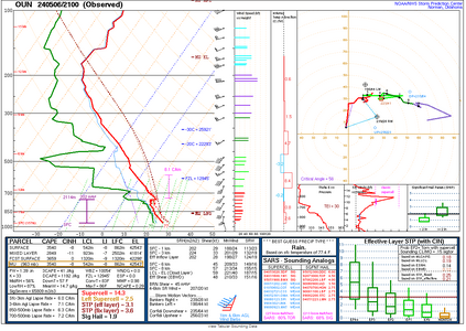
Per GOES West Meso Sector, you can see agitated cumulus and TCU in southern into central Oklahoma. The CAP was weakening per the 21z sounding out of OUN.
I am not sure if we will have enough time for open warm sector storms though.
I am not sure if we will have enough time for open warm sector storms though.

