State of the Chase Season 2021

Status
Not open for further replies.
Par for the course this season, I guess it’s safe to say yesterday’s northern Plains event underperformed. I wasn’t able to follow the situation consistently throughout the entire evening, but the few times I checked radar it looked underwhelming. The one tornado-warned storm appeared to be embedded/semi-discrete, not discrete, at least when I looked at it. Only 3 SPC tornado reports, although one was a wedge. Curious whether it was photogenic or if any chasers were able to get close enough for a good view, I can’t imagine the road network is great out that way…
 
Enhanced risk added for parts of Kansas today, but it's for 30% wind with "less than 2%" probability of a tornado within 25 miles of a point anywhere in the CONUS. #2021ing
 
Par for the course this season, I guess it’s safe to say yesterday’s northern Plains event underperformed. I wasn’t able to follow the situation consistently throughout the entire evening, but the few times I checked radar it looked underwhelming. The one tornado-warned storm appeared to be embedded/semi-discrete, not discrete, at least when I looked at it. Only 3 SPC tornado reports, although one was a wedge. Curious whether it was photogenic or if any chasers were able to get close enough for a good view, I can’t imagine the road network is great out that way…

The pics that came out the last couple of days that I saw were pretty impressive. Amazing mothership on Wednesday the 9th and the tornadoes yesterday were visible from time to time and had some amazing structure with a tornado underneath a sculpted updraft.
Problem was these storms were in central Montana and then the MT/ND border yesterday.
We had a severe tstorm watch issued here for eastern Nebraska. The first watch of 2021 for my part of the state. The watch was issued at 8am and expired at 11am if that also says anything.
At least it rained for the first time in 2 weeks here and thundered for maybe the 3rd time this ENTIRE season.... No severe weather locally, but some gusty winds west and south of here.
I have an entire week free next week, in the middle of June and it looks pretty hopeless again.
 
We got our 2nd SVR warning of the year for the entire CWA yesterday. A pulse thunderstorm in the middle of the afternoon at the pool. Ironically the warning back in March and yesterday were in the same areas, so I guess its kinda cool to have been under the "only" 2 warnings of the year, but still a sad feat on June 11th.
 
I haven’t been on here complaining yet this year, so I’ll give it a bit of a go here. Since I retired last year I pointed to this year with a goal of chasing everything. Fate had other ideas. Other unexpected commitments and the lack of even modest setups when I could go have left me with just one chase day up to this point. Just one day in Kansas, which produced nothing during the daytime, is all I have to show for my “big” year. Now I just watch the GFS throw darts into my back every time I start to think a good couple of days are just a week or so away. It’s been frustrating. I feel like Charlie Brown trying to kick the football as Lucy (GFS) pulls the ball away and I end up on my back again and again.
We’re all getting kind of used to bad years here, so if we’re expecting anything more than that, it’s on us. There’s a zero percent marginal by me tomorrow and I’m pretty excited by that. I’ve barely heard thunder yet this year and I’ll be thrilled to see it! If I get some hail I’ll probably do a dance. This will be the end of my whine fest for now. I’m just going take whatever I can get and be thankful for every little thing I see, because come January I’ll be begging for even a little thunder.
 
Par for the course this season, I guess it’s safe to say yesterday’s northern Plains event underperformed. I wasn’t able to follow the situation consistently throughout the entire evening, but the few times I checked radar it looked underwhelming. The one tornado-warned storm appeared to be embedded/semi-discrete, not discrete, at least when I looked at it. Only 3 SPC tornado reports, although one was a wedge. Curious whether it was photogenic or if any chasers were able to get close enough for a good view, I can’t imagine the road network is great out that way…

I was up on the SD/ND border that day.. staged out of Buffalo SD... 2 things I think played into the underwhelming result.. cirrus shield and some kind of subsidence/Cap which prevented alot of the cells from maturing, there were alot of juvenile storms but unless it was co-located with the actual front, nothin materialized.. I was not happy, later that evening as the boundary kicked out, storms fired but it was primarily nocturnal. so really a Bust day. the videos that came from the cells in MT/SD were decent, and I saw the video of the wedge, seemed pretty heavily rain wrapped.
 
I think some posts lamenting past chases belong in the companion thread Chase Season 2021 In Review.

Anyway later this week could be a northwest flow set-up in the Upper Midwest. I have no plans to travel for it though. Sunday also offers a possible Nebraska Iowa special, but with the front pushing on through (not mutli-day). Monday in the Midwest?

Then unseasonably low 500 mb heights with moderate flow is forecast for the Northern Plains a few days next week (of June 21) after the surface front returns north. Midweek? At any rate it looks like the Northern season is not cancelled.
 
I’ll probably be out around the Wisconsin/Minnesota border this coming Thursday. After that it looks like around every two to three days there could be a gem or two for those willing to go the one and done route. Challenge accepted.
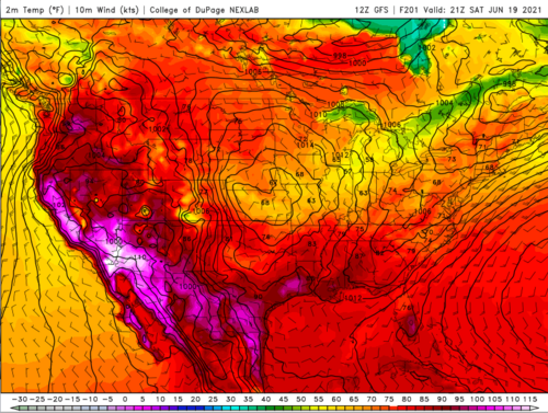
Just to piggyback a bit on Jeff’s post, after seeing the temps hitting the triple digits in Canada I kind of had given up hope. The next couple of weeks could serve up a nothing burger still, but seeing potential as far South as Kansas on the docket has lifted my spirits again.
 
Keeping an eye on Thursday and Friday locally here. Thursday features extreme instability, modest low level shear, and a 50 knot 500mb jet max moving into Eastern IA at 00z. While the tornado and supercell parameters are spiking, this definitely reminds me of something that could be a long lived wind event with high instability + shear combo persisting well into the night. Not to say there won't be a couple hours at onset or if we get storms even at all during the day (CIN is high, its Iowa in June lol).

Then watching the front slide south a tad on Friday and pretty much the same setup over IL/IN/MO with extreme CAPE and rather meager low level shear, probably another wind/hail day with the outside chance of a tube if you are very lucky.

Not the best June setup's I've seen, but I could see Thursday turning into something decent if we do get day-time initiation across Central/Northaest Iowa. Probably bite if it looks good since its only a 2 1/2 hour drive or so.

PS I wouldn't discount Wednesday (6/16) across Eastern SD/Western MN either. Could be a late show with a couple supercells evolving into an MCS again. Tis the season! Long range looks like we will have several of these chances coming up into the end of June.
 
Oh yeah @Ethan Schisler those are all local chase days if one lives there. I'd be going to Lieowa on Thursday and try IL/IN Friday. Northern Missouri is quite chasable compared to southern Mo; but as you know, central IL into northwest IN is prime time flat open chasing.

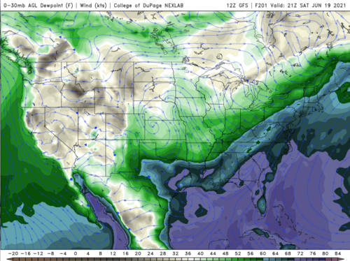
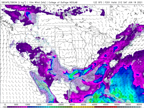
Might get a more robust version early next week, if tropical remnants don't interfere with the wind fields. SPC is feeling it for Sunday Upper Midwest. ECMWF verbatim is Monday on the Indiana Ohio border, which is also a flat open region with good roads. However the good chasing ends farther east.

Finally I managed to jinx Nebraska with my post on Monday. Anything late next week (Days 8-10) now looks like the Upper Midwest on NW flow. The modest Nebraska flow is gone. Still, the state of the North / late season looks good.
 
I'm probably sitting today out. Lack of model agreement on day-time initiation has me on edge for what looks like a 5+ hour drive up to SE MN/SW WI (awful terrain). Tomorrow is looking more interesting locally. Tornado threat is probably brief, but there appears to be a window for significant damaging winds and hail (perhaps some HP storm structure). I'll take that an hour or two from home. See what happens today, if something can fire up within 2-3 hours of home, I'd be game, but right now I'm not liking the prospects. Also the 850mb moisture across much of Iowa is absolutely awful. Go up a couple thousand feet and have a nose bleed lol. Hopefully that doesn't translate into tomorrow. Beyond tomorrow, we have a shot in the Midwest on Sunday and then a cf clears the area for a few days.
 
Maybe the Sunday through Monday trough will be better in the Midwest. Saturday and Tuesday are possibilities back East, but that's only for really local chasing.

Late next week zig zag continues. Nebraska and Kansas are back in the game but always Days 7-10. Also need the 700 mb furnace to back off a bit. It tries to fire up again Wednesday.
 
Status
Not open for further replies.
Back
Top