State of the Chase Season: 2015 Edition

Troughs - some vigorous negative-tilt - have been coming each weekend like clockwork. That should be great for chasing, except that early crapvection has been our CAPE killer. In late May/early June, even weak shortwaves with healthy instability could make big storms. But this year's anemic EML has given us a rainy pattern for weeks now. I hope we can break the cycle and get the CAPE back up to a more normal 3000-4000 level. Then with even a few ripples in the SW flow we would be back in business. That's how it looks to me anyway.
 
GFS has been teasing some northern Plains/upper Midwest possibilities in the first week of June. Decent instability, the 500 MB winds vary from run to run, from totally anemic to 40-50kt SW/W/NW flow over the warm sector. That would suit me just fine since I'm on vacation that week.
 
Hopefully we don't have to write off the upcoming week just yet, as it is the second and last week of my two week chase vacation. For those of us that don't live out here, it is very painful to leave unfulfilled and have to wait a whole year for the next opportunity. If you live out here, at least you have some hope for another whole month at least... Anyway, with a generally southwest (though weak) flow pattern and plenty of moisture in the southern Plains much of this upcoming week, I am hoping we can squeeze out at least a couple of mesoscale events.
 
Looks like our ol evil nemesis makes his way in next week. Yep, looks like Death Ridge is showing up on the GFS. Big 500 mb high sitting in central TX. Although, if it stays that far south, the central/northern Plains may still squeeze some tornadoes out. We see this a lot in June/July with westerly flow on the northern periphery of the high, producing some very photogenic tornadoes. Regardless, I'm not totally sold on the last week of May and June shutting down yet. Some subtle impulses do show up as well. With the moisture staying put, this makes several days looking good. Don't think we'll see very many large synoptic systems rolling in though. What worries me is what @Jeff Duda talked about on my podcast, which is all this rain. Sure, its very beneficial, but it's not helping with the EML issue. And weak EML with any sort of forcing on the dryline could mean even more rain. It will be interesting to see how the season plays out between now and let's say the end of June.
 
Well, I gambled a bit by waiting until the first few weeks of June to chase (new product launches at work, family commitments, vehicle issues), but that's cool. I have no issue chasing the northern Plaines and southern Canada if needed. Four weeks of vacation coming next year, so I'm not really feeling too bad about missing some events out there this spring. Plus, who knows. We could be in store for another Fall like 2013..
 
While the rain in Colorado is extremely beneficial for drought and agriculture, I hate it because all my dirt roads are mud bogs and thus can't get to any of my favorite photography spots.

On the bright side, had a quick lunchtime chase today and witnessed a very nice wall cloud just a few miles from home.
 
This is the first time I’ve delayed my chase vacation until June. Mid-to-long-range GFS continues to confound me run after run. I don’t mind chasing all the way up to Canada, but I’m not sure even that is going to do the trick. There’s too much n00b in this brain of mine to have a feel for whether this will be overcome in a more isolated fashion. I’m starting to troll through SPC storm reports from Junes-gone-by to see what analogies might serve up.
 
Looking like the shift to the central and northern High Plains is coming in right on schedule. After tomorrow it looks pretty dead for the end of May but some NW flow opportunities in the TX/OK PH up through SE Colorado look like a distinct possibility along with the next impulse coming out of the central Rockies around midweek next week. Might be time to start packing it in across the southern Plains, especially with the source region for the EML down here repeatedly getting rained on.
 
Yeah I let myself get a little too concerned yesterday morning. More recent runs of GFS and ECMWF are suggesting less miserable H5 flow and more useful impulses next week. The upper level jet is still looking like it might be somewhat allergic to the central plains, so it has me wondering if HP will still reign supreme.
 
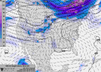
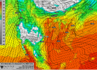
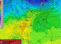
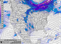
To your point @Jeremy Pérez, and this is just one snapshot of one day. Yeah, the H5 flow isn't 100 kts but its not 25 either. I'm liking next week more and more. Looking forward to finally putting down the 55 hour work week and getting out there.h5.PNG surface_dews.PNG 700_mb_temps.PNG
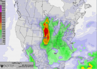
ml_cape.PNGsounding.PNG
 

Attachments

  • bulk_shear.PNG
    bulk_shear.PNG
    1.4 MB · Views: 204
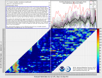
FWIW, the CFS has been showing a lot of widespread "hot" activity throughout June and into July as well, as seen in the chiclet chart from Greg Carbin. I've noticed the CFS has not performed very well this spring as far as picking up on the bigger troughs with lead time. In fact, for some of the bigger days, the CFS didn't show any consistent signal until as late as 3 or 4 days out. In the past it has given some indications as far out as 10-12 days. It seems to suggest the first 10 or so days of June will be inactive or very spotty (signal seems to get pretty coherent and accurate within 10 days or so) with activity increasing afterward. I still think June will have a lot of tornadoes since it's climatologically favored. The EML source region is still very wet and only in the last few days have I started to notice 10+ C 700 mb temps coming out of that area, so I think capping, or rather lack thereof, will continue to remain an issue until much later next month (barring a sudden and complete cessation of precip across the entire southern and central US), but I think it will gradually improve. I can't speak to the trend for troughing and cyclogenesis events. They indeed tend to get weaker and less frequent during June, and the CFS seems to indicate pretty much normal 500 mb heights during the late June-early July period, with some cool 850 mb temps in the southern plains area.

GC_chiclet_chart.png
 
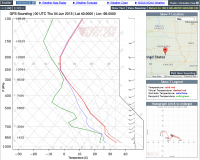
Chris, I would say that next week actually looks to have some possibilities. GFS is forecasting a lot of cape and some good 850s on a few of the evenings next week. It does look like capping could be an issue. The 500s and 250s are far from impressive, but this is a pretty decent looking sounding from the GFS 06z run earlier.
06_GFS_114_45.44,-99.63_skewt_ML.gif

I think if some things work out, next week has some possibilities on a couple of days.
 
I have to think that the prospects for an active June would be above average this year. Climatology favors an increase of extreme instability days in the southern/central Plains. Normally, that CAPE goes to waste due to the thermonuclear cap usually in place by early June that far south. That's assuming a western trough and southwest midlevel flow of at least 20-30kts over the Plains. That said, I've never personally observed or read about a season quite like this one, so beyond that I'm really not sure what to expect. It will be interesting to see how it plays out.
 
Back
Top