• A friendly and periodic reminder of the rules we use for fostering high SNR and quality conversation and interaction at Stormtrack: Forum rules

    P.S. - Nothing specific happened to prompt this message! No one is in trouble, there are no flame wars in effect, nor any inappropriate conversation ongoing. This is being posted sitewide as a casual refresher.

State of the Chase Season: 2015 Edition

James Gustina

Supporter
I think it was @Jeff Duda who said that we had moved beyond the pre-season and were into the actual chase season which would require a different thread so I thought we may as well get the ball rolling before the next slew of troughs rolls in. This thread can be used to talk about distant pattern shifts, how your season is going so far, climatology or anything else related to the 2015 chase season you can think of.
 
I should add to my post from the previous thread that spring green-up appears to be underway across Oklahoma, but it seems to be occurring slower than in prior years. Buds started appearing two or so weeks ago and there are many trees with small leaves now, but much of the grasses still appear brown, and there are still issues with grass fires across the southern Plains. I'm not sure exactly what the climatological curve of greenness vegetation fraction with respect to time is in the region, but the departure from average greenness shows we are indeed behind schedule with green-up so far this year.

da1panel.png


The positive side of that is that reduced vegetation reduces water stress, which keeps soil moisture from dropping like a rock after a few days with no precipitation. On the negative side, reduced vegetation means reduced latent heat flux, and thus drier PBLs. Obviously that will change, and soon, but such a soil-vegetation state will have some negative impact on storm systems in the near-future.
 
Don't look now, but today's 12z ECMWF deterministic run has a high-amplitude trough crashing into the Rockies around 8 April with rich low-level moisture in place over the southern-central Plains. While even the generalities of any trough beyond D8 are low-confidence, there's increasing confidence that our pattern over the next week will help to establish seasonably rich moisture over the southern tier of states. That opens the door to a significant event if the details of any subsequent trough translating across the western CONUS work out favorably. I'm becoming a bit more optimistic about the chances for a "real" chase day during the 8-10 April timeframe, with drought- and greenness-related impacts (outlined nicely by Jeff above) my biggest concern at this range.
 
Seconding Brett's thoughts above, it does appear that the springtime battle of airmasses is beginning. Haven't had time to look at any models, and my own chase trip is seven weeks away, but a quick read of the SPC outlooks this morning shows a few days of activity this week (although not particularly favorable for chasing) and a mention of a west coast trough emerging around/after Day 8.
 
"Watch as the elusive Red River dryline stalks its natural prey: the meth lab of SW Oklahoma..."

All joking aside, Monday/Tuesday have been trending in a good way so far on the GFS.
 
Trending in a bad way for my area of IL though, that Warm Front keeps dropping farther and farther south...
 
"Watch as the elusive Red River dryline stalks its natural prey: the meth lab of SW Oklahoma..."

Anyone else hear this in your head as either Steve Irwin's voice, Morgan Freeman, or David Attenborough's?


While I'm really happy with next week's prospects the early part seems plagued with cap bust potential. I am however extremely biased toward that latter half of the week when I can actually chase. It probably makes sense for this to cook a littler longer. The pattern that is, not the meth.

itgoesto11.JPG .

I especially like Thursday. "It goes to 11"
 
Anyone else hear this in your head as either Steve Irwin's voice, Morgan Freeman, or David Attenborough's?


While I'm really happy with next week's prospects the early part seems plagued with cap bust potential. I am however extremely biased toward that latter half of the week when I can actually chase. It probably makes sense for this to cook a littler longer. The pattern that is, not the meth.

View attachment 7401 .

I especially like Thursday. "It goes to 11"
DID SOMEONE SAY ELEVEN?

Note: Clicking that link will take you down a rabbit hole of music you will generally be unable to comprehend.

Weatherwise though, I have to say latest GFS run very promising, keeping those Capes (and caps) high on Monday - Thursday, and at least moderate 500mb flow on top of it the whole time.
 
The forcing each day with little impulses shooting out ahead of the main jet makes me less concerned about cap busting Monday/Tuesday but its definitely something to look at.
 
The medium-range models are showing a noticeable uptick in the amount of western US troughiness coming up, that's for sure. It looks like the system that had been previously forecast around the Tuesday timeframe has been shoved back to at least Wednesday, but really more Thursday in the GFS. The 00Z ECMWF suggests Wednesday may be "the day" next week. The CFS shows a lot of short waves coming by late in the month.

One positive factor in all this is that the Gulf (more the western half than the eastern half) is pretty juicy and the current front is not forecast to push very far into it, thus not clear it out, potentially leaving for great moisture return once the flow comes back around. Last year around this time I recall moisture, capping, AND timing were all problems with the few troughs coming through. Capping doesn't look to be horrendous so far this year (I know yesterday's event was capped south of the warm front, but not by that much). SW TX is still looking at a precipitation surplus over several time periods. So that leaves timing. Will just have to keep our fingers crossed that these disturbances are favorably timed.
 
Last edited:
GFS keeping that moist air over Texas, Oklahoma, eastern Kansas and Western Missouri/Arkansas for almost the entirety of next week. Only Monday is in range for the NAM so far, but it seems to agree. Could have 4-5 consecutive days of chasing in the same general area next week if this hold together.
 
Alright, Time for a breakdown of the week ahead. GFS teased this scenario several times beginning last week. A broad southwest Jet across much or all of the plains and midwest, with ample suface instability in place for several days.

Monday 4/6 : Many ingredients established in the south central plains for supercells. Both GFS and NAM solutions, while NAM is more aggressive, both agree on a CAP bust or just lack of surface moisture to make it happen.
Tuesday 4/7: Suffering from many of the same problems, but even then not as good of a setup overall as Monday
Wednesday 4/8: Now things escalate quickly. Along the dryline from Del Rio to Salina, KS and along the warm front extending to Cincinnati exists the chance for severe weather including supercells. Some of the best chasing opportunities include a triple point setup around Salina. The dryline in Central Texas to OK, and possibly even southern Illinois and central Missouri as well.
Thursday 4/9: Low pressure moves to Iowa area. This time the entire warm sector is in Lock and Load. Cap erodes toward late afternoon allowing convection to form in a large area from Chicago to Dallas. While mid level flow doesn't exactly scream major outbreak, it is sufficient enough that this day could move into "upper-moderate" risk territory. One dangerous scenario is the possibility of early evening or even nocturnal tornadoes over populated areas of the country. Forecast day is 5 days away and with all of the things that can happen before that, this is likely to change. Definitely commands attention however.

Friday-Tuesday continue to show potential chase days, but too far into the future. GFS in particular has changed its mind on the location, timing, and southern extent of the front quite a few times.

#wedgefest2015 #allaboardthehypetrain
 
Last edited:
I like Wednesday the most as it exhibits a very classic Plains setup. I'd probably pick the dryline near the Oklahoma/Kansas border. For Thursday, I would go eastern Kansas. But, this region struggles with backing of the winds in the upper-levels or weak upper-level shear. Not to mention the less instability overall. Of course, it's early and a lot can happen.

I can't chase either day so why am I excited anyways...?
 
I am really liking Wednesday/Thursday at the moment, but it's early April and 4-5 days out, so things could change a lot in the next few days. I admit current models have me ready to break out the Rain-X and do a multi-day trip to Kansas/Oklahoma.
 
Forecast Reality time. I posted my long term best guess based mostly on GFS data and here's how it scored. Since it's hard to get time off work, anticipating good chase days well in advance is key for me!

Monday 4/6 : Many ingredients established in the south central plains for supercells. Both GFS and NAM solutions, while NAM is more aggressive, both agree on a CAP bust or just lack of surface moisture to make it happen.

VERIFIED
Tuesday 4/7: Suffering from many of the same problems, but even then not as good of a setup overall as Monday

Partial VERIFY. Nocturnal storms produced tornadoes is SE Kansas.

Wednesday 4/8: Now things escalate quickly. Along the dryline from Del Rio to Salina, KS and along the warm front extending to Cincinnati exists the chance for severe weather including supercells. Some of the best chasing opportunities include a triple point setup around Salina. The dryline in Central Texas to OK, and possibly even southern Illinois and central Missouri as well.

VERIFIED. Triple point forecast moved to Wichita, then eventually ended up well to the west. Best storms were in N TX, W OK, and along the triple point. One tornado in Missouri near Mississippi river. LOTS of hail/wind reports in areas otherwise forecast for severe.

Thursday 4/9: Low pressure moves to Iowa area. This time the entire warm sector is in Lock and Load. Cap erodes toward late afternoon allowing convection to form in a large area from Chicago to Dallas. While mid level flow doesn't exactly scream major outbreak, it is sufficient enough that this day could move into "upper-moderate" risk territory. One dangerous scenario is the possibility of early evening or even nocturnal tornadoes over populated areas of the country. Forecast day is 5 days away and with all of the things that can happen before that, this is likely to change. Definitely commands attention however.

Partial VERIFIED. While much of this happened, the nocturnal tornado event didn't pan out. I'd like a post mortem from an expert, but it appears moisture was the factor. Still, violent tornadoes in afformentioned areas, severe from Chicago to Dallas. Overall risk category never made it past "enhanced"


Friday-Tuesday continue to show potential chase days, but too far into the future. GFS in particular has changed its mind on the location, timing, and southern extent of the front quite a few times.

BUST in progress.

...wedgefest2015 .... There was a A wedge. so maybe not.
...allaboardthehypetrain ....It was hyped for sure.


GFS? 18 days of meh.


Also, I leave you with this nugget of awesomeness from the CFS!!!!!! :p :p. 630 Forecast hour winnage.


cfsUS_500_spd_630.gif
GFS_3_2015040618_F12_WSPD_500_MB.png
 
Last edited:
Michael G.---- Not sure why you didn't record the multiple touchdowns in SW Ks. for April 8 in your verification posts?
 

Attachments

  • 150408_rpts.png
    150408_rpts.png
    16.9 KB · Views: 268
Michael G.---- Not sure why you didn't record the multiple touchdowns in SW Ks. for April 8 in your verification posts?

I didn't specifically call that out because that was the most obvious part of the forecast. The triple point was the exact spot tornadoes were most excepted. I just wish I didn't think they would also form on the dry line :( otherwise I would have got some footage.
 
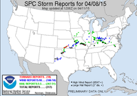
Time to revisit this thread. We had an interesting week of severe weather events, but it looks to be quiet for at least a few days now, so we have some time to sit down and evaluate the upcoming few weeks for the next threats.

We seem to be in a period of low synoptic scale predictability or just overall forecast jumpiness. Recent GFS runs have been all over the place regarding a cutoff low and eventual shortwave trough that becomes embedded within the sub-tropical jet later this week. Looks like Dixie Alley may see its first solid severe weather setup this week (although currently the details suggest the severe threat may not be on the high end like we seem to see around this time of year). There was quite a shift in the location of the cutoff between the 00Z and 12Z runs today, too, so it's a little hard to know for sure what to expect this week, other than it looks like the southern plains and southeast are going to get a drought-reducing amount of rain (when considering the amount that has fallen in the region the past few days).

After that, however, it looks kind of sad. It looks like a strong eastern US trough will form with quite low heights later in the forecast period, which will likely spill a cP air mass all over the eastern half of the country. It also appears this trough may clean out the Gulf of moisture.

Now for the good: rain, and lots of it. The southern plains has been getting a lot of rain lately. This will do wonders to keep the area from starting to bake early on once May rolls around. The rain will also help keep soil moisture up and will help with green-up so that future disturbances may give more moisture (recall the system this past week had pretty good moisture to work with: mid-upper 60s dews in early April is pretty decent if you ask me). It looks like there will be more to be had this next week, as the 7-day WPC rain forecast (see below) suggests over 2" may fall across much of OK and parts of TX as well. Even drier areas to the west look to get in on some of the action.
p168i.gif

CPC agrees and has wet anomaly probabilities for the southern/southwest US over the next two weeks:
814prcp.new.gif

It's never fun to see an extended hiatus from severe weather after an active week early in the season, but hope is high that we have many good weeks of chaseable severe weather ahead of us this year. While the predicted 500 mb height anomalies from recent CFS runs are a little conflicting (both positive and negative anomalies west of the central US, see below), the forecast for below normal heights in the southern latitudes could be an indication of southern stream troughs coming through more often.

cfs_AnomAveAveNH500hgt_3-6.png

Lastly, the CFS had a pretty good signal for this past week's severe weather when you look at the charts Greg Carbin has put together (http://wxvu.net/spc/cfs_scp/). Looks like it still only picks up a solid signal once something is in the 8-12 day range, so don't get too concerned about the lack of "hot" boxes showing up down the line. It may not mean anything.
 
So if the CFS continues to show jack squat for may 2-3, which is one of my only possible chase weekends on the plains this year, don't worry? You mean they can't predict weather that far out???? :)
 
Back
Top