• A friendly and periodic reminder of the rules we use for fostering high SNR and quality conversation and interaction at Stormtrack: Forum rules

    P.S. - Nothing specific happened to prompt this message! No one is in trouble, there are no flame wars in effect, nor any inappropriate conversation ongoing. This is being posted sitewide as a casual refresher.

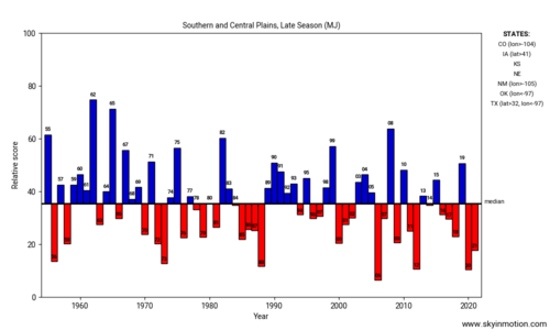
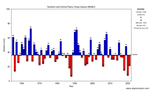
State of the Chase Season 2022

Looks like @Jeff House beat me to it, but there is an encouraging sign on the horizon from the MJO phase diagrams:

ensplume_small.gif

A big swing from nothing through phases 6-7-8 looks to be progged starting the next few days. The ideal phase movement is through 8-1-2 to get US severe weather outbreaks, but perhaps the "momentum" of the swing through the upper left quadrant will continue on down and give us a show in June.
 
Starting to believe a Northern Plains Upper Midwest sequence is on-tap beginning this weekend. Too good to be true again? Let's look under the hood.

We have reeled it well into the 6-10 day; so, I'm cautiously optimistic. Models smodels, but they are a tool. I look for failure modes, like forecasting snow in the South, haha. Any tropical depression looks buried south Gulf or Yucatan, greater than 15 degrees away from the US trough - no impact if models are right. Probably no TD anyway. Back to the hemispheric pattern forecast; well, it's amazing Rockies trough with Mid-Atlantic ridge.

Looking at the Indian Ocean and Pacific satellite.. MJO and Kelvin Waves are supportive. Pacific jet extension is robust; look for that to poke in North America and retract, yielding the Rockies trough. Global Wind is falling, which is favorable for that pattern in late May early June.

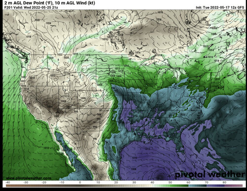
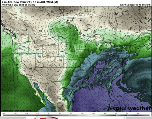
As for the meso-scale and daily details, it's morning of most days. This time of year I'll take broad trough with subtle waves. Boundary forecasting will also be paramount. Forecast dewpoints are quite enough in that part of the World: Northern Plains Upper MW.

Barring a major debacle (which is less and less likely) we are going to tee up a sequence for the Northern Plains and Upper Midwest. Happy and SAFE chasing!

SPC seems unconvinced of anything through the weekend. Chances seem to go up beyond that.
 
Alright, leaving for my Chasecation on Wednesday. Since there's no chance of anything until Saturday, I'm going to go visit the World's Largest Easel and the World's Largest Ball of Twine. Then on to the Twister Movie Museum. Then I'll get in position for whatever happens on Saturday. I can't change my dates again, so I've just got to make the best of the time I've got. There is a very small chance for something to improve in Oklahoma on Friday, so I'm saving the Twister Museum for Friday just in case the models improve.
 
I feel bad for suggesting to you on Saturday that it wasn’t worth it… But as Warren noted, the outlook for Monday did improve on Sunday… Even still, I probably would not have made the drive from Idaho, I was already on chase vacation and coming from Colorado…

I did end up on the Morton tornado, although nowhere near as close as the pictures posted above… Will post a full account in the Reports section when I have time.

No worries, James! It was my decision! And I had to make it by Saturday night since it was so far. I still think minus that outflow boundary hitting that storm, the larger scale environment was marginal for tornadoes. Nonetheless, another factor in my decision was the possibility of Northern Plains chase days this weekend, and that does look to be coming together! I went to Yellowstone yesterday, and heading to ND today, so I will already be in position for a marginal day Friday, and then follow it east to the upper Midwest. I'm excited to chase up here for the first time!
 
In keeping with the seasonal trend of capping problems, I suspect our collective mood over Memorial Day weekend will hinge greatly on whether the incoming longwave trough can eject somewhat cleanly into the Plains, rather than getting held up over the Great Basin for several days and then shunted off to the NE.

Many of us spend the offseason yearning for stretches of subtle southwest flow ala this upcoming Sat-Sun 5/28-5/29. The problem here may be prohibitive 700-800 mb temperatures, confirmed by a glaring lack of warm sector QPF for this weekend in the ensembles. Saturday looks to offer the better chance of warm sector CI, but moisture will still be recovering, especially in NE where the only decent QPF signal exists. By Sunday, current progs have rising heights through the day and little indication of storms, other than north of the surface front.

To me, our best hope is for the Mon-Tue period to trend just a bit more progressive over the CONUS, in which case we could net a legitimately exciting setup. NWP trends yesterday looked grim, but today's 12z suite seems to be leaning back in a positive/progressive direction. Watching the wave train evolve over the next 7 days on the models suggests this whole period may be very sensitive to small perturbations early in the period. If the ridiculous upper low currently parked over the SGP could just kick out faster, we'd probably be looking at a really interesting stretch of several days. On the other hand, there are still plenty of model runs and ensemble members indicating that energy from this upper low will break off and ride anticyclonically all the way around the eastern U.S. ridge into the Gulf by Mon-Tue, which would probably be disastrous thereafter. As it that isn't enough, the ECMWF and its ensembles are now trending toward tropical development in the Gulf during the first few days of June, which concerns me a lot more than the GFS fantasycanes we saw earlier in May...
 
Landed in Dallas from Sydney , Australia late Sat afternoon. Haven't been able to get over the last couple of years. I am going to play in the Tex panhandle on monday afternoon. I would be guessing with the drought conditions that a bit of a haboob might be on the cards. HRRR and NAMNEST have plenty activity though nothing particularly decent on the helicity tracks. im here for a couple weeks so ill take everything offered. Im not really a fan of chasing the hill country in far south Texas unless desperate so ill ignore the slight zone.
Awesome to be back for my 7th US chase.
Well
Things went well for me. just kept dropping south on each of the cells as they all looked like they wanted to hook when they had the tail end position and then bingo.
 

Attachments

  • sttrack.jpg
    sttrack.jpg
    90.3 KB · Views: 1
Congratulations @Nick Moir and welcome back! I'll buy some AUD/USD tonight, ha. OK back on topic..

SPC concedes Saturday could be an MCS mess. Might be a short window early; however, we are leaning travel day only. Sunday offers a conundrum. GFS is rising heights cappo. EC has a little wave; and therefore, a better set-up. Should we be encouraged the SPC seems to have gone with the EC?

Monday and Tuesday indeed the main trough comes out, hopefully gradually so it's two full days. Shortwaves welcome each day. Main trough, please don't pop out like a water melon seed.

Appears the Plains could come up with one more accidental day on Wednesday. Like the day before the day, sometimes we get southern High Plains day after the day.
 
I'm a bit shocked at the lack of talk about the northern plains in here. As much as I like how much less crowded the roads are up here compared to the central and southern plains, I feel like I need to mention that the northern plains has great terrain and offers some great storms (despite the busts up here the last couple of weeks). This weekend looks like it'll have some decent chances up here. For anyone on a chase vacation, it is probably worth the time to venture north for what could be a multi day stretch.
 
I'm a bit shocked at the lack of talk about the northern plains in here. As much as I like how much less crowded the roads are up here compared to the central and southern plains, I feel like I need to mention that the northern plains has great terrain and offers some great storms (despite the busts up here the last couple of weeks). This weekend looks like it'll have some decent chances up here. For anyone on a chase vacation, it is probably worth the time to venture north for what could be a multi day stretch.
Hush. Just keep it our secret.

Saturday and Sunday (I'm going off the euro, which SPC seems to be hugging pretty tightly) look very "MCSey", maybe even a Sunday derecho a la a couple weeks ago riding up out of Nebraska through South Dakota and MN. Monday has my full attention. Very do-able 750mb temps and the Euro pops off both the cold front/dryline and the warm front up here.
 
I'm a bit shocked at the lack of talk about the northern plains in here. As much as I like how much less crowded the roads are up here compared to the central and southern plains, I feel like I need to mention that the northern plains has great terrain and offers some great storms (despite the busts up here the last couple of weeks). This weekend looks like it'll have some decent chances up here. For anyone on a chase vacation, it is probably worth the time to venture north for what could be a multi day stretch.

That's all perfectly reasonable, but there's no point in chasing over terrain that has nothing to chase. The northern Plains season happens later on in the year, and we're not quite there just yet (June is right around the corner, though).

I'm not seeing a ton of instances of the ingredients coming together in a great way over the Dakotas/W MN/E WY/E MT on the latest GFS forecast. But that will likely change as we get into June.

The encouraging thing I see on the GFS is that it is still tossing out massive troughs in the western CONUS out past 300 hours, rather than going dead or developing a death ridge.

Ah yes, the "blind squirrel and the acorn" parable. Eventually, it'll be right.

Yesterday was my fifth local/regional chase through May 25th, a personal record although with little to show for any of them. It was probably the most productive/enjoyable of the lot although it was an almost exact repeat of my April 30th chase where I drove in a big loop targeting storms developing east of I-39 only for them to crap out and/or move into the Chicago suburbs, reoriented towards new storms further west that looked somewhat interesting but didn't seem in a big hurry to do anything and I didn't really expect it to given mediocre parameters (slight or marginal risk) so I left it and started for home, only for it to go tornadic in the IL/WI border area once it was just out my reach.
 

Attachments

  • 052522_01_512.jpg
    052522_01_512.jpg
    112.5 KB · Views: 1
  • 052522_02_512.jpg
    052522_02_512.jpg
    90.1 KB · Views: 1
  • 052522_03_512.jpg
    052522_03_512.jpg
    235.3 KB · Views: 1
I'm a bit shocked at the lack of talk about the northern plains in here. As much as I like how much less crowded the roads are up here compared to the central and southern plains, I feel like I need to mention that the northern plains has great terrain and offers some great storms (despite the busts up here the last couple of weeks). This weekend looks like it'll have some decent chances up here. For anyone on a chase vacation, it is probably worth the time to venture north for what could be a multi day stretch.
That's because the northern plains have been utter trash for chasing for the better part of a decade. :confused: Haven't seemed to have a decent setup verify since about 2014.
 
That's because the northern plains have been utter trash for chasing for the better part of a decade. :confused: Haven't seemed to have a decent setup verify since about 2014.

That may be true but with the D3/4/5 outlooks from the SPC I would have thought there would be some more excitement than there is considering those are the only opportunities coming up. A D4 enhanced risk in KS would probably spark some excitement. The same risk up here doesn't seem to get much attention.

Back on topic. NAM has some big parameters for Sunday in the northern plains. Very warm H7 temps in the 12-14c range will likely limit the day but there is some potential for CI, particularly in western MN or the eastern Dakotas IMO.

Monday has potential too but how much potential depends on which model you want to believe. 0z GFS looked solid, but has trended crappier the last couple of runs. Euro is more bullish. Either way I don't get too excited or bummed until we get in range of the medium range models which won't be until tomorrow.

I mean...it nice that there's some potential, gives the chasecationers something to do, but there are enough questions about whether this event will actually yield quality tornadic supercells that most people are holding off on getting excited. Case in point, the EHI map at FH84 on today's 12Z NAM looks gorgeous, but all the soundings are ironclad capped.
 
Last edited:
That's all perfectly reasonable, but there's no point in chasing over terrain that has nothing to chase. The northern Plains season happens later on in the year, and we're not quite there just yet (June is right around the corner, though).

I'm not seeing a ton of instances of the ingredients coming together in a great way over the Dakotas/W MN/E WY/E MT on the latest GFS forecast. But that will likely change as we get into June.

The encouraging thing I see on the GFS is that it is still tossing out massive troughs in the western CONUS out past 300 hours, rather than going dead or developing a death ridge.

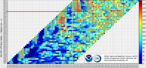
Zero signs of death ridge when the past several years we were into it and the jet was well into Canada. CFS june precip maps don't look terrible either. What CFS is doing with region 3.4 is a little bit exciting too. I should know better but it still is intriguing especially since it nailed the early spring failure to make it out of la Nina and is now forecasting a rapid warming-too little too late? Maybe.

nino34Mon (1).gif
 
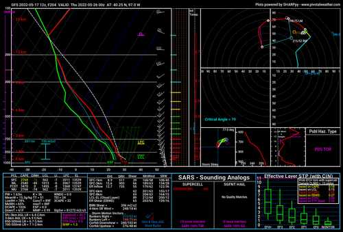
Look at those CAPE, SRH and LI numbers...then look at that vertical temperature profile and CINH number (sob).

Huge area of 3KM EHI >7 on that run, from southern KS to upper Michigan, and it's ALL like that.

Unless something changes, 2022 is gonna go down as the year of "close, but no cigar" in the atmospheric violence department. At least I'm listening to thunder right now...

An aside, but what does it signify when SHARPpy doesn't give you a critical angle value on the hodograph, as in this sounding? The ones I'm taking over Wisconsin for this run/FH are the same way.
 

Attachments

  • nam_2022052618_078_42.63--92.26.png
    nam_2022052618_078_42.63--92.26.png
    233.9 KB · Views: 1
Looks like we weren't the only ones who decided to visit the Twister Museum while waiting for storms to start this weekend.
 

Attachments

  • 20220526_162012.jpg
    20220526_162012.jpg
    324.6 KB · Views: 0
  • 20220526_154305.jpg
    20220526_154305.jpg
    476 KB · Views: 0
  • 20220526_163630.jpg
    20220526_163630.jpg
    160.3 KB · Views: 0
I'm a bit shocked at the lack of talk about the northern plains in here. As much as I like how much less crowded the roads are up here compared to the central and southern plains, I feel like I need to mention that the northern plains has great terrain and offers some great storms (despite the busts up here the last couple of weeks). This weekend looks like it'll have some decent chances up here. For anyone on a chase vacation, it is probably worth the time to venture north for what could be a multi day stretch.

I'm excited, lol. I've never chased the northern plains, so looking forward to it. And yeah, I'm not expecting much the next 2 days, but Sunday looks better, and beyond that I haven't looked as much, as I've been more focused on the short-term. But just having at least 4 straight days is a plus. I feel like the prettiest storms I've ever seen pictures of have been in the northern plains. And I'm completely fine if most chasers decide to sit it out!
 
0z GFS last night was absolutely on fire for the next 2 weeks. Nothing but troughs. And not just for the northern plains. 06z isn't much different. When it actually all busts then I will eat crow. Until then it's just exciting to see an active pattern headed into June. For a large part of the plains.
 
I really want to head out to the Dakotas for the next targets but after my Southern Plains chase a few weeks ago (3k mi driving o_O) , I am not sure if i want to drive 12+hrs and fight Memorial Day traffic. I may just sit out the weekend and target/wish/hope early June for Northern Plains serves up. But...if someone here can guarantee me a good solid week...i am gone....Anyone :rolleyes::rolleyes::rolleyes:
 
This year I decided to take two chasing vacations. The first one was in early May which produced the beautiful Crowell, TX tornado, but not much else. The second one is coming up in the second week of June. And I have to say I’m feeling pretty optimistic. As someone else pointed out, the GFS has an amazing pattern all the way till the end of its run. Its ensembles agree with it, as well as the Euro ensemble suite. The CFS has also been very consistent in showing low height anomalies in the west for weeks. There’s still time for things to go wrong, but as it stands now, I’m feeling pretty good about 2 weeks from now.
 
If you have a chasecation planned in the next two weeks, you should be getting pretty excited. Central and Northern Plains into the midwest look active along with a few high plains upslope setups possible. Also, don't count out the southern plains for another chase op or two. I think overall, the pattern should promote some "mesoscale maddness" with a day or two possibly offering more of a regional tornado threat.
 
Back
Top