This... did not age well. The 4/29-5/4 period was certainly active and even productive for chasers by early season standards, but what appeared an equal or better stretch this weekend into early next week via ensemble consensus went up in flames. Just like that, the preseason analog suggestions of "active early, ridgey and dry for peak season" look all too plausible again.
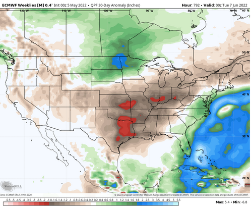
I guess there are two silver linings: (a) there were some legitimate quality events (4/29 and 5/4) that would've been top 2-3 days of the season in many recent years; and (b) there was some partial drought relief over areas from C/E OK and KS into NE. Overall, the period from mid March to early May was relatively active and probably qualifies as an above-average opening to chase season by most standards... as long as you were willing to venture pretty far E and/or S within the core alley (IA, I-35 corridor of OK/KS, and TX). This is at least better than some years like 2006, 2009, and 2017, when synoptically favorable patterns were biased early but generally unproductive for event quality.
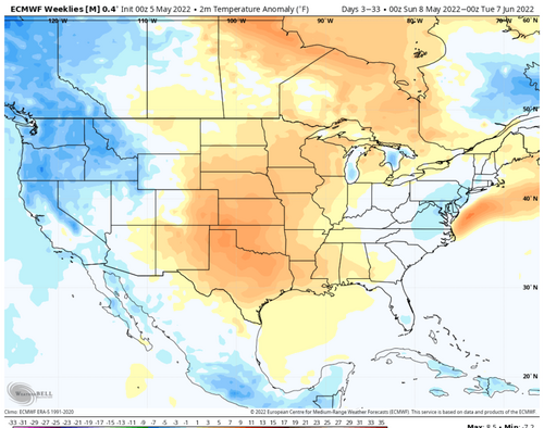
Resetting expectations looking forward, it appears we're basically stuck waiting and hoping for a pattern recovery in the period beyond D10. Drought is still going to be a major problem up and down the High Plains, including the chase-ruining dust problem highlighted on 4/22. It looks like our best bet will be any resurgent favorable pattern between late May and late June, and that events near the I-35 corridor may continue to be preferred if you're looking for tornado-friendly LCLs.