State of the Chase Season 2022

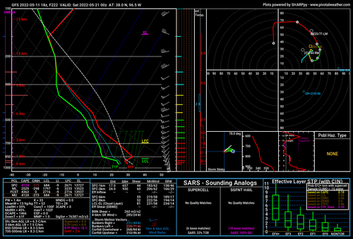
In Hobbs, NM. Forecast turned out pretty much as expected. Nothing overwhelming, but at least some chances. From Saturday onward, not looking too exciting. I will likely return home for a few days. Model consensus paints a very boring picture for the Southern Plains in the near future, or at least through the middle of next week. Could be some opportunities in the far NP's but RH forecast is not impressive ATM.
 
Further addendum to my previous: Latest GFS/GEFS still look decently favorable at least for a few days, mainly centered late next week into the following weekend. Again, just watching how it evolves.
 
Indeed the Rockies trough this week is impacted by the Carolina low, soon to be Tenn Valley low. Northern Plains looks to have an interesting couple days though.

Middle of next week through about May 20-22 starting to look more interesting. Don't need a classic deep West trough (preach Warren). Zonal to southwest flow is forecast. Bit of a cap risk south; however, should be boundary and of course warm/stationary front central Plains. Maybe get a DL day or two south. GL to New England trough early week *should* eject South low and prevent another SE low immediately.

Non-model news, tropical cyclone Indian Ocean did not sap all the energy. MJO trying to reset, but still muddy with convection West Pac. Need Maritime Continent (Indonesia) to be the main influence. Either way all that convection should promote the Pacific jet extension. Though not classic dropping into big West trough, it could help with flow from the Rockies over the Plains.
 
I just have to post this forecast sounding off the 18Z GFS...obviously way too far out to take seriously for better or worse but it is rather remarkable. Nearly 1,000 m2/s2 of 0-3KM SRH in the presence of over 4,000 j/kg of SBCAPE...but it's totally capped.

There are some pretty large areas of rather astounding EHI values over the Plains for the 19th and 20th on that run, but I can't find a single "PDS TOR" hazard type sounding seemingly due to either capping or LCL issues.
 

Attachments

  • gfs_2022051118_222_38.0--96.5.png
    gfs_2022051118_222_38.0--96.5.png
    234.9 KB · Views: 0
The GFS is trying to place some kind of tropical system in the Gulf during the third week in May. Not clear yet how that might effect the season.

My main concern is the difference in orientation/flow in the 500mb trough (looking at the FH valid 00Z 5/25) between the 12Z run vs. last night's 06Z. Weaker and much more meridional (in fact, SE to NW) in the exit region on the newer run. Yuck.

It (supported by the ensemble) is at least consistent on the idea that there should be some sort of western/central US trough hanging around from about next Thursday through early the following week, but it's also consistent on capping issues with most of those potential setups, as well as the strongest 500mb flow mostly lagging north/west of the warm sector.
 
After the way things looked in late April, I'm just excited to see various troughs coming into the West starting late next week. My hope is that with enough troughs sooner or later one aligns with other ingredients. My dates are fixed so I am out there regardless and can go after such opportunities with short notice.
 
Not feeling too good about prospects during at least the first week of my chase vacation that begins May 21. Both the GFS and Euro show the traditional Alley dry as a bone almost as far as I can see on either model… The Euro I can only see out 10 days, which is only a few days into my scheduled trip, but has a big ol’ ridge at the end of its run. As Warren noted above, the GFS shows a tropical system in the Gulf around May 23-24. A day or two ago, the system was shown in the western Gulf, near the Mexican coast; now it is shown in the eastern Gulf, landfalling near Tampa, which would appear worse for the prospect of quality moisture advection from the Gulf into the Plains.

Sure, lots can change, and let’s hope it does… But it gets depressing when the eternal hope of the pre-season, and the excitement of the recent early-season action, generates optimistic anticipation for chase vacation, only to finally enter the time horizon covered by the models, and see it all crash and burn in the pessimistic assessment they offer…
 
@JamesCaruso Looks like we might get a little action closer to home Mon night. Unfortunately I'll be working, but I'm hoping to get a little armchair chasing in. The upper forcing looks decent and there seems to be strong turning in the lower levels, just need a few discrete cells to go up before the cold front sweeps through. I'll be interested to see how things shape up going forward. Got my fingers crossed for ya over the next few weeks.
 
Of course we've all been watching that trough being forecast for late this coming week on the models for days now, and the evolution at least as portrayed on today's 12Z GFS is just annoying. With a 980mb low sitting over Colorado and a large area of 60s/70s dewpoints over the central and eastern CONUS, you'd think the table would be set for something huge, but the ingredients just aren't lining up. It looks like Thursday will be the only real interesting chase day in the Plains, and there are several potential target areas but they all have issues. For example, down in Oklahoma there is great 0-3KM SRH but very weak mid-upper level winds and it's capped all to hell anyway. Then the following days the trough just lifts north around that juicy airmass rather than ejecting out through it, while the cold front sweeps the moisture away for the weekend and into the following week.
 
Going to likely be a very late May or early June season in the Northern Plains... if at all. Returned home due to the low probabilities (including sneak attacks), in the near future. Will consider Colorado and NW Kansas in early June if nothing picks up soon. Not even sure NW TX will have the typical, late-season NW flow events in late May at this point due to RH / drought issues.
 
I'm currently considering changing the dates for my chasecation from May 20th-30th to May 25th-June 4th. The models are showing the plains being swept of moisture until at least mid-next week. Can't guarantee anything past May 31st at this point but definitely looks like the plains will be dead at least up to May 25th at this point; just can't get those damn ingredients to line up.

Again, I won't pretend to be an expert on long-range analysis but ECMWF, GFS, and CFS all agree on that trough coming through and seeping out moisture for a good few days.
 
Last edited:
I can’t recall ever seeing the Plains this devoid of moisture for as long as the GFS is showing… I can’t remember ever seeing so much of the country this dry at this time of year - look how Far East the moisture is shunted in this image valid for 12Z on May 23! I caught myself laughing out loud as I watched the moisture being pushed farther east with each frame… That’s all you can do is laugh, with this maddening hobby… I also can’t recall so many days of northerly surface winds deep into the central and southern Plains. Every time there appears to be some return flow, it lasts for only a short time and everything gets scoured out again.

I am going to make a go/no-go decision by Wednesday or Thursday. I may change my 5/21-6/4 trip to 5/27-6/10. Another option is to head out on my original schedule and see if I can stay an extra few days into a third week. If things are as dead as they look, and I can accomplish a lot of remote work during that time, I can probably make the case for staying. The way things are going, there wouldn’t be a need to stay anyway… But with my son coming with me, I can’t just expect him to sit in a hotel room with me all day while I work…

E1A17542-97AA-41C3-9723-9F7618020A3B.jpeg
 
Back
Top