Jason N
EF5
Thanks Warren, boy what a difference in only the last few weeks to a month.
Thanks Warren, boy what a difference in only the last few weeks to a month.
Looks like we are getting into what I like to call mesoscale season where synoptically evident events are rare but one can find decent day-to-day chase opportunities, some of which featuring high reward storms.
When the SPC day 4-8 outlook says “potential too low” for the entire time period, that’s not a good sign.
Looking at the 500mb pattern I think we’ll have a bunch of marginal risk days this weekend into early next week. Maybe a slight or two. Moisture looks to be good enough but the flow is just too weak for any large-scale events.

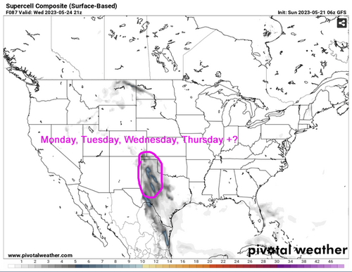
.png")

This is what has me analyzing road network and tree density in Montana/Idaho for maybe the first 2-3 days I can get out there before a trough/low/short wave finally nudges some snippet of H5 flow back where it's needed. I've had beautiful chases and tornadoes on synoptically non-evident days. But seems like those days were constrained more by capping/forcing rather than general lack of upper level support/shear.just a total lack of synoptic scale flow.
This is what has me analyzing road network and tree density in Montana/Idaho for maybe the first 2-3 days I can get out there before a trough/low/short wave finally nudges some snippet of H5 flow back where it's needed. I've had beautiful chases and tornadoes on synoptically non-evident days. But seems like those days were constrained more by capping/forcing rather than general lack of upper level support/shear.

Looking like the severe weather pattern will soon shift to my favorite style of chasing..... surface based forecasting, low risk / high reward or total bust with steaks and bourbon. All of this occurring in western regions with great road networks. Most of these set-ups are not obvious until late in the day, which will likely result in fewer chasers in the target areas. I don't want to jinx this set-up, but it would appear the flow gets even better as we move forward towards late May and early June.