Starting to believe a Northern Plains Upper Midwest sequence is on-tap beginning this weekend. Too good to be true again? Let's look under the hood.
We have reeled it well into the 6-10 day; so, I'm cautiously optimistic. Models smodels, but they are a tool. I look for failure modes, like forecasting snow in the South, haha. Any tropical depression looks buried south Gulf or Yucatan, greater than 15 degrees away from the US trough - no impact if models are right. Probably no TD anyway. Back to the hemispheric pattern forecast; well, it's amazing Rockies trough with Mid-Atlantic ridge.
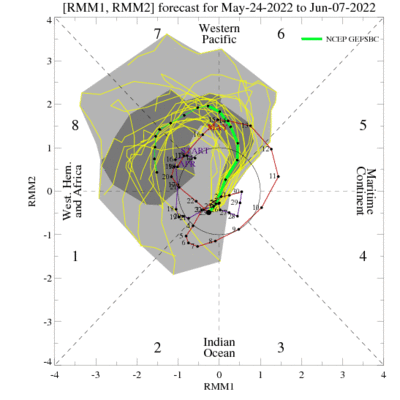
Looking at the Indian Ocean and Pacific satellite.. MJO and Kelvin Waves are supportive. Pacific jet extension is robust; look for that to poke in North America and retract, yielding the Rockies trough. Global Wind is falling, which is favorable for that pattern in late May early June.
As for the meso-scale and daily details, it's morning of most days. This time of year I'll take broad trough with subtle waves. Boundary forecasting will also be paramount. Forecast dewpoints are quite enough in that part of the World: Northern Plains Upper MW.
Barring a major debacle (which is less and less likely) we are going to tee up a sequence for the Northern Plains and Upper Midwest. Happy and SAFE chasing!