State of the Chase Season: 2016 Edition

Looks intriguing to me in the last few runs due to the fact as Jeff said there is no big moisture scouring signal. I think ~4/23 will have some potential with even a better set-up possible just a few days after with what looks like a slower moving and further south trough on or about - (4/26,4/27)
Anyway, better this then worrying about a Front ripping into the gulf.
 
The first shortwave looks like it may not really dig in, skipping mainly to the north of the moist axis. Definitely a chase event as it's shown, but it looks like more of a 'primer' to pull some deeper moisture northward in advance of the next impulse. All in all, I'm optimistic for the last part of April!
 
Actually last few GFS runs have been making a High Pressure form over the plains late this week and push the moisture all the way back to the GOM for saturday, meaning last second moisture would be in order for the next weekend once again. Although, I am not a plains guy, and last Friday seemed to perform pretty well overall given the mediocre moisture, so we will see...
 
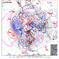
Man, there are some pretty notorious cases for the Plains looking at the CPC analogs for the mid range pattern (i.e. next weekend into the following week). The thing I'm liking about the ensemble guidance is that it's not just one trough ejection. It looks to be more of persistent western trough with repeated shortwave ejections east of the Rockies. That is the type of idea that typically yields more impressive periods of above-average severe activity.

With regards to Chris' post above, we're starting to get to that point in the year where any return flow for a day or more from the Gulf is going to get decent moisture into the Plains (assuming there hasn't been a massive cold frontal intrusion prior), as opposed to March and early April climo where you typically need a couple days or more.

Thanks Andy, that is making me nervous about comitting to next weekend as a Plains chase, but I will keep an eye on it.
 
Here's an example about what I posted above. Obviously most of the attention is going to be taken by the #1, but there are other bigger Plains months/events/periods hidden in here (May '55, April/early May '93, May 11, 1953, late April '84).

f807295877b575a8a932b21078b1fc8e.gif
 
The discrepancies with the ECM and GEFS/GFS this far out aren't too surprising but the ECM's solution is not looking chaser-friendly for the weekend whereas the GFS is all aboard. at least one decent day setting up. I'm doubting we encounter moisture return issues, even if it's the night before, just due to the complete lack of frontal intrusions throughout this week. Might be able to squeeze out a western Oklahoma day should things maintain more on the GFS' path.
 
It's wierd to me that 5 days out, they still disagree this much, but it probably shouldn't surprise me. It seems like if anything, Saturday will be marginal, with Sunday being a decent setup and perhaps Monday being "the day". I am running out of time to choose to bite on this 2-3 day plains trip though. If it doesn't look pretty good by Wednesday evening, I will probably hold off and see what the following weekend holds, since I have just one "weekend" to work with!
 
18z GFS just out, makes sunday and monday really lackluster. If things don't trend better towards the end of the week, not sure I can justify the drive from IL

I'm considering the drive from Montreal mainly because I have off from the job and it's my only opportunity until June. I think so far the main lines appear not too bad, maybe because my best chases in the past happened on not-so-obvious days. Seems like moisture will be there along with some perturbation we have yet to identify clearly because of the lack of consistency between model runs. Every new run I can see at least one good local opportunity, just never at the same place with the same timing. Maybe I'm overly optimistic because I have yet to chase this year.

We'll see.

Yup, one of those pieces of energy will tap into that moisture and draw it in, and give whomever is lucky enough to be there a nice chase day in the next week.
 
Really not enamored with 12z gfs. Sunday looks okay, not great, at this point, and then you have bad moisture depth on Monday and the placement is pretty far east in OK. Not to mention the flow looks pretty weak.
 
Really not enamored with 12z gfs. Sunday looks okay, not great, at this point, and then you have bad moisture depth on Monday and the placement is pretty far east in OK. Not to mention the flow looks pretty weak.

At that forecast length, synoptic scale uncertainty can still be an issue. As I've said several times before now, there's really no point in getting worked up over the details of any specific forecast at this range. Check the ensembles or d(prog)/dt for uncertainty estimation. The 12Z GFS is dramatically different from recent runs. A similar shift or noise can also be seen in recent FIM runs. The 12Z GEFS has noticeable variability in the phase and shape of the trough, and the control member (what you saw) is towards the edge of the GEFS distribution as far as placement of the trough. The 00Z Canadian ensemble is all over the place with that trough. Some members have a "northern" trough just barely crossing onshore with the height min in the Pacific northwest. Some members have a closed low skirting the Mexico-California border. Others have the more favorable placement over the high plains, and yet I see one other member with only broad low heights over the southwest US with a cutoff or extremely negatively tilted trough over the upper Midwest!

I understand you need to plan ahead, but this is the game. Risk and uncertainty are part of it.
I totally hear you, Jeff. Just trying to get some thoughts written down while I was going over it.
 
The GOM is loaded and all indications are for western CONUS troughing to develop placing Tornado Alley in southwest flow aloft. While we cannot determine this far out which days will be players and which ones will be duds, it appears probable there will be tornado activity at least one day next week.
 
Back
Top