State of the Chase Season: 2016 Edition

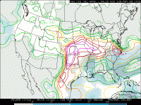
An amplified flow regime around the NH seems to be progged for at least the next 10 days - e.g. over here in Europe we're looking at major upper troughing later next week downstream from a large mid-Atlantic upper ridge, itself downstream from a major eastern US upper trough. I would expect several bouts of cP air to move into the Gulf through next weekend, with (e.g. ECMWF ensembles) still showing an eastern trough into the start of the next week. However, amplified wave patterns break sooner or later and I suspect that a more low amplitude pattern should emerge from around April 13/14th onwards. EC ensembles hint at this fact although one has to be careful as they typically will show a more climatological look late in the run. One not-so-favourable feature is the persistence throughout the run of a trough close to Hudson Bay.
 
Those few decent days sprinkled in during the last week of May weren't bad for 2012 either. 2006 was before my time by two years but I remember the consensus disdain for 05 and 06.

Sent from my XT1080 using Stormtrack mobile app

Yea, you can always find the gems, May 25th 2012 is still my second best storm chase to date. Lacrosse KS....
 
I'm now seeing strong indications of high amplitude and persistent western US troughing sometime in the middle of next week. The GFS, GEFS, FIM, ECMWF, NAEFS and Canadian ensembles all indicate a moderate to high probability of a big trough moving in off the eastern Pacific early next week and slowly progressing across the western US with multiple shortwave impulses riding around the trough. If such a pattern were to emerge, we could be looking at a string of severe weather days across the Plains.
 
Looking forward for this season as well. Probably going to be a solo state chaser this year. As far as the long-term projections are concerned, they are about as valid as a three-dollar bill. Everything needs to be looked at objectively and with a huge grain of salt.
 
I'm now seeing strong indications of high amplitude and persistent western US troughing sometime in the middle of next week. The GFS, GEFS, FIM, ECMWF, NAEFS and Canadian ensembles all indicate a moderate to high probability of a big trough moving in off the eastern Pacific early next week and slowly progressing across the western US with multiple shortwave impulses riding around the trough. If such a pattern were to emerge, we could be looking at a string of severe weather days across the Plains.

Given it is a little far out, but whats your take on the 500mb split flow regime that the GFS and to a lesser extent the ECMWF is suggesting mid-next week while that troughing sets up? If what these models are suggesting comes to fruition, could this put a damper on moisture advection from the gulf until the second half of the week? I realize moisture advection doesn't primarily occur on the 500mb level, but the models were also suggesting a pretty weak 850mb flow during the 500mb split.
 
Given it is a little far out, but whats your take on the 500mb split flow regime that the GFS and to a lesser extent the ECMWF is suggesting mid-next week while that troughing sets up? If what these models are suggesting comes to fruition, could this put a damper on moisture advection from the gulf until the second half of the week? I realize moisture advection doesn't primarily occur on the 500mb level, but the models were also suggesting a pretty weak 850mb flow during the 500mb split.

Maybe this is semantics, but I don't really see what I would consider a split flow pattern in the GFS or ECMWF at all next week. To me it looks more like the subtropical jet stream will become more active. I wouldn't worry about moisture return either. The GFS forecasts a big anticyclone to move southeast across the eastern US beginning Saturday, following the final impulse associated with that deep eastern US trough, along with the pattern shift we've all been waiting for. Having a surface high over the southeast and western Atlantic is absolutely ideal for moisture return across really the entire central US. Granted, Gulf moisture gets cleaned out a bit by the fronts this week, but recharge doesn't take that long, and the Gulf really appears to be fully open for business by the middle of next week. I don't see any fronts pushing into the Gulf after this weekend in the 06Z GFS.
 
Thanks for the clarification Jeff, I appreciate it! I definitely also appreciate how open this site is in providing constructive feedback to non-meteorologists like myself.
 
I'm glad to see some prospects for western CONUS troughing over the next 10 days, but I'm also skeptical of moisture return and the breadth of any warm sectors that might be in play, at least between now and the end of next work week (April 15). Most deterministic runs I've seen maintain some type of Great Lakes or northeast US troughing even as western troughing develops, which typically isn't favorable for higher-end severe weather this early in the season. Part of the issue, as Andrew alluded to, is that the so-called "Ridiculously Resilient Ridge" persists in the polar jet over western Canada, encouraging downstream troughing over the eastern half of the continent. At the surface, this corresponds to surface highs that linger over the Southeast and Midwest - a bit farther west than ideal, in my opinion.

However, an active southern jet carving out a western US trough is still a marked improvement over our recent pattern. For one thing, it can hopefully help us to catch up on short-term precipitation deficits. Also, some type of chaseable severe weather is still possible over parts of the southern Plains. And as we move beyond next week, hopefully our prospects will continue to improve.
 
Heck, I'll have some of what the CFS is smoking.

Seems like every year we have to sweat at least one blocked-up eastern trough pattern. Better now than May, but I'm never one to scoff at early season opportunities just on the assumption that May will be better.
 
During these severe drought years there has been a tendency for the models to over estimate the western edge of the "actual" dryline and where the quality RH will end up. It will be yet another interesting year to see if the DL can stay west of OKC.
 
I'm glad to see some prospects for western CONUS troughing over the next 10 days, but I'm also skeptical of moisture return and the breadth of any warm sectors that might be in play, at least between now and the end of next work week (April 15). Most deterministic runs I've seen maintain some type of Great Lakes or northeast US troughing even as western troughing develops, which typically isn't favorable for higher-end severe weather this early in the season. Part of the issue, as Andrew alluded to, is that the so-called "Ridiculously Resilient Ridge" persists in the polar jet over western Canada, encouraging downstream troughing over the eastern half of the continent. At the surface, this corresponds to surface highs that linger over the Southeast and Midwest - a bit farther west than ideal, in my opinion.

However, an active southern jet carving out a western US trough is still a marked improvement over our recent pattern. For one thing, it can hopefully help us to catch up on short-term precipitation deficits. Also, some type of chaseable severe weather is still possible over parts of the southern Plains. And as we move beyond next week, hopefully our prospects will continue to improve.
Although the pattern looks better by late next week/next weekend, the above mentioned points are reasons to believe that any threat will probably be on the lower end of the spectrum. The models have shown a pattern shift around mid-April for quite some time, but there was a bias to bring back Southeast U.S. ridging too fast.

With that said, we are now moving inside of two weeks and the models/ensembles/analogs suggest at least some pattern improvement by April week 3. Across the board, data seems to suggest western troughing finally returns, along with that ridging in the East that we've been "hoping" for. There is the issue with somewhat of a split flow prevailing, but the indications I see point toward an improved pattern by either April week 4 or the beginning of May. (Improved pattern doesn't necessarily mean a super active stretch)

This isn't an ideal evolution of the pattern, however, I'd be willing to bet that as long as the Oklahoma/Kansas vicinity short-term drought doesn't worsen, modestly dry conditions over the High Plains could possibly work in our favor for the following reasons.
  • A more pronounced dryline that may be able to penetrate farther east than recent years. (also could mean the High Plains sees a slower or at least slower-to-start season than 2015.
  • Assuming we don't see a sudden flood pattern (ala spring 2015) set up, we could see less HP junk for more LP opportunities into May across Texas/Oklahoma.
  • A better balance between dry intrusions from the Rockies/High Plains and a moisture and return flow from the Gulf Coast/Lower Mississippi Valley.
If anyone is becoming bored with the severe pattern, there is reason to believe that a fairly active fire season may continue for at least another week or two, particularly over Kansas and west/northwest Oklahoma.

I don't like to take the CFS too seriously beyond week 2, but it's showing very good signs for May (as well as the very end of April). I would take that with a grain of salt.
 
While that trough out towards 180 hours was looking nice, it seem we're still going to be suffering from some return flow issues on top of the weird angle and ejection timing. Just echoing the other sentiments in this thread, it looks like we might be getting off to a bit of a late start this April unless something this weekend or the end of next week starts improving rapidly. This flow pattern is a step in the right direction, but these timing issues and the setup of the flow pattern is a killer.
 
Back
Top