The elderly meteorologist here... and, I wish to pass along some synoptic climatology info that may be helpful tomorrow.
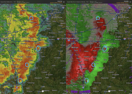
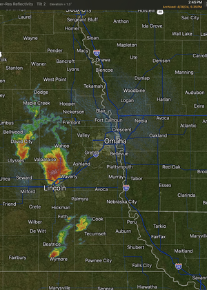
I keep reading that Kansas won't have major tornadoes because the storms are going to "line out." I don't think the storms will line out until evening, but even if they do, that doesn't prevent strong (≥EF-2) tornadoes from occurring. I have attached the OUN/Twin Lakes radar from Saturday, 27th, as of 10:54pm. There were two strong tornadoes in progress and two others that had tornado warnings. This included the Ardmore and Wewoka area tornadoes.
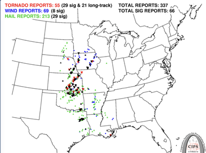
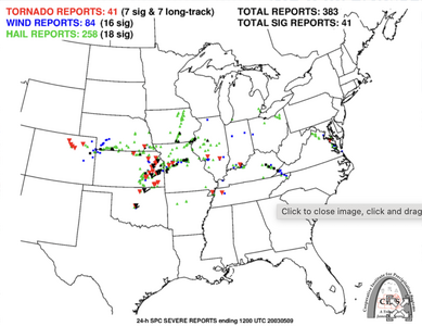
The second point I wish to make is the fact that, as Jeff Piotrowski and others have pointed out, the analogs for tomorrow are:
- April 26, 1991 (F-5 Wichita-Andover, Red Rock, etc., etc.)
- May 8, 2003 (F-4 Yates Center, etc.)
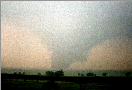
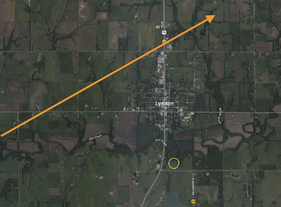
Below, you will find the storm reports from those two days. Both were verified as "high risk." And, it was a nearly solid line in eastern Kansas. On the 8th, I intercepted and photographed the F-3 Lyndon-Lawrence Tornado (see below) even as rain from the supercell that produced the Yates Center tornado was falling on me! It was raining so hard, I could hardly see the tornado a mile to my NW. A map is attached. The tornado photo was enhanced by a professional photography lab and that was the best contrast they could get from my 35 mm SLR.
I'll be the very first person to acknowledge the analogues don't always work out and that I may be over-forecasting Monday's tornadoes. But, that doesn't matter much to my primary points:
- Solid or nearly solid lines can produce strong tornadoes and they can be chased successfully. But they require extra care.
- Not all "high risk" days are made up of 3-4 supercells equally spread out over a 300 mi N/S corridor.
Good luck and be safe tomorrow!
Mike