Upcoming 2016 Storm Chasing Season

yeah just based solely off the 0z GFS, I now thoroughly have my eyes locked and watching next Tuesday, Very early yes, pretty much a 1 run masterpiece yes, but hey ill take anything to keep my eye on at this point. Basically we have a compact wave with plenty of both lift and lapse rates ejecting into the high plains and according to one run of the GFS, mid 50's dp and a glorious looking wind profile.

Hey all im sayin is we finally have something to look at.

Edit: at this point there is a hint of an S-shaped hodo, but still with plenty of SRH. (In northweast OK)
 
It is definitely something fun to look at again. A nice western Oklahoma dryline. Hopefully future runs continue to show this potential setup. Not sure I could pull the trigger on vacation time this early, but who knows.
668c921c0f50cd09f91affeb9b86076b.png
 
Last edited:
That weakness in the mid-levels looks like it might be the main issue should the rest all hold together. Even then, the S-shape isn't necessarily a death sentence with how enhanced the low levels are.

Sent from my XT1080 using Stormtrack mobile app
 
yeah just based solely off the 0z GFS, I now thoroughly have my eyes locked and watching next Tuesday, Very early yes, pretty much a 1 run masterpiece yes, but hey ill take anything to keep my eye on at this point. Basically we have a compact wave with plenty of both lift and lapse rates ejecting into the high plains and according to one run of the GFS, mid 50's dp and a glorious looking wind profile.

Hey all im sayin is we finally have something to look at.

Edit: at this point there is a hint of an S-shaped hodo, but still with plenty of SRH. (In northweast OK)

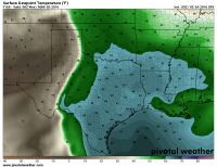
I agree that this is definitely something to keep an eye on. Probably should look at model run-run consistency before getting too excited 160+ hours out. It will be interesting to see what the CIPS analog guidance has to say:

http://www.eas.slu.edu/CIPS/ANALOG/analog.php
 
Well thanks for tuning in for the show, now back to regular programming.. says the 12Z GFS.

Crashing cold front type pattern progged now. Any guesses what the next fantasycast will show?
 
I can almost guarantee there will be some activity in Eastern Colorado during the last week of April. Why? Because I'll be out of the state...damn you Simla.
 
Yep was not pleased to see that but still have two more days until we get additional guidance. The track of that surface low was awful on the last run though coupled with the crashing cold front.
 
If you guys are going to get so excited about one model run 150+ hours out, I would suggest looking at the forecast from a probabilistic standpoint by using ensembles. You can look at a poor man's multi-model ensemble by checking the FIM and ECMWF (and the Canadian GDPS when it comes within 144 hours), or check the GEFS or CFS. At least then you'll get an idea of the likelihood of a single GFS forecast verifying.

The trough being discussed is present in basically all of the 00Z global deterministic models, and with some consistency. It looks like a positively tilted trough that occludes shortly after ejecting. There are some phase differences among the models, and the devil is always in the details, but there certainly seems to be some signal of that trough, especially since it appears in the GEFS and ECMWF EPS ensemble mean fields. Now, will this trough result in a setup favorable for severe weather? Will it be a setup that is worth chasing? Those questions can't really be answered as of now.
 
Yeah I just intended to make a post about the fact that we finally had something to watch, I am not/was not trying to generate some enormous excitement over one model run, which i stated in my post. SDS does get to me this time of year.

Thanks Jeff for the for mentioning the ensembles, I agree that if your gonna model watch this far out they should be in your toolbag.
 
Just as a follow up to yesterday's excitement: today's 12Z GEFS is all over the place for early next week. It suggests synoptic scale predictability with any troughs progressing across the western US is pretty low right now. Seems like a major change since last night, as the 00Z GFS was still insistent on a southward diving shortwave that would've made for interesting weather in TX/OK on Tuesday March 1. The 00Z ECMWF EPS and NAEFS still contained the trough within their ensemble means, but the spread was pretty large.
 
It seems to me that recently the GFS had been doing a pretty consistent and accurate job. Once a system was within the 120-150 hour range it was a pretty safe bet it would be fairly close to the GFS' portrayal, so seeing the southern plains dryline setup within that range was a bit exciting. But now it is all over the place. Todays 12z run gives me a nice snowstorm next Tuesday, and last nights 06z run even had a decent little tornado setup all the way up into Iowa and Nebraska towards hour 372 hahaha. I guess it is the season of waiting, watching, and hoping with the models. Just be prepared at about any time to take vacation time and chase.
 
To be honest, I'm more concerned right now with just getting some precip across the southern and central Plains. It's been exceedingly dry so far in 2016, and if it continues that way it won't matter if troughs start coming through in March...there will be insufficient moisture for good events (or there will be too much capping). The good news about next week is it appears there will at least be some formidable rains somewhere in the region. I'm seeing hints of green-up starting here in Norman already, so getting some precip to keep soil moisture up as vegetation comes back to life and starts pulling up the deeper layer soil moisture is going to be important to having enough moisture around once the troughs really start coming through.
 
To be honest, I'm more concerned right now with just getting some precip across the southern and central Plains. It's been exceedingly dry so far in 2016, and if it continues that way it won't matter if troughs start coming through in March...there will be insufficient moisture for good events (or there will be too much capping). The good news about next week is it appears there will at least be some formidable rains somewhere in the region. I'm seeing hints of green-up starting here in Norman already, so getting some precip to keep soil moisture up as vegetation comes back to life and starts pulling up the deeper layer soil moisture is going to be important to having enough moisture around once the troughs really start coming through.
Agreed. Thankfully, the rainfall event a couple days ago was fairly impressive by wintertime standards, and helped much of TX and OK (outside the Panhandles) catch up on the short-term precip deficit. So if we can just get average rainfall from this point forward through March, I think our ET will be in decent shape to start off the chase season -- especially relative to the "new normal" we got used to in the southern Plains from 2011-2014. I'd definitely like to see some rainfall further west across the EML source region, though.
 
Back
Top