Upcoming 2016 Storm Chasing Season

I've been keeping an eye on Tuesday for awhile. The GFS keeps trending the system faster and further east with every run it seems. Today's 12z run shows a severe threat all the way in SE Indiana and NE Kentucky. But now that the setup is within range of the NAM, that shows it slowing down. Both northern Illinois and Indiana could be in a favorable environment for tornadoes. The SPC highlighted the area in the day 4 outlook.
 
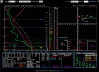
I have been watching Tuesday as well. NAM is showing a somewhat favorable scenario for severe weather in Central/Eastern Illinois on Tuesday afternoon. GFS is less bullish with the moisture and instability than the latest NAM, however we will likely have decent lapse rates this go around, so we should get SOME instability (Latest NAM soundings showing values around 7.8C/KM in Central IL). The question is going to be how much instability, speed of the system, and timing. The typical question marks of an early season severe weather event in these parts....something interesting to keep an eye on nonetheless, before we see a brief cool-down toward next weekend.
 
NAM/NAM4k seem to be hinting at a string of semi-discrete cells forming from southern Lake Michigan to roughly Terre Haute, IN (splitting the difference). GFS has backed off on the front's supersonic velocity and seems to be in general agreement on location of the front. NAM however is much more aggressive on moisture, by some 4-8 degrees on the northern end where all the action might be. SPC has chimed in on the event calling for "all hazards." It may be time for a target area thread. because #wedges. I hear that steam whistle blowing. ;):)o_O

I-65, ~50 miles s of Gary,IN.

wedges.JPG
 
The last 2 runs of the NAM have really moved the threat closer to the Chicago area. I wonder if this will affect voter turnout for the Illinois primaries? It seems strange that the SPC didn't mention the T-word in their day 3 outlook. I hope any tornadoes happen a bit further south so there's less of an impact and it will be more chaseable. Eastern Illinois is one of the best places you can chase with an excellent road network and very unobstructed views.
 
Looking like the rest of March might be dead as a doorknob. Getting strong cold fronts late in March isn't unheard of but it definitely doesn't inspire confidence moving into April with the way the pattern has shaken out. The timing is just off enough to ensure nothing west of the Cross Timbers in the foreseeable future.

Hoping a day with a non-retreating dryline and initiation will present itself in the next few weeks.
 
Although it's 2 weeks away, the GFS does look to put some moisture along the red river (Wichita Falls area), but the dynamics don't look too hot. Maybe we can eek out a chase before the month of March is over. Heck, right now, I'd love to just see a marginal risk or two fall on my days off before the month is out.
 
Flow pattern continues to look like crap with respect to timing plus the repeated movements of troughs across the southern CONUS are continuing to trap moisture along the Gulf Coast looking ahead. We've still got 13 days of March left, but it's not looking like we're going to luck into a decent day in late March on the S. Plains like last year. I don't hold any delusions about April and it only takes a few days to get the season going but seeing some signs of life early would be nice.
 
This year is well ahead of the last two in terms of activity. I've already got a tornado (albeit a brief glimpse of a nocturnal one) and it's not even astronomical spring yet. We could just as easily still have six inches of snow on the ground and highs in the 30s here in southern WI in mid-March. The Pacific "blob" is either gone or at least a lot weaker than it has been, and I think that was a real wrench in troughs being able to dig into the western US the last two years. We're also transitioning out of a very strong El Nino towards a possible La Nina. I'm not too worried.
 
Back
Top