Derek Weston
EF5
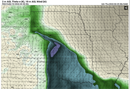
Wouldn't get too attached to southern target. NAM strongly favoring NW KS along WF. HRRR breaks out cells up there and nothing south. As of right now would be my target area.
(Granted, somewhat of a northern bias due to location)
Just my 2 cents after looking at data this evening. (Won't make it out tomorrow but will be out rest of the days)
(Granted, somewhat of a northern bias due to location)
Just my 2 cents after looking at data this evening. (Won't make it out tomorrow but will be out rest of the days)
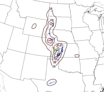
 Will keep watch for a tall man near the crossroads community of Dighton standing alongside a rural road while franticly waving his arms about in the air as anticipated parameters attempt to fall into place. Time will tell. Good luck to all roaming the Plains this week!