State of the Chase Season: 2017 Edition

My chase vacation starts next Monday and I'm pretty stoked. The GFS is showing several "marginal" setups with good moisture along the high plains and front range. It will be my first time in a couple years getting out to those parts, so I'm excited to say the least. The week later could be something to keep an eye on. We have to return home on June 12th to bring the guests back, but I may go back out pending whatever I hear from this job I've been waiting on. So we shall see! All hope is not gone though! Its June and high instability and low shear can get it done out there.
 
0Z GFS last night was looking pretty darn good for next week. It started with a nice piece of energy middle of next week(8th) and then followed that up with a big cutoff low and strong southwest flow over a very unstable airmass for next weekend(10-11th). Hodo's looked good with no veer back to be seen. Of course this was for 7-10+ days out.... The 12Z GFS still has the piece of energy mid next week, but then it holds back the cutoff low and weakens it quite a bit compared to the 0Z. Again a long ways a way but the middle of next week to the following weekend holds promise. I'd just like to chase in Nebraska or heck even Kansas as I've only made 2 big trips this year and both were to OK/TX. In fact this weekend I am home alone with no wife/kids and much to my dismay I have nothing to chase that looks decent even though I have the freedom to do so!
 
Staff note
I decided to clean up this thread up to this point. I noticed a secondary topic had broken off (aided by me) and there were some other noisy posts that didn't need to be here. I moved the discussion to the Bear's Cage where those who want to talk about how to deal with dry spells when chasecationing can talk about it.
 
Next week of June 4 kind of fell apart. GFS followed the bearish Euro into the chaser abyss.

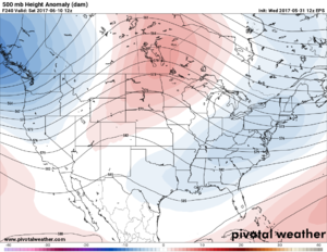
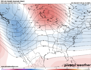
Following week of June 11 still has hope, but could be north. Pieces of the active Pacific jet are forecast to come into western North America. Said pattern change has a history of being pushed back and/or north. However this time the MJO is forecast to be friendly, assuming the MJO forecast is right. In the coming days we will see how it progresses from the 11-15 into the 6-10 day forecast.
 
I'm starting to feel at least slightly more optimistic; last three runs of the GFS have some potential action in E WY to Black Hills area as early as Jun 8, with a weak disturbance rounding the ridge. Yeah its iffy and marginal, but beggars can't be choosers...then a string of possible regional events starting north and finishing south as the main trough and jet moves through and mid month winds down...so all is not lost!
 
Yeah looking at the GFS, the period of June 8-12th appears to hold some potential in the Northern Plains (MT, SD, ND, WY). Luckily for me, that is during our scheduled June 5-12th chase trip. After that there appears to be more potential in the Midwest/Corn Belt toward mid and later month as the heat and humidity build up and give us that typical ring of fire type pattern that we expect.
 
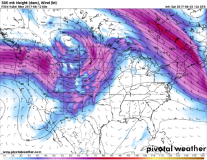
A strong June EML remains my biggest concern, although its really too far out to make this call, I really dont like that the past several GFS runs all have a very strong capping regime, so even if we do get excellent wind fields and solid CAPE, it may not matter. However, the main part of the trough is in Canada, which probably contributes at least a little to the whole plains being capped off. If the trough is able to slide south some and not eject so far north, I feel like eroding it should become much easier. This trough also has a huge area of 50kts+ 500mb flow, which is excellent for June, would be a shame to see it largely go to waste. Like I alluded to, we still have at least 180+ hrs to go yet, which is plenty of time for stuff to change, especially a relatively small detail like the EML, but this will continue to be at the back of my mind going forward.
2625bbe2928f6fb9f68ff99c7ac4e4f5._.png
 
Just in case you have had your models zoomed in on the plains - a new wrinkle appears. GDPS is now showing the eye of a tropical system making landfall in the FL panhandle on Wed 6/14. GFS and Euro aren't on board with this, but GFS does try to take a weaker system up the east coast the following week.
 
Just looked at the overnight GFS run as I consider my option of returning to the Plains for "week two" of my allotted chase vacation, after bailing out and returning home last Thursday night.

Nothing much going on this week, maybe some northwest flow events but in my opinion nothing worth heading back out for.

Saturday 6/10 looks like it has potential in the eastern Dakotas as southwest flow over-spreads adequate moisture, but the cap is strong even up that far north, and the main source of lift is a cold front. Maybe eastern Nebraska has potential as well but there is weaker midlevel flow.

On Sunday it looks like a surface low sets up in western KS with a trough/dryline trailing to its south but the cold front continues dropping down from the north and may overtake the dryline. Meanwhile the cap is even stronger. Then Monday it looks like the potential would move into OK as the cold front moves south, while adequate southwest flow remains atop favorable moisture, a trough/dryline is present in western OK but again there is quite a strong cap. By Tuesday 6/13 the cold front has pushed well south into TX and we are back in northwest flow with the moisture shunted east.

Well personally I highly doubt I will be coming back out, using two days of total round trip travel to chase just three days, none of which look that great and if I am right in my analysis of the best regions I don't even think I could be in range of all three, i.e. having to reposition from the eastern Dakotas on Saturday back into the southern Plains for Sunday/Monday.

If anything in my analysis is off I would appreciate learning from the mets where I am going wrong and whether I am squandering my last opportunity until a whole year from now...


Sent from my iPad using Tapatalk
 
The next trough I see two sub-events. First the far northern Plains this weekend, may turn into the Minnesota forest. Second is really conditional on the position of the stationary front early next week.

Northern Plains at times looks as good as two Dakota days and as bad as two Minnesota forest days, and everything in between, depending on model run. Southern Manitoba has a classic looking outbreak on some runs Saturday. MB is quality chase terrain up to Winnipeg, but not much east or north due to forest and lakes. At any rate it is still too far out to pin down details.

Sunday/Monday or Monday/Tuesday could feature modest flow over a stationary front as far south as Kansas. Most runs are Nebraska or even South Dakota or Iowa. GFS sends another chunk of energy pretty far south from the Four Corners toward Kansas Mon/Tue. As usual 2017ing the Euro is less bullish, with lower dews and a positive tilt. Euro is also faster since it does not dig the next chunk, ejecting it Sun/Mon. Euro usually knows when to dig 'em and knows when to punt 'em; therefore, I do not buy the GFS yet. At least the cap weakens early next week.

Looking back through the years Kansas tornadoes can and do happen as late as mid-June. Need that trough to really dig into the Rockies. If it becomes reality, models will take another couple days to be consistent. If not, we get the Euro solution which is north then positive tilt.
 
If anything in my analysis is off I would appreciate learning from the mets where I am going wrong and whether I am squandering my last opportunity until a whole year from now...
Sent from my iPad using Tapatalk

Don't squander man, chase! Where you are going wrong is analyzing anything more than 48 hours out...all that matters at this point is that there is a trough coming through, the other details will be ironed out as things get much closer. Sure, there is a distinct possibility that every day will be a total cap bust or frontal wipeout, but there is also a distinct possibility that a crappy outlook could turn gold in the space of a day. So take the chance, that's what chasing is all about! ;)
 
I'm not really understanding the negativity and/or lack of posting/chatting about this weekend and beyond. Pattern is 100000000 times better than what we have had, yes the cap is gonna be strong but there are gonna be SEVERE storms over CHASABLE terrain for the majority of next weekend and the following week! It's go time!
 
I'm not really understanding the negativity and/or lack of posting/chatting about this weekend and beyond. Pattern is 100000000 times better than what we have had, yes the cap is gonna be strong but there are gonna be SEVERE storms over CHASABLE terrain for the majority of next weekend and the following week! It's go time!

Don't know the deadline for optimism is on May 31st? You can't be optimistic at this time of year! What's the matter with you?!

SHAME!

/sarcasm ;)

You have a point, although you didn't get into much specifics. The GFS has been pretty consistent with the return of an actual CONUS-crossing jet stream beginning later this week and remaining through much of next week. There are even some rather high-amplitude/low-latitude troughs showing up out towards the end of the predictable range, but obviously any specific events are going to shift around until they get a few days closer. What I find interesting is the continued push of cool, dry air masses nearly all the way to the Gulf coast this late into the season. It may help keep the jet from clearing all the way into Canada until later than usual, thus extending the season in the northern US. Therefore, I see moisture struggle a bit to stay up in the range of really rich and juicy. It doesn't look like events will be moisture starved, necessarily. It just looks like we won't have insane instability like we saw about 10 days ago.

Certainly looks like activity may ramp up in the 6-14 day period, though.
 
Back
Top