Warren Faidley
Supporter
Models are suggesting a typical start to the monsoon late this week (20th+).
Typical low quality action initially with increasing chances by the weekend+. Likely a few wildfire starts in the mountains.
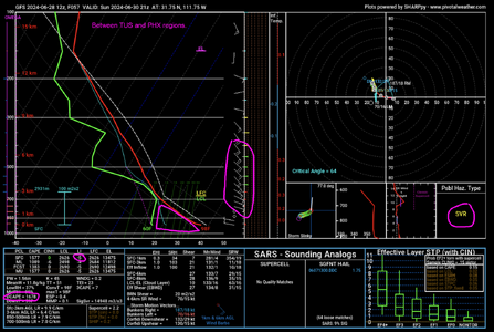
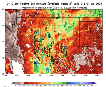
The upper-level steering winds do not seem to be favorable for organized haboobs, although it's possible a few outflows could consolidate given inverted-V soundings with strong down drafting. The ground is bone dry, so it will not take a lot to kick up some dust.
Typical low quality action initially with increasing chances by the weekend+. Likely a few wildfire starts in the mountains.
The upper-level steering winds do not seem to be favorable for organized haboobs, although it's possible a few outflows could consolidate given inverted-V soundings with strong down drafting. The ground is bone dry, so it will not take a lot to kick up some dust.
")
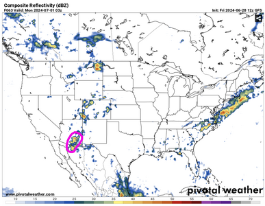
 require a line of organized, moving cells, surviving long enough to produce continuous outflow.