Southwestern Monsoon Discussion - 2020

Warren Faidley

Supporter
Joined
May 7, 2006
Messages
2,311
Location
Mos Isley Space Port
Figured it was time to start this annual thread since we are about 3 weeks away from the average start of Gulf and/or Pacific RH working into the southern parts of Arizona and New Mexico.

With such a crappy tornado season, I was wondering how many chasers are eyeing the monsoon as a back-up adventure this year? Most of Arizona is low-COVID except for Phoenix.

For me, the ever-increasingly extreme dust storms are my main target early-on. You only get a few (2-3) shots at a good dust storm, because once the ground is saturated, it's harder for repeat performances. We did not have a hard freeze this year in the deserts, so without the small plant particles we might not get the "big-one" unless everything sets-up just right. It is bone dry right now (see SPORT data below) and no precipitation is expected between now and the start of the monsoon -- e.g., no tropical activity.
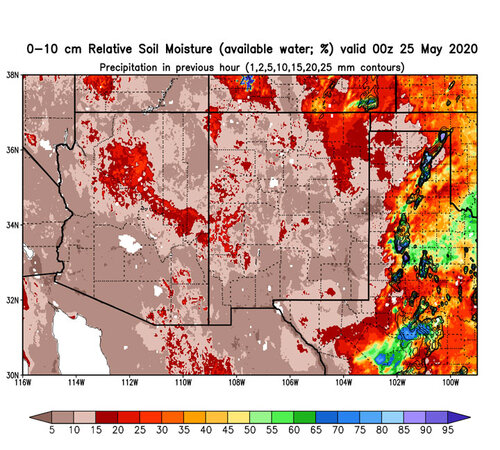
rsoim0-10_20200525_00z_swus.jpg
 
After nixing 2020 plains vacation plans, I've been pinning hopes on doing more monsoon day trips this season. Last year I put some effort into plotting out spots with good visibility and decent data reception to work remotely while waiting for storms to fire up. Focusing on the MRCZ in northern AZ again, but eyeing strict boundaries not to cross into the Navajo Nation. They're being hit really hard by the virus and I don't want to add to aggravations for them even though I'm staying isolated. There might even be a couple days of pre-season moisture next weekend pulling in from an AZ/NM high pressure between cutoff lows.
 
Last edited:
Scuppered here as well as Tornado Alley and called off our Arizona Chases this week due to ongoing outlook that no Trans Atlantic Flights will be happening anytime this side of Autumn. So its Tornado and Monsoon Season game over for us this year.
Gutted
 
Monsoon dust storms coming soon to AZ and NM. Just a reminder that dust storms are a constant hazard. Remember to get off the road (exit if possible) and take your foot off the brake pedal. If you can get all the way off the highway safely, that is even better. These storms come up quickly and what seems like a small amount of dust and rapidly turn into a blinding wedge of dust. Don't think you can simply drive through it. I-10 in Arizona is very dangerous, especially between Tucson and Phoenix. As some of you know, I saved my own life by pulling off the road during a dust storm in Colorado. The DPS car seen below was fortunately unoccupied.

572bcfc36e129.image.jpg
 
Looks like some RH will begin to trickle into Arizona over the course of the next week, but a system moving in from the west will move storms east. This is not a good set-up for mega-dust storms in Phoenix and central Arizona. Travelers near Wilcox and the AZ / NM border will need to be watchful of outflows. This is a good set-up for isolated thunderheads. It looks like the big show will begin to take shape after July 3rd as the 500mb flow turns east.
 
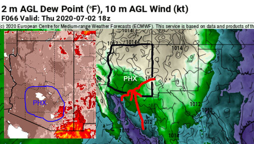
Monsoon is here! Wednesday (7-1), is still questionable, but Thursday+ looking good for all monsoon hazards. Latest soil moisture content data (inset) shows very dry / undisturbed soil, so major dust storms are likely over the next 3-7 days. I went out on Monday and surveyed the ground between Tucson and Phoenix and it's like talcum powder. Just walking on it creates a dust cloud.

The upper-level winds should be moving storms N/NW allowing them to mature and consolidate outflows in favorable direction. Pretty difficult to forecast monsoon storms too far in advance as a lot depends on cloud debris from the previous day's activity in Sonora, Mexico and the unpredictable surges of RH from the south. (The RH on the day of the ultra-massive dust strom in PHX (7-6-11) was 31 ºF at 3pm in Tucson).

I should note that the majority of epic-class dust storms occur within the first week of increased activity.

Needless to say, if you are coming out to Arizona to chase, we are having a major resurgence of COVID-19.

az-mon.jpg
 
I'm not goin' near Arizona right now, but do have hope that some of that moisture will make it up into southern Colorado by Friday or Saturday. Did you mean the dewpoint was 31F at 3:00 p.m.? Dry for getting much rain, but good for that dusty outflow you're looking for.
 
I'm not goin' near Arizona right now, but do have hope that some of that moisture will make it up into southern Colorado by Friday or Saturday. Did you mean the dewpoint was 31F at 3:00 p.m.? Dry for getting much rain, but good for that dusty outflow you're looking for.

Thanks for the correction... the RH was 31 percent, not ºF.
 
Looks like we will finally see "ripsnorting" levels of monsoon activity starting today and especially tomorrow onward as upper-level thermodynamics / directional flow / disturbances and low level RH come together over SE and eventually central AZ. Dust beds between TUS and PHX have received some spotty, light precipitation, but high temperatures of 110+ and low RH over the last few days should allow for recovery and raise the potential for MEGA dust storms, especially in Phoenix. I should point out that the most prolific regions of dangerous dust production are still untouched south and east of PHX.

It will be interesting to see how the new dust storm detection system works along I-10 near Eloy, AZ. Just reminding chasers to try and use the frontage roads or get the hell completely off the highways as dust approaches. Last week, I was on the frontage road west of Tucson during periods of near-zero visibility and people were still plowing down I-10 at 75+ mph.

 
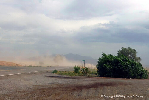
On Monday, I headed out to the top of La Bajada Hill just southwest of Santa Fe as a SVR-warned storm was moving NE through the Albuquerque area. The SVR warning and the various special weather statements and severe weather statements for the storm all mentioned that the high wind was well ahead of the rain (which was also evident on radar) and that low visibility from blowing dust would be a hazard. I did not get to see a true haboob, but it was a pretty intense dust storm, especially just south of where I stopped at Waldo Canyon Road as the high wind kicked up dust from an unpaved road and an open field. Here is a picture that is pretty representative of what went on for about 15 minutes:

duststorm71320-1.jpg

My full report, which includes video, is posted at:


You can really see the hazards of driving in such dust storms, as a couple vehicles coming north on Waldo Canyon Road pop out of the dust, totally invisible one second and there the next.
 
Starting to look like the SW monsoon is suffering the same fate as the tornado season. The upper levels look great one day, then go anemic for the next week. RH surges come up to the border, then end being ankle-deep, mixing out by mid-day. Both the TUS and PHX discussions are starting to mimick the Central Plains discussions, "maybe next week."
 
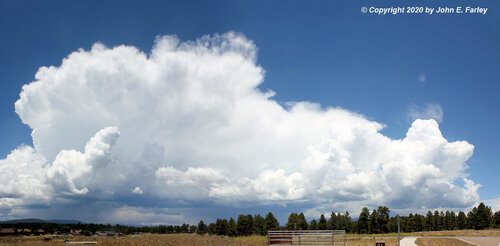
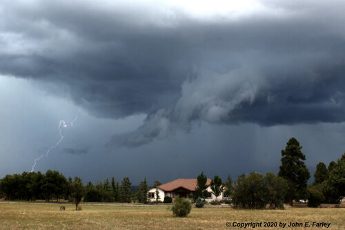
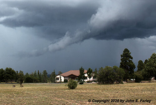
It has started to kick in a little better over the past week or so in southwest Colorado. It has now rained here for 5 days in a row. Much needed; a little more than a half inch so far, and hopefully quite a bit more the rest of this week. A couple days ago, I caught a very pretty storm that formed northwest of Pagosa Springs and gradually drifted southeast toward town. It was very photogenic when I first saw it from Veteran's Memorial Park, looked increasingly menacing as I approached it, and eventually gave me some good hail video - lots of hail, but all small so no risk to the car.

storm71820-1.jpg

Full report with more pictures and video at:

 
So far, the Arizona monsoon has been about a 3 on a scale of 1-10. A couple of localized events, but no major dust storm for the PHX area is quite unusual for July. Very few PM lightning fests -- zero for Tucson. This will likely go down as the worst chase year for me in over 30 years. We still have another month of monsoon possibilities and what appears to be a busy tropical season, so anything can happen.
 
We actually had about average precipitation around Pagosa Springs, CO in July. However, this monsoon has pretty much been a dud so far around here as far as lightning has been concerned. There has been some decent mammatus on occasion, and I caught a couple hailstorms near here and one dust storm down in NM. So not a total fail. August has been very quiet so far, though, and looks to continue that way for a while.
 
If it were not for the wintry storm September 8-10, we would have had NO precipitation the whole month of September in Pagosa Springs, CO. And September should be our wettest month. In 16 years that I have lived part-time or full-time in the NM/CO region, this was hands-down the worst monsoon.
 
Basically the same where I am for Sept here as what @John Farley said... That one snowstorm was essentially it on moisture for the month. There was one little rain, but I can't hardly count that since it no more than wet the surface...
 
Back
Top