Upcoming Chase Season: 2017 Edition

View attachment 15436

After the past week, concern for drought to mitigate severe weather opportunities later this spring in the southern Plains is dwindling fast. Particularly across most of the southern High Plains (at least from the TX Panhandle northward), these are very impressive totals for March.

I would speculate that so long as we see April rainfall that's at least within the normal range, we should be well on our way to a third straight year of quality evapotranspiration west of I-35. This should be great news for all chasers, and particularly chasecationers focused on the late season. Unless the large scale pattern is particularly awful throughout the late season, I'd expect a tendency for weakly forced, mesoscale setups to overperform under these conditions (similar to the late May periods in 2015 and 2016).

Hard to believe, after we could hardly buy a setup west of 98°W with <20 F T-Td spreads from 2011-2014.

Made the round trip from AMA to OUN on Thursday-Friday and it was amazing how wet/much standing water there was the entire corridor of I-40 from the recent system. Amarillo is sitting at about 3 inches above normal for the year along with some of the other locations in the central/eastern Panhandle. Looks pretty healthy out there too at the moment as long as the rain keeps up.
 
Looks like we have at least a week of nothingness ahead!

Indeed. Nothing obvious coming up in the reliably predictable future. The CFS has gone mostly dark recently, not painting any widespread supercell supportive conditions until early next week. Recent GFS runs continue to show a tendency towards a northward jump in the jet stream, and with the exception of one trough that swings through the innermountain West, also progs a largely zonal pattern emerging after that. Weak ridge possible over the central US mid next week. After that, who knows. Latest ERTAF outlooks go for "below average" tornado activity through most of April.

Build up your savings and time off now, because it looks pretty quiet for at least the next 7-10 days. Hopefully by the end of April we'll start to see more events.
 
Agree nothing much is on deck for the next 7-10 day predicable future. Active jet up North would be more intriguing a month from now. Out in the 11-15 day (Apr 22-26) a trough may pass through the Rockies but details are fuzzy that far out. Trough may not even dig much into the Rockies or eject right. Only value in the 11-15 day is a decent temperature signal cool Rockies warm Southeast.

I like the first half of May for several reasons, first of which is May climo. If the 11-15 day trough verifies, severe or not, one might expect a few quiet days behind the trough at the end of April. With persistence one would expect another West/Rockies trough in early May. Weekly charts hint at it, but cannot agree on timing (no surprise that far out). Path to quieter May would be faster El Nino response but I'm not too concerned about early May.
 
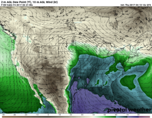
GFS has been wanting to bring a pretty potent system through the Upper Midwest about a week from now for several runs. Agree this would be nicer to see in late May or early June, but something to watch at least. Not sure why it's so stingy with the CAPE on the 18Z run since it brings >60 dews and decent lapse rates well into IA, MN and WI. Of course that is just about meaningless at this range.
 
Last two runs keep the same general idea for mid to late next week but now with the system in the central Plains. 0-3 KM EHIs in the 9 to 10 range over portions of OK.
 
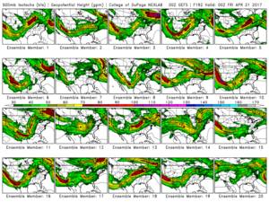
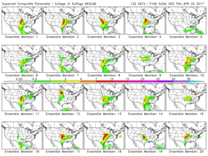
I have been monitoring the GEFS over the past few days, and most members have been hinting at something good across the central plains and mid/upper MS valley this coming Wednesday and Thursday. Will be fun to see if this pans out
 
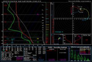
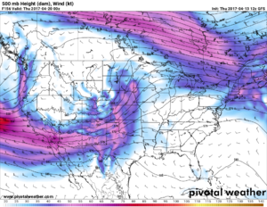
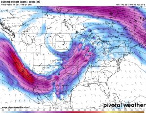
I had pretty much written off most of the rest of the month, but looking at the latest GFS (20170413 6z) and GPDS (20170413 0z) runs gives me a slimmer of hope. Both show a potent low moving thru the plains late next week. GFS fires things on Thur 4/20 and Fri 4/21. I even found a PDS TOR sounding in Texas. GPDS is a little slower and makes Sat 4/22 look like the day. The bad news is when you look at the model run trend in the GFS, it has been very inconsonant for this time frame. We will see over the next few days if it latches on to this. The GPDS has just started to get into this range. Guess I shouldn't give up on April just yet.
 
As JeremyS posted above, last night's 00z GFS run was quite impressive for a possible active day next week. Looking at the ECMWF from recent runs and today's 12z GFS run, it does appear that things may be on the uptick. Moisture should slowly gather in the plains over the weekend. Starting Monday, there could be multiple dryline setups. The GEFS runs are starting to show multiple members agreeing on some disturbances swinging through the Southern and Central Plains with west coast troughing. Obviously, important details are still impossible to gather this far out. Things will continue to evolve. But, I did put in vacation for all of next week, hoping to be ready to chase anything that looks worthy of the long haul to the Southern Plains.

12fd4afef3b67b8039a5a4b0282630ca.png
13318ca96d7f4d02ea25fe7aa6ffaf83.png

8d8344121ad77223635efadbc56bb154.png

51a5b88e33a28af940f8baafe72b437c.png

d0857c9d80509c13365154e421b2dcaa.png
 
Last edited:
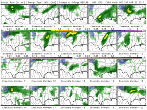
Guess most of you saw that SPC just went 15% on day 8 (Fri 4/21) in OK and southern KS. Latest GFS run still has me excited. I actually found some better TOR soundings in TX than OK that day in the latest GFS. GDPS still not as nice for that time period. Still not a lot of agreement in the GEFS ensemble, but it is early.

GEFSSGP_prec_ptypens_186.png
 
For what it's worth, the latest euro deterministic run has a potent looking severe setup in the high plains rather than C/E OK

Granted this is west of where the EPS mean and GEFS mean would probably be.
 
Last edited:
Back
Top