Thoughts about the upcoming 2015 chase season

Not good for storm chasing but at least it will likely help out with death and destruction.

Ignoring 1998, which was coming out of the strongest El Nino on record and had the most fatalities of any tornado season between 1984 and 2011. 1953 featured a weak El Nino for the entire year and was the second deadliest year since 1950.
 
Coming out and being in are two different things and I posted the NOAA website I got the info on what months were El Nino, La Nina, neutral and what strength they were.
 
Coming out and being in are two different things and I posted the NOAA website I got the info on what months were El Nino, La Nina, neutral and what strength they were.

You keep posting that "El Nino is bad for tornadoes" and seemingly ignoring the previous cases, regardless of whether it is coming out of an El Nino, during an El Nino, or heading into an El Nino. If you're going to give me a dislike for correcting you, then that's your loss.
 
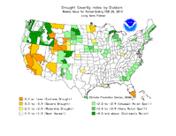
In the near term while there is remaining snowpack/freezing soil temperatures, I will be watching to see how incoming systems are affected as they cross from Missouri into Illinois. February 20th of 2014 was a big event with all significant activity ceasing once crossing a local E to W snowpack roughly parallel to I-72 in Central Illinois. Would be nice to have something right now just to whet my curiosity as to whether Midwest activity will be delayed or at least marginalized in the short term? Once the existing snowpack is fully absorbed by thawing soil, there too, I will be looking to see if there is any minor influence on systems as they interact with this region. Back in late 2011/early 2012, there was much more precipitation across SE IL into Southern Indiana and in turn, I remember noticing a higher frequency of significant thunderstorm activity "down south" vs. the Central region. The February 29th (Harrisburg IL) as well as March 2nd (Henryville IN) outbreaks occurred along this corridor of previously higher snowpack/soil moisture. This is all purely anecdotal of course but something else I'm watching is where we stand overall with respect to drought potential or lack thereof. I hope for the Midwest it's not another 2008 with training systems and significant flooding though unlike late winter of that year with above average precipitation to set the stage locally, so far so good. Likewise, if we remain stuck in a NW flow pattern as has been the theme for this winter, it could be another 2009 that was great for us, not as much for you guys out west.

sat.PNG palmer.gif
 
Calvin,

I'm not sure what constitutes a good storm chasing year to you. Maybe you could elaborate? To me it's typically the number of tornadoes that occur in a given year. Here's a few numbers for some of the recent El Nino years we have had.

1992- We were in an El Nino during storm chasing season. This year had an above average number of tornadoes (1297) featuring the Chandler, MN F5.

1998- We were in an El Nino through the March, April, May tri monthly period. This year had a well above average number of tornadoes (1424) including two F5's (Birmingham, AL and Nashville, TN).

2010- We were in an El Nino through the March, April, May tri monthly period. This year had an above average number of tornadoes (1266) Including 13 EF-4's.

So there are 3 recent examples of good storm chasing years that happened during an El Nino year.
 
While we are finally warming up, the overall pattern does not appear to favor severe weather at all. Largely zonal and split. The split flow keeps a pretty active southern storm track near the gulf, good for replenishing moisture, but in the form of general spring rains. This also continues to shunt return flow from the gulf in the near term.

The good news though is these types of patterns tend not to last long especially in spring. It really can go either way from there as we move into March's final days. This is about as smooth of a transition from winter to spring as you can ask for. Hopefully we get to reap some benefits later. Im prepared for a chase-less March at this point, unless I let desperation + low gas prices bait me out to Central Texas for a marginal hail day...which is about the closest thing I see to an actual setup in the fantasy range.
 
Calvin,

I'm not sure what constitutes a good storm chasing year to you. Maybe you could elaborate? To me it's typically the number of tornadoes that occur in a given year. Here's a few numbers for some of the recent El Nino years we have had.

1992- We were in an El Nino during storm chasing season. This year had an above average number of tornadoes (1297) featuring the Chandler, MN F5.

1998- We were in an El Nino through the March, April, May tri monthly period. This year had a well above average number of tornadoes (1424) including two F5's (Birmingham, AL and Nashville, TN).

2010- We were in an El Nino through the March, April, May tri monthly period. This year had an above average number of tornadoes (1266) Including 13 EF-4's.

So there are 3 recent examples of good storm chasing years that happened during an El Nino year.

2011? Megaoutbreaks of 2011 and 1974? Outbreak in the northeast in 85? Outbreak in 91 with Andover? Biggest outbreaks of the 2000's?
 
The GFS backed off that strange Rex block with a longwave trying to take a vacation to Honduras thankfully. Definitely agree that its unlikely we see anything of note in March but unless we have some seriously bad luck, I doubt the GOM is going to take many more hits like it has lately. Only takes one impulse to change a flow regime so the end of March/start of April might get it done.
 
This is a newer, experimental analog product from Levi Cowan, working off the best matching 500 mb composites for a given month (it then projects forward into future months). You can see that the majority of the years listed here (aside from 2014) actually weren't too bad for spring in terms of consistent activity, especially come the second half of April through May and June.

analogs_monthly_z500.png


Link here: http://www.tropicaltidbits.com/analysis/analogs.html
 
So if I'm not mistaken the reddish colors represent areas of high pressure in the mid atmosphere while the bluish colors low pressure? I'm not sure what the contours are.
 
Are the contours are geopotential height? The colors evidently represent the height anomaly (i.e. the difference from the long-term mean).
 
2011? Megaoutbreaks of 2011 and 1974? Outbreak in the northeast in 85? Outbreak in 91 with Andover? Biggest outbreaks of the 2000's?

There's no denying that the 1974 and 2011 outbreaks were among the greatest of all time. If your expectations are so high that only these types of years are considered good chase years then you are going to be very disappointed. As for the other years you mentioned, 85 and 91, lets take a look at some comparisons with El Nino years.

The 1991 Andover outbreak featured 55 tornadoes and the 1985 outbreak featured 43 tornadoes.

1992- June 15th featured 58 tornadoes and June 16th had 65. This is the 3rd largest two day outbreak in U.S history. This was an El Nino year.

1998- June 2nd Northeast outbreak featured 50 tornadoes. This was an El Nino year.

2010- April 24th outbreak featured 77 tornadoes. This was an El Nino year.

So there are outbreaks for the three years I posted about that are larger than two of the outbreaks you posted about and they occurred in El Nino years.
 
Thanks, Adam for some interesting insight into the way the pattern is shaping up in the prognostications. Although this February was actually colder than 2014's locally, we sure didn't have this kind of 7-8 day warm up in early March, either! I just have to keep reminding myself that a lot of spring storm seasons don't really kick off until mid-late April. Some of the years that DID feature active early seasons actually turned out to be pretty lousy chase years overall (2006, 2012).
 
Back
Top