Andrea Griffa
EF5
Hi all,
I'm starting a new thread for 2007 season forecast thoughts.
Last year I tried to imagine how could it be the month of may.
I thought that the 2006 season started up so early and making a comparison, we could compare the month of March and the whole month of April of that year, to a may of a normal year. As to me this was a sign that the season was just well set.
In this way a deductive reasoning did lead me to think that the month of may could be like a normal june and the end of may could be an early july.
We all know how things evolved in the last season.
This year the season is completely influenced by the full activity of the Polar Vortex and USA winter is a demonstration of that. The more spring came near, the more we could understand that the thunderstorms activity was made easier, and you all know that when you have more cold air descent with the polar front that comes down, southern Plains storms(and not only) are more numerous.
So I wanna make a correlation(not necessary scientific) between Nino activity(of the last months) and the strong presence of the polar vortex activity. So we had Nino and USA got a lot of precipitations, strong low pressure systems,snow and tornadic storms(the high number of february's tornado is evident).
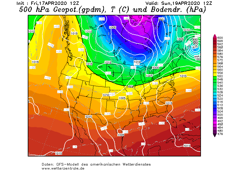
At this point there's something to say; first, I don' wanna make any kind of conclusion. I'm monitoring Nino and Nina and from some days and it seems that the Nino pattern is changing into a La Nina pattern..I don't know if it's only a little downfall of the Nino pattern that will last only for a little period, but if you see this map you well understand what's happening:
Anyway I repeat I don't wanna make any conclusion but I'm hoping that things come back in the last months pattern..If the cold air descent tendence still remained the same during this spring, we could have an incredible may.
As conclusion I say that making a similar comparison,(not too much scientific) could be not really representative of the reality, but as last season theaches could be useful in forecasting.
Guys and girls, lemme know your thoughts.
I'm starting a new thread for 2007 season forecast thoughts.
Last year I tried to imagine how could it be the month of may.
I thought that the 2006 season started up so early and making a comparison, we could compare the month of March and the whole month of April of that year, to a may of a normal year. As to me this was a sign that the season was just well set.
In this way a deductive reasoning did lead me to think that the month of may could be like a normal june and the end of may could be an early july.
We all know how things evolved in the last season.
This year the season is completely influenced by the full activity of the Polar Vortex and USA winter is a demonstration of that. The more spring came near, the more we could understand that the thunderstorms activity was made easier, and you all know that when you have more cold air descent with the polar front that comes down, southern Plains storms(and not only) are more numerous.
So I wanna make a correlation(not necessary scientific) between Nino activity(of the last months) and the strong presence of the polar vortex activity. So we had Nino and USA got a lot of precipitations, strong low pressure systems,snow and tornadic storms(the high number of february's tornado is evident).
At this point there's something to say; first, I don' wanna make any kind of conclusion. I'm monitoring Nino and Nina and from some days and it seems that the Nino pattern is changing into a La Nina pattern..I don't know if it's only a little downfall of the Nino pattern that will last only for a little period, but if you see this map you well understand what's happening:
Anyway I repeat I don't wanna make any conclusion but I'm hoping that things come back in the last months pattern..If the cold air descent tendence still remained the same during this spring, we could have an incredible may.
As conclusion I say that making a similar comparison,(not too much scientific) could be not really representative of the reality, but as last season theaches could be useful in forecasting.
Guys and girls, lemme know your thoughts.
Last edited by a moderator: