Tim Vasquez
EF5
- Joined
- Dec 4, 2003
- Messages
- 3,411
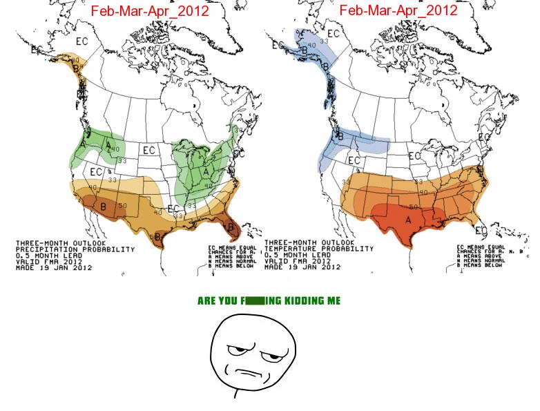
I notice this drought pattern is getting a bit persistent from year to year (see graphics below). Almost every year, the drought is centered somewhere in the Texas to Central Rockies region, with normal or above-average precipitation in the Midwest through the Great Lakes Region.
What is most concerning is that the winter months are THE most important time for recharging soil moisture and aquifers in the Great Plains, since vegetation is dormant and evaporational losses are lowest. Drought and a lack of days with snow cover tend to perpetuate the drought. The coverage into the southern Rockies also suggests warmer than normal dry sectors / caps, and that long wave ridging in the western US could be a problem.
I have to say it would be interesting to recalculate an annual average precipitation map based on the past 10 years of data.


