Tim Gonyo
EF2
Folks,
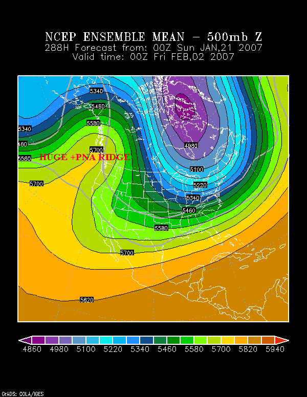
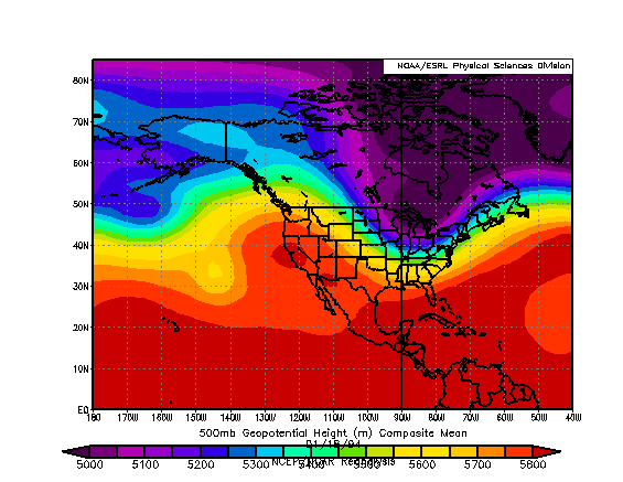
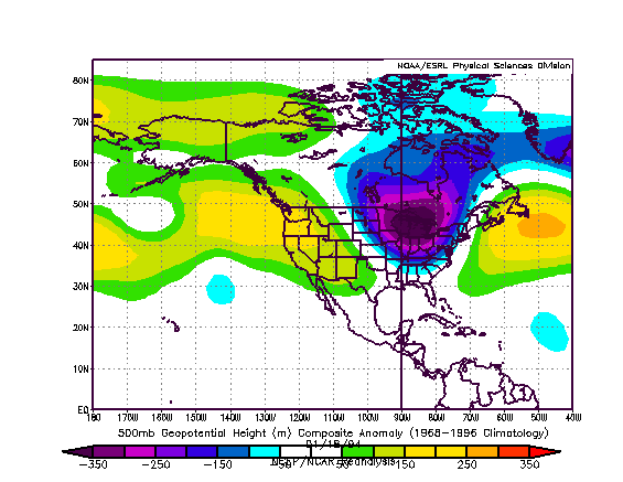
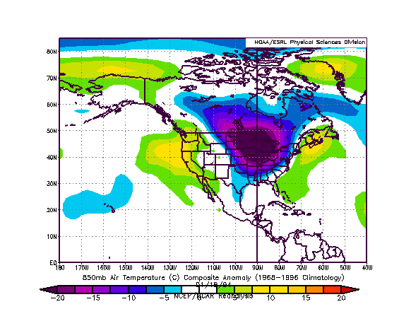
We're on board to experience some of the coldest temperatures to hit the eastern CONUS in the last 10 years.
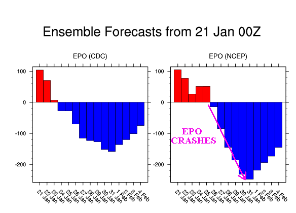
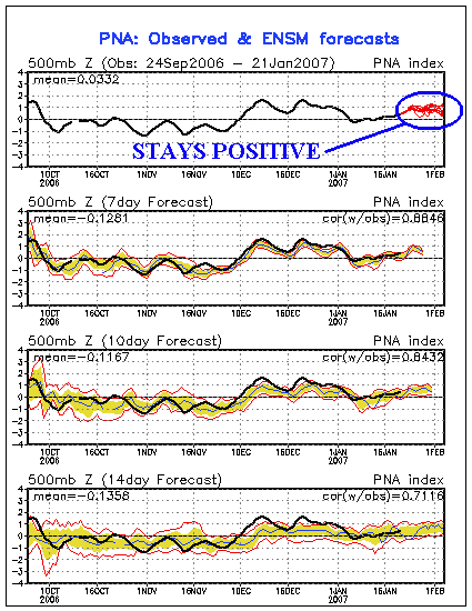
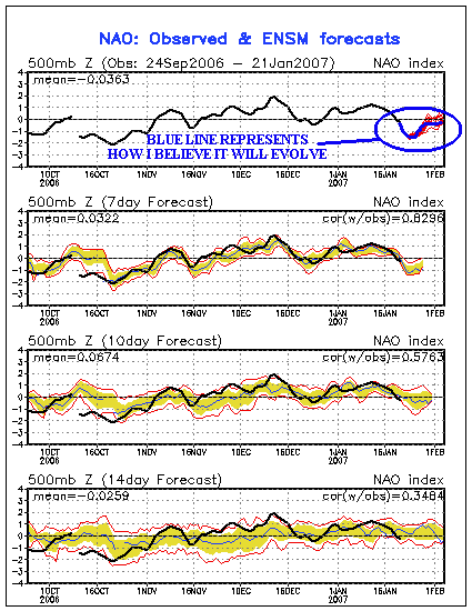
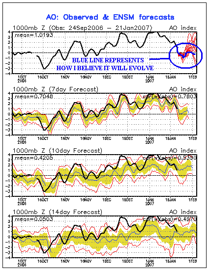
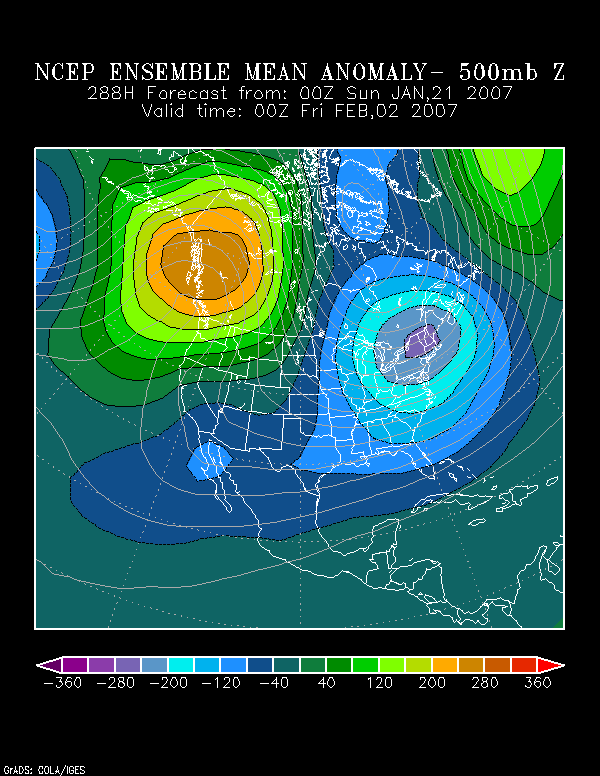
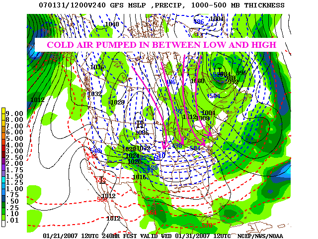
After looking over data, I believe we will have a short window of -EPO/-NAO/-AO/+PNA. This will provide us with the right ingredients to usher in progressively colder weather for the next 2 weeks, and the most extreme cold coming around the changing of the months.
What does this mean for cities across the US? At the heart of the cold, the following will be common for the specified cities:
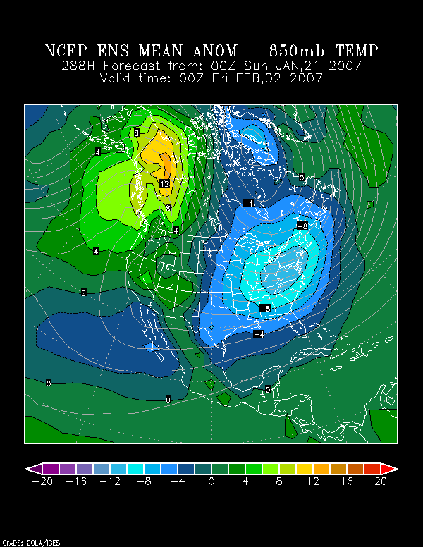
Boston: Highs in the single digits and lows around -10.
New York: Highs in the teens and lows in the single digits below zero.
DC: Highs in the teens to around 20 and lows in the single digits.
Atlanta: Highs in the 20s and lows in the single digits.
Milwaukee: Highs in the single digits BELOW zero and lows around -20.
Chicago: Highs around zero and lows in the teens BELOW zero.
Even the operational GFS has been hinting at this vodka like cold for the last several days now. Take heed people, this cold will end up being talked about as much as the warm period from Dec 15 - Jan 15. Departures could approach -30 in the heart of the cold.
Someone could approach -50F in a remote location of the northern US (below 1500 ft altitute) during this period if everything comes together perfectly.
We're on board to experience some of the coldest temperatures to hit the eastern CONUS in the last 10 years.
After looking over data, I believe we will have a short window of -EPO/-NAO/-AO/+PNA. This will provide us with the right ingredients to usher in progressively colder weather for the next 2 weeks, and the most extreme cold coming around the changing of the months.
What does this mean for cities across the US? At the heart of the cold, the following will be common for the specified cities:
Boston: Highs in the single digits and lows around -10.
New York: Highs in the teens and lows in the single digits below zero.
DC: Highs in the teens to around 20 and lows in the single digits.
Atlanta: Highs in the 20s and lows in the single digits.
Milwaukee: Highs in the single digits BELOW zero and lows around -20.
Chicago: Highs around zero and lows in the teens BELOW zero.
Even the operational GFS has been hinting at this vodka like cold for the last several days now. Take heed people, this cold will end up being talked about as much as the warm period from Dec 15 - Jan 15. Departures could approach -30 in the heart of the cold.
Someone could approach -50F in a remote location of the northern US (below 1500 ft altitute) during this period if everything comes together perfectly.
") God bless America....
God bless America....