Post your best severe weather - 2014 chase season

Man there are a lot of excellent 2014 shots here!

These are my pics—no tornadoes for me last year, but still managed to view some beautiful supercells.

Arthur County, Nebraska - May 19, 2014
While shooting time lapse of this tornado-warned supercell approaching over the sand hills, I got a few decent frames with lightning. Had to cut that short to get out of the way and wind south to Ogallala.


Goshen County, Wyoming - May 20, 2014
Two supercells near Torrington were competing for attention. I eventually chose this southern storm with its better defined structure. Naturally, the northern storm strengthened and picked up a tornado warning once I was committed—and then spat out a brief tornado. I was still really happy with the structure and solo views on this one.


Adams County, Colorado - May 21, 2014
Lots of moods to the HP supercell east of Denver.


At this point, a new RFD cut managed to form nice and clear and for a couple minutes I thought I might get a view of at least a brief spinup. Nothin' doin'. This cone-shaped wall cloud was still excellent though.


Wickenburg, Arizona - September 27, 2014
My best Arizona supercell catch so far took place during a transition event at the end of the monsoon season.
 
There are so many excellent photographers in the storm chasing community. I could look at threads like this all day. Here are a few of my favorite images from 2014.

April 3, 2014 near Shelbina, MO


April 27, 2014 southwest of Butler, MO looking at a tornado occurring in Kansas


June 7, 2014 near Roswell, NM


June 16, 2014 near Pilger, NE
 
WOW! That is really cool seeing the Pilger storm from that distance away. All of my pics are from an iPhone so they aren't great, but o well. Thankfully this year I will be chasing with an actual legit camera.
IMG_0566.jpgIMG_0571.jpgIMG_0690.jpgIMG_0721.jpg
 

Attachments

  • IMG_0819.jpg
    IMG_0819.jpg
    7.9 KB · Views: 19
Last edited by a moderator:
Great photos everyone! Here are a few more that I forgot about...

NEAR BIG SPRING TX 5-26-2014


NEAR BIG SPRING TX 5-26-2014


NEAR LEFORS TX 9-2-2014


NEAR WHITE DEER TX 9-2-2014
 
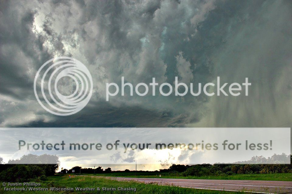
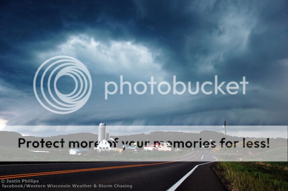
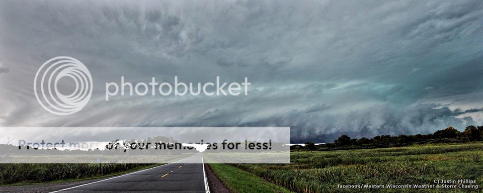
May 8 tornado near Madelia, Minnesota. Very brief touchdown, wasnt quick enough to catch the full condensation to ground.


June 20 tornado warned supercell near Wadena, Minnesota.


August 6 after dark shelf on severe storm near Eau Claire, Wisconsin.


September 3 severe warned supercell near Milaca, Minnesota. Dropped ping pong sized hail on me right after the shot.
 
Justin, it's awesome to see that Wadena, MN image. I was doing a virtual chase from home that day and had targeted Brainerd, Minnesota the night before. I remember following somebody's stream...it might have been yours...wishing I was there to see that first-hand. So I recognized your view immediately. That's a great shot of a very photogenic storm.
 
Thanks Jeremy!!, that was one of my biggest risk chases of the year. Just under a 4 hour drive on a two percent tor day, I had a gut feeling all morning and the day before that SPC was underplaying it since models were really consistent on a lone supercell happening in north central Minn. Glad I stuck to my gut, easily the best supercell I have seen in my 4 years of chasing up here in the north :D Even in its dying stages it was insanely photogenic!
 
I was stuck at home last year and didn't get to chase, but that didn't stop me from getting my camera out when severe storms rolled through my area. This is my favorite.

 
Big Spring, Texas - May 26, 2014
1979344_10152295664925318_2571343941279325996_o.jpg


(The Beginning of the storm) Miles City, Montana - Wed. May 28, 2014
10482250_10152334074935318_90183393873688471_o.jpg


Consul Sk. Canada - July 23, 2014
10497519_10152392764900318_2961778620729875661_o.jpg


10446218_10152414318485318_5412836337872787956_o.jpg
 
Last edited by a moderator:
http://BDJPHOTO.zenfolio.com/p891556587/e144cf78c
Panorama of Supercell near Matador, TX 6/7/14

http://BDJPHOTO.zenfolio.com/p891556587/e32b20807
Supercell Updraft outside of Henrietta, TX 5/7/14

http://BDJPHOTO.zenfolio.com/p891556587/e25f9aa24
Severe storm east of Crowell, TX 5/26/14

http://BDJPHOTO.zenfolio.com/p891556587/e33e3861a
9 image panorama of Severe thunderstorm shelf cloud and updraft 5/26/14

http://BDJPHOTO.zenfolio.com/p891556587/e3d9cc7b6
LP updraft in sunset light Kadane Corner (Kamay), TX 4/23/14
 
Great images everyone! Here are a few of mine that I shot in 2014 and what I consider to be some of my favorites! Hope everyone has an awesome 2015.


Pilger, Nebraska Tornado crossing the highway exiting town. June 16, 2014

10830538_1564024737162963_6975730022648677597_o.jpg


Double tornadoes northwest of Wisner, Nebraska on June 16, 2014. Growing in size.

10649076_1564432317122205_2911982754247745264_o.jpg


Cedar Rapids, Iowa June 30, 2014 Shelf Cloud.

10842110_1564435083788595_5783509535200969636_o.jpg


Tupelo, Mississippi Tornado. April 28, 2014

10854500_1564436920455078_7841561997693968562_o.jpg
 
I've resisted this thread for a long time, but it finally sucked me in, and I'm glad. You all have posted very very good pics.

Here are some vidcaps from Pilger from a perspective that many of you may have not seen. These are from the SE and S of the tornado that went through town:

attachment.php


attachment.php


attachment.php


Here are some more vidcaps from SD on June 18:

attachment.php


attachment.php
 

Attachments

  • IMG_2505.jpg
    IMG_2505.jpg
    7.7 KB · Views: 145
  • IMG_2506.jpg
    IMG_2506.jpg
    7.9 KB · Views: 145
  • IMG_2508.jpg
    IMG_2508.jpg
    7.6 KB · Views: 145
  • IMG_2701.jpg
    IMG_2701.jpg
    6.2 KB · Views: 142
  • IMG_2702.jpg
    IMG_2702.jpg
    7.7 KB · Views: 143
Back
Top