Margie Kieper
EF1
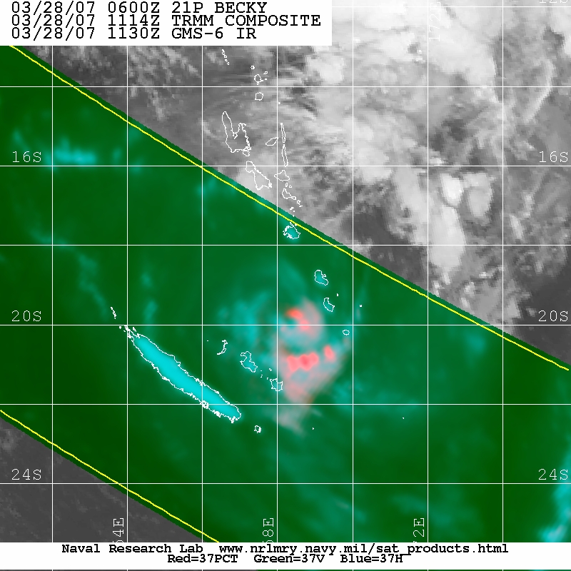
TC Becky is forecast by JTWC to intensify to 110 kt by Thursday evening, and Fiji forecasts moderate strengthening. Becky has been consolidating quickly and is moving under a large anticyclone (see recent microwave below to see the band of convection that has been continuing to wrap around the large warm center the last 24 hours). Intensity estimates are at T3.5 from JTWC and SAB.
As Becky intensifies, the current forecast track takes it directly over the South Pacific island chain of Vanuatu (in the news recently when a strong quake struck in the vicinity, but left little damage). While Kara is fizzling prior to landfall, the situation with Becky could potentially be much more dangerous.

As Becky intensifies, the current forecast track takes it directly over the South Pacific island chain of Vanuatu (in the news recently when a strong quake struck in the vicinity, but left little damage). While Kara is fizzling prior to landfall, the situation with Becky could potentially be much more dangerous.

Last edited by a moderator:

