• After witnessing the continued decrease of involvement in the SpotterNetwork staff in serving SN members with troubleshooting issues recently, I have unilaterally decided to terminate the relationship between SpotterNetwork's support and Stormtrack. I have witnessed multiple users unable to receive support weeks after initiating help threads on the forum. I find this lack of response from SpotterNetwork officials disappointing and a failure to hold up their end of the agreement that was made years ago, before I took over management of this site. In my opinion, having Stormtrack users sit and wait for so long to receive help on SpotterNetwork issues on the Stormtrack forums reflects poorly not only on SpotterNetwork, but on Stormtrack and (by association) me as well. Since the issue has not been satisfactorily addressed, I no longer wish for the Stormtrack forum to be associated with SpotterNetwork.

    I apologize to those who continue to have issues with the service and continue to see their issues left unaddressed. Please understand that the connection between ST and SN was put in place long before I had any say over it. But now that I am the "captain of this ship," it is within my right (nay, duty) to make adjustments as I see necessary. Ending this relationship is such an adjustment.

    For those who continue to need help, I recommend navigating a web browswer to SpotterNetwork's About page, and seeking the individuals listed on that page for all further inquiries about SpotterNetwork.

    From this moment forward, the SpotterNetwork sub-forum has been hidden/deleted and there will be no assurance that any SpotterNetwork issues brought up in any of Stormtrack's other sub-forums will be addressed. Do not rely on Stormtrack for help with SpotterNetwork issues.

    Sincerely, Jeff D.

Becky's turn

Joined
Oct 30, 2006
Messages
74
Location
Minneapolis, MN
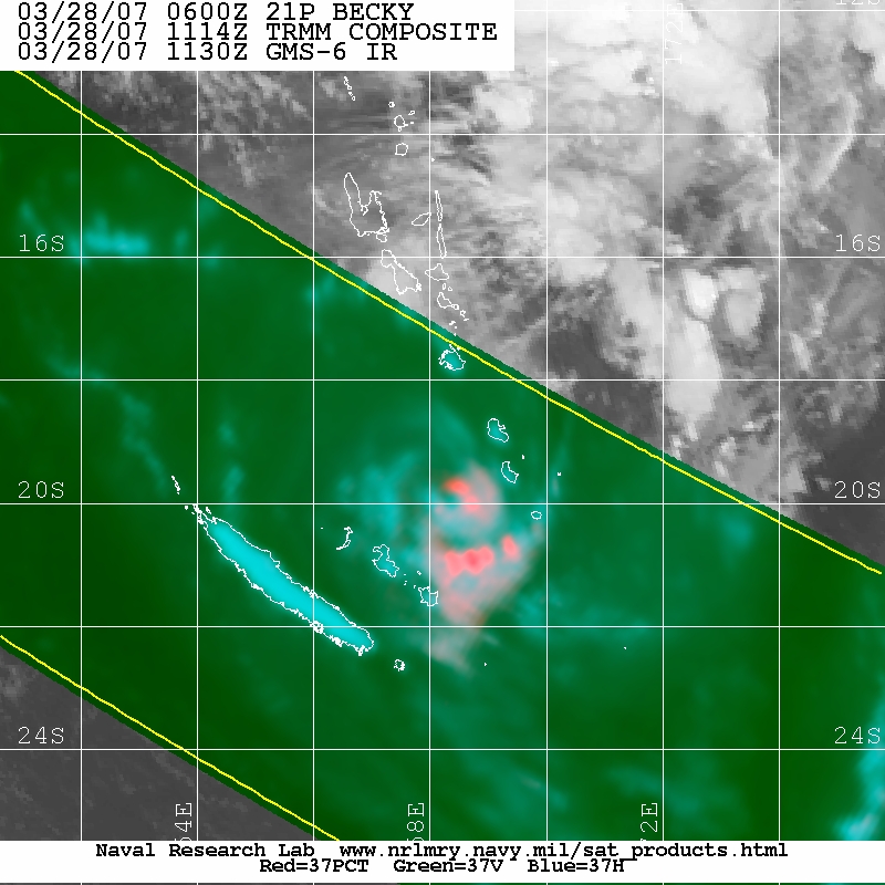
TC Becky is forecast by JTWC to intensify to 110 kt by Thursday evening, and Fiji forecasts moderate strengthening. Becky has been consolidating quickly and is moving under a large anticyclone (see recent microwave below to see the band of convection that has been continuing to wrap around the large warm center the last 24 hours). Intensity estimates are at T3.5 from JTWC and SAB.

As Becky intensifies, the current forecast track takes it directly over the South Pacific island chain of Vanuatu (in the news recently when a strong quake struck in the vicinity, but left little damage). While Kara is fizzling prior to landfall, the situation with Becky could potentially be much more dangerous.

20070326.2108.f16.x.91h_1deg.21PBECKY.50kts-987mb-136S-1639E.94pc.jpg
 
Last edited by a moderator:
JTWC forecast went from strengthening to 100 kt in 36 hr, to weakening to 60 kt in 36 hr.

Even though Becky has deepened just a little, as initially often happens in a sheared environment, shear will continue to increase and weakening will occur quickly. This recent 37ghz microwave shows the effect of the (northwesterly) shear very well: the convective structure (pink) is displaced to the SE of the lower level structure (light aqua), and even though the eye is well-defined, both are open to the NW:

20070328.1114.trmm.x.color37.21PBECKY.65kts-976mb-190S-1682E.58pc.jpg
 
Back
Top