Jimmy Deguara
EF3
A Happy New year to all.
SOme of you may have noted of the incredible drought conditions across Australia. It seems we may be in El Nino breakdown mode.
Consequently, moisture has fed inland with a cut off low creating conditions leading to heavy rains across far NW New South Wales and SW Queensland. Most of this came from active storms particularly during the 1st to 3rd January 2007.
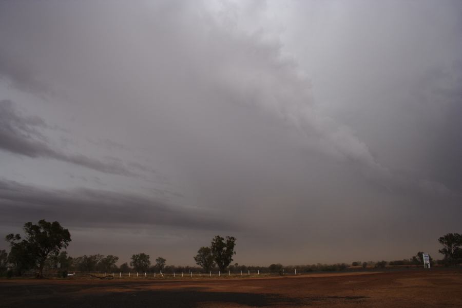
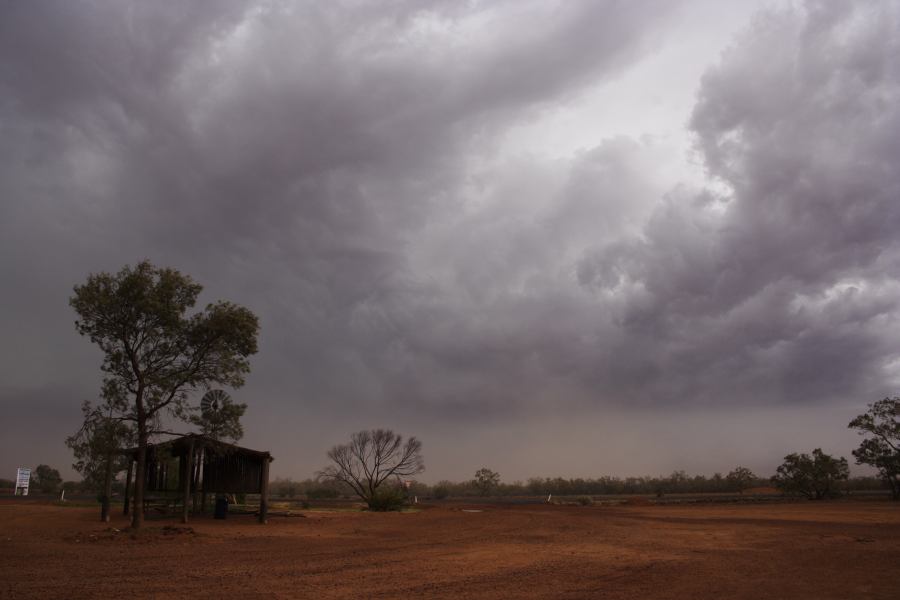
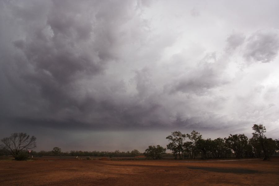
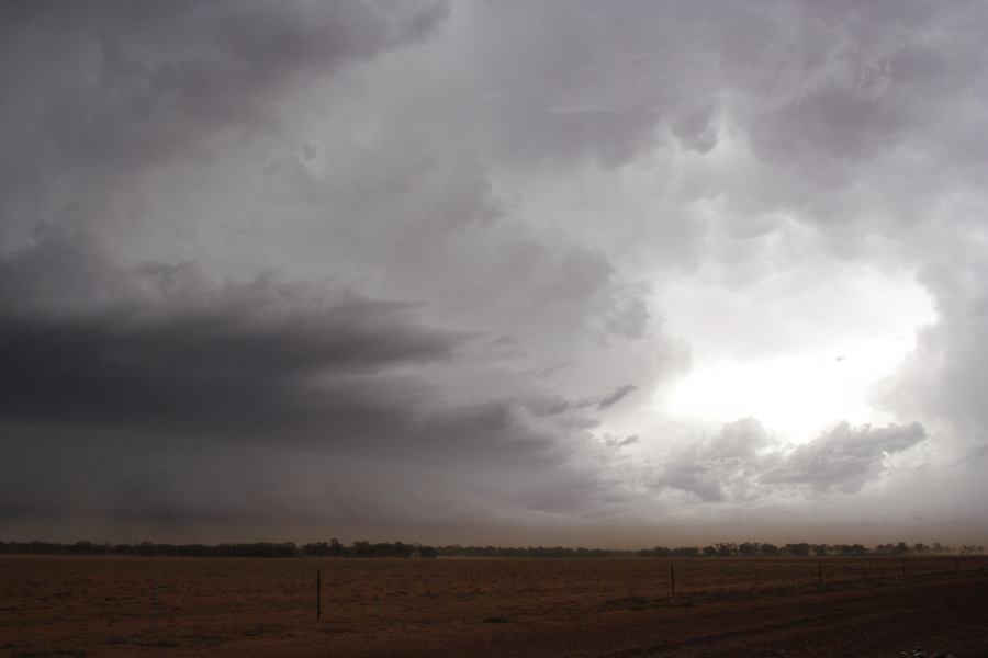
I thought I would share with all of you one particular cell of the chase. It occurred in far western Queensland in a region known as the Outback. What we consider as major towns are separated here by minumum 130km and even 250km or more. What it also means you are limited to road choices - spaced about 250km apart. Gravel roads are not an option and are closed after even moderate rainfall.
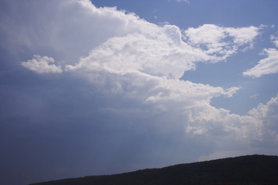
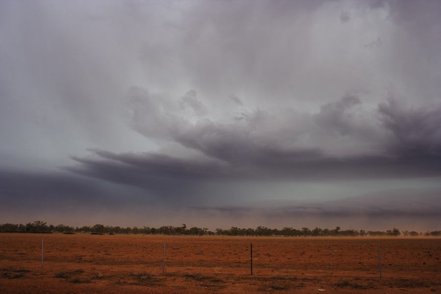
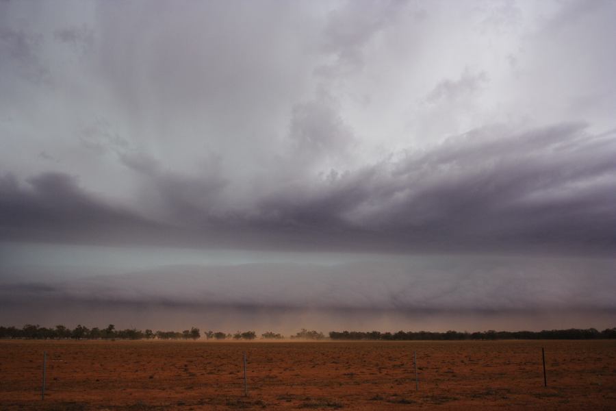
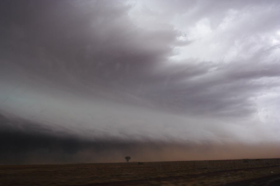
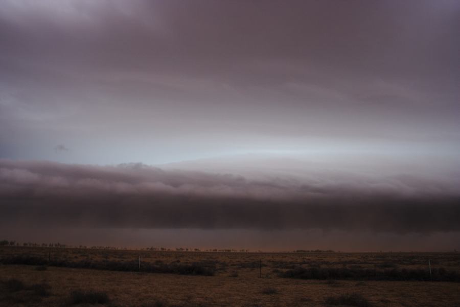
On this day, for the first time in many chases, we had deep layer shear with winds curving in on the southern quadrant of the low. Early ongoing convection occurred to the south and perhaps aided in the formation of a boundary slowly spreading north. It also helped cool temperatures to a reasonable level to close the gap between the dew point spreads. The end result emerging out of the inflow dust was the following cell:
Click on thumbs for the larger images


More available on this page
Regards,
Jimmy Deguara[/img]
SOme of you may have noted of the incredible drought conditions across Australia. It seems we may be in El Nino breakdown mode.
Consequently, moisture has fed inland with a cut off low creating conditions leading to heavy rains across far NW New South Wales and SW Queensland. Most of this came from active storms particularly during the 1st to 3rd January 2007.
I thought I would share with all of you one particular cell of the chase. It occurred in far western Queensland in a region known as the Outback. What we consider as major towns are separated here by minumum 130km and even 250km or more. What it also means you are limited to road choices - spaced about 250km apart. Gravel roads are not an option and are closed after even moderate rainfall.
On this day, for the first time in many chases, we had deep layer shear with winds curving in on the southern quadrant of the low. Early ongoing convection occurred to the south and perhaps aided in the formation of a boundary slowly spreading north. It also helped cool temperatures to a reasonable level to close the gap between the dew point spreads. The end result emerging out of the inflow dust was the following cell:
Click on thumbs for the larger images
More available on this page
Regards,
Jimmy Deguara[/img]
Last edited by a moderator:
")
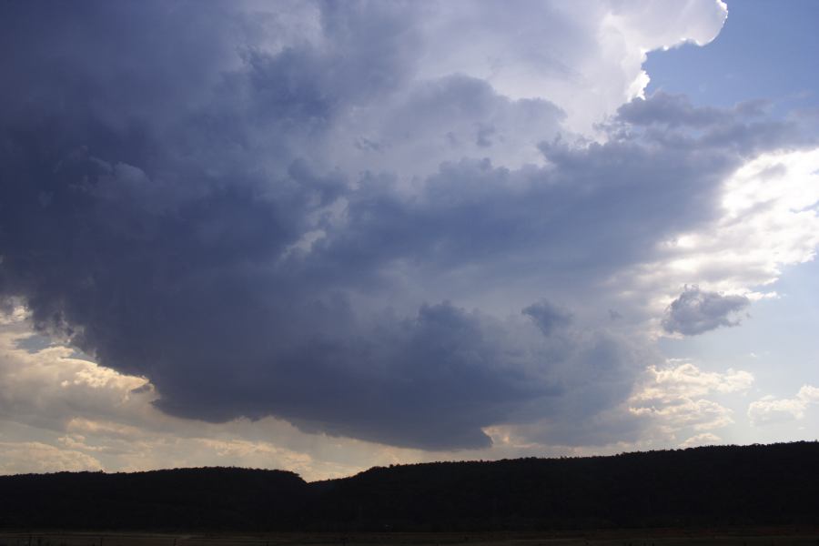
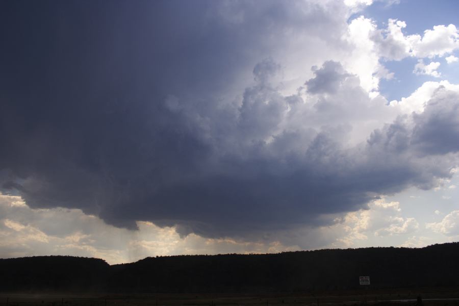
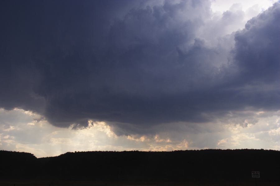
") The storm was one of the most inflow prone storms I had chased in Australia but definitely one with the deepest inflow!
The storm was one of the most inflow prone storms I had chased in Australia but definitely one with the deepest inflow!