Brian McKibben
EF3
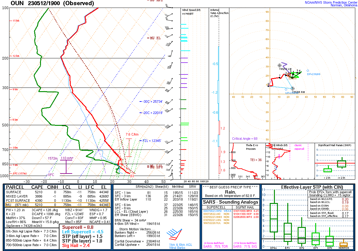
This could be one of those huge CAPE low shear sleeper days.
Plentiful moisture this morning as low 70 Tds extend to the OK/KS border and then upper 60s up through Nebraska.
If you could teleport, head up to Nebraska for your best chances. You have some upper support.
Down south along the DL/Front you could still get lucky though. I would expect explosive development by this afternoon as we are already sitting on >4,000 j/kg of SBCAPE and 3000 MLCAPE.
There is just enough bulk shear to get some marginal supercells in KS and OK. And with the explosive development we could get a brief window 1-2 hour to get a tornado.