Patrick K
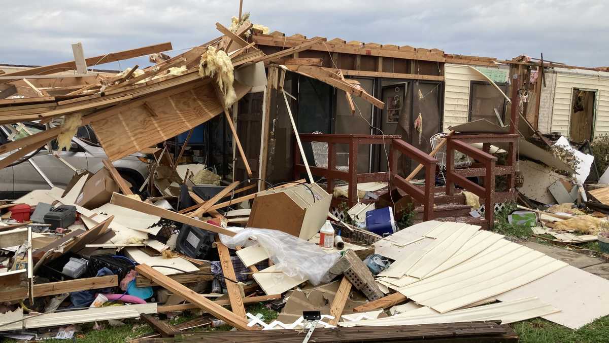
EF0
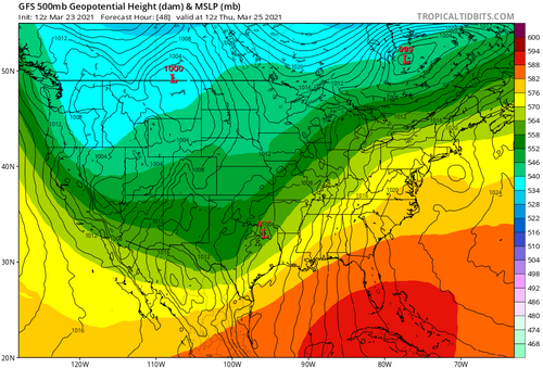
On Thursday, a positively-tilted trough is forecast to move from SW Texas into the MS valley and deepen as it develops into a closed low. Being Dixie Alley, moisture appears in place on morning of, with dew points climbing into the upper 60s / lower 70s as early convection lifts northward on the heels of a rather diffuse-looking warm front moving into TN. Behind this convection, some degree of air mass recovery looks likely, with favorable parameters spreading northward across much of central MS by about 18z. Certain parameters appear to align in this timeframe with good 0-1km SRH, STPs in the 4-5 range over a wide area, and widespread 1500-2000 j/kg MLCAPE. NAM3k forecast soundings from today's 12z model are of the PDS tornado variety in this timeframe.
The potential mitigating factors for a major tornado outbreak are similar to the 3/17 event, with a more spatially confined warm sector for storm development, also relatively uncapped and so instability, cloud cover, and early convection timing could be issues. Additionally, storm motion is close to parallel to the forcing gradient, with storms firing closer to said gradient in this event, which could be a potential storm mode issue. Despite early indications of PDS tornado soundings, hodographs are a bit messy above 2-3km, which could present another storm mode issue. And, yes, positively tilt situation as well. Still, the setup seems too favorable to ignore.
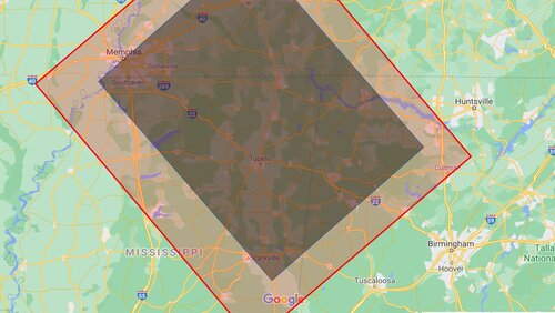
The usual Dixie Alley chasing considerations will be of interest, of course, and despite small-scale details needing resolved closer to the event I would target near Philadelphia, MS.
The potential mitigating factors for a major tornado outbreak are similar to the 3/17 event, with a more spatially confined warm sector for storm development, also relatively uncapped and so instability, cloud cover, and early convection timing could be issues. Additionally, storm motion is close to parallel to the forcing gradient, with storms firing closer to said gradient in this event, which could be a potential storm mode issue. Despite early indications of PDS tornado soundings, hodographs are a bit messy above 2-3km, which could present another storm mode issue. And, yes, positively tilt situation as well. Still, the setup seems too favorable to ignore.
The usual Dixie Alley chasing considerations will be of interest, of course, and despite small-scale details needing resolved closer to the event I would target near Philadelphia, MS.