2016-04-26 EVENT: TX/OK/KS

The 18Z NAM is starting to come around to what I was thinking originally. It's showing QPF output between 21Z-00Z from OKC south to DFW. Still showing pretty much the same as the previous runs parameter wise.

I still think the best bet is south where the 200mb jet and more westerly 500mb component is. Not quite sold on the Kansas play yet.
 
Chasing Tuesday is not an option for me but my chase vacation partner was thinking of flying out from Chicago just for this one event. He is not the forecaster in our duo so he asked me what I thought. I told him that if we were out there of course we would chase and there will be tornados somewhere but if it were me I would not fly out just for this. The way I see it there are two primary targets - southeastern NEB where winds are backed along a diffuse warm front. And the dryline in OK. However, mid-level winds are meridional in both regions. Chasing northward moving storms is a pain in the you-know-what. And in OK the flow is more parallel to the dryline than across it, which means storms seeding/interfering with each other. There is really not that much directional shear from 850 to 500mb and above. 850mb flow has a southwesterly component in OK on the GFS which could bring dry air in. (It is more southerly per the NAM). High precipitable water values and limited deep layer shear could mean HP storms. Some have mentioned a more southern target into north TX but IMO there is not much convergence along the dryline. Maybe things look different tomorrow with some mesoscale processes but he had to make a decision tonight so I suggested he bag it.
 
I am pretty confident at this point that we are not going to be looking at any form of significant event. I haven't been enthusiastic about this setup in a while, but today especially I am not taking a liking to it. Honestly, fat cape is just about the only thing that this setup has going for it. 0-3km SRH has been forecast to be quite low for some time now, and with meridional flow in the mid levels, quite a bit of VBV is showing up. I have a hard time believing in any one area for truly good tornado potential... the northern target may not be a great play due to overnight convection and potential southward pushing outflow, and the southern target has the issues mentioned above.

With that being said, I still think there will be some higher end severe reports somewhere in the large risk area, likely in the form of giant hail given the extremely unstable (SBCAPE 4500 j/kg plus and MLCAPE 3000 j/kg plus) and relatively strong bulk shear.

If something changes overnight I may still chase a closer target to central OK, but I can't see myself driving very far for this.
 
I've become very down on this setup after looking at data tonight. Couldn't figure out why the NAM was killing CAPE, but it seems to be picking up on the dry air over the Gulf of Mexico and the 00Z BRO/CRP soundings. I think we're going to have some big problems if that dry air comes northward as the NAM depicts.
 
There are a lot of hodographs that do not look supportive of a high-end (or even a moderate "end") threat for tornadic supercells ahead of the dryline in S KS and OK tomorrow on tonight's 00z NAM. Before we get to the models, though... The moisture has arrived with 65-70 F Tds in OK per current surface obs. Evening soundings in the southern Plains indicates that the dewpoint / mixing ratio decreases just a bit just off the surface, but the 2m mixing ratio isn't much different than that in the rest of the PBL.

00z NAM has a lot of ugly hodographs ahead of the dryline tomorrow afternoon and evening. Loops, "S"s, counter-clockwise curves, etc., as a result of backing in the 600-800 mb (in OK and S KS) or in the ~600-300 mb layer (farther north). Analysis of the wind fields is a little tricky because the NAM has some convection near and east of the the I35 corridor before 00z. 850 mb winds maintain a westerly component through most of the event in the warm sector except in KS after 0z. There is little QPF in the 00z-03z time period in OK despite a lot of coverage of QPF in the 21-00z period. In my opinion, tomorrow is no more clear now than it was this morning. Oy.

Usual caveat: hodograph shape and derived shear parameters such as SRH can be highly sensitive to minor changes in wind speed and direction. As such, I view hodograph forecasts with a much more cautious "eye" than I view thermodynamic forecasts. Some of the wind issues closer to the dryline may be related to the model's adjustment to convection in the 21-00z time period closer to and east of I35.

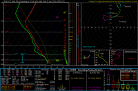
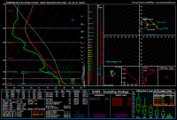
The attached sounding is valid 00z tomorrow evening somewhere near Lawton ahead of the dryline. Nearly all of the soundings I've looked at show <200 m2/s2 0-3 km SRH ahead of the dryline at 0z...
Near Lawton or just east of there I think:
00_NAM_024_34.31,-98.15_severe_ml.png

Closer to P28ish:
00_NAM_024_37.44,-98.4_severe_ml.png
 
Last edited:
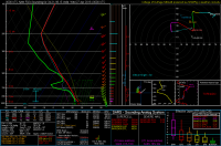
After looking at 26/00Z runs a little, TX looks better to me than it did this time last night. Even low level sheer has picked up some. Bellow is the sounding for my home county (Collin County TX) at 27/00Z. With a sounding like that close to home and a source of lift nearby, I'm staying closer to home. Right now, I plan to head out before lunch and drive west of DFW and stop short of the dryline and wait for initiation. We wil lsee if that changes in the AM.
nam4km_2016042600_024_33_19--96_68 Collin sm.png
 
I think it has all been said above, but I am not super confident in tomorrow, either, and will consider myself lucky if I see a tornado. On the plus side with the 00z NAM, upper-level forcing looks to arrive in time throughout OK. But the S-curved hodographs are getting worse, and even the CAPE is decreasing, though it's still high. I'm leaning toward a shorter drive from DFW tomorrow, possibly somewhere near Lawton, but will hammer out the details after the 12z run tomorrow.
 
So I woke up this morning and some of the local shops are putting the tornado threat at nearly their highest level into the "significant" category. I expected to see some significant changes to the models...I don't see that. In fact the NAM looks far worse than last night, showing some minor convection and then blowing up a storm over Joplin at 7pm. Hodographs are a mess...the 4KM NAM doesn't have storms going up over Joplin or really anywhere in OK until after 7pm...and then pretty far east. HRRR breaks out convection by 4pm in OK but the RAP holds off until 7pm and then blows up a line just east of I35...

The GFS appears to break out convection (although I can't view simulated reflectivity so may I'm misinterpreting) around 4pm just to the east of I35. CAPE values trending much lower than last night...

I'm sure I'll chase it's too close to not chase on an MDT but these feels like a bust to me and to see the local shops ramp up vs last night? I can't figure it out, what am I missing? There will be tors and hail but this is hardly a robust plains setup...it's a hot mess right now.
 
Hmmm. This really seems like one of those "the only show in town" type of chase days where you have to find one of the few storms that actually gets going before dark and can stay semi-discrete despite the meridional flow garbage winds (GFS is the worst for 00Z with nearly straight south-north 500mb winds). Be ready to follow many of the storms straight north today (with your lucky "right mover" might actually get something that moves NE). HRRR and NAM hint at E KS getting the bulk of the pre-dark storm initiation (E of the ~993mb low at 00Z), and that looks to be the only likely place you can get SigTor's above 3 AND a supercell that actually gets cranking with 2+ hours of light left. If I were chasing today, I'd probably head over to Junction City or Salina for lunch and kick back until the Cu field gets going. Good luck for those out today!
 
I picked a few spots off of the 12Z HRRR in northern Kansas near the warm front and it appears to me the mid level winds aren't as backed there as they were. They have more of a westerly component than they did last night. It's not a huge difference but to me the hodo's look a little better. The profile isn't straight south from 850 all the way 200 at least.
 
Sitting in Wichita, KS this morning. Will probably head south out of here shortly for the dry line in Southern/Southwest Oklahoma. I like the orientation of the dry line better in this area and I think this region has a better shot of things staying discrete opposed to further north...honestly this whole setup kinda reminds me of May 16th of last year....without the morning convection that is. Was a little concerned seeing the dry air last night on the Corpus Christi and Brownsville 00z soundings (at 850mb). However I'm not sure how big of an issue this will be in the end, could be a non-issue overall....we will see. I do believe there will be a few "diamonds in the rough" somewhere today. Good luck to those heading out. You are gonna need it seriously lol.
 
Ugh, this is a very difficult forecast for me. Morning soundings and surface obs look pretty typical for a non-trivial chase day in the Plains. It looks like there will be substantial insolation today when looking at current Vis sat, which will lead to further destabilization (note that the 12z OUN sounding had ~4000 j/kg SBCAPE already). Seasonal PBL moisture and very steep lapse rates (almost dry adiabatic above the PBL and below ~5 km) substantiate the risk for very large hail.

To me, the morning runs I've examined (12km NAM, 4 km NAM, and 12-13z HRRRs) look a little more favorable for tornadic supercells than did last night's runs, with perhaps less backed mid-tropospheric flow. The chaser in me still eyes that OFB in northern KS as an obvious target. However, I'm not entirely sure I want to blast up there yet. Depending upon your particular model of choice, the environment in parts of SC KS, NW/NC OK, C OK, or SW OK / W N TX may be supportive of a substantial tornadic supercell risk later this afternoon and evening. When I click around areas from northern KS to northern TX, I can find really ugly looking hodographs on some models and some runs in some locations, but I can also find more "typical" tornadic supercell hodographs on different models and different runs in different locations.

Frustratingly, I'm no closer to choosing a target now than I was last night. I'm having a very hard time nailing down the latitude at which I think the greatest risk for a tornadic supercell exists later this afternoon or early evening.

BTW - I think Edwards and Cook wrote a fantastic 13z SWODY1 today.
 
Definitely not an ideal setup. I'm getting out of work at 2, driving from Topeka to Junction City and then either driving north into what will surely be a mess of embedded hp cells, or I'll go south towards Newton/McPherson area, which could end up being a bust.
 
Ugh, this is a very difficult forecast for me. Morning soundings and surface obs look pretty typical for a non-trivial chase day in the Plains. It looks like there will be substantial insolation today when looking at current Vis sat, which will lead to further destabilization (note that the 12z OUN sounding had ~4000 j/kg SBCAPE already). Seasonal PBL moisture and very steep lapse rates (almost dry adiabatic above the PBL and below ~5 km) substantiate the risk for very large hail.

To me, the morning runs I've examined (12km NAM, 4 km NAM, and 12-13z HRRRs) look a little more favorable for tornadic supercells than did last night's runs, with perhaps less backed mid-tropospheric flow. The chaser in me still eyes that OFB in northern KS as an obvious target. However, I'm not entirely sure I want to blast up there yet. Depending upon your particular model of choice, the environment in parts of SC KS, NW/NC OK, C OK, or SW OK / W N TX may be supportive of a substantial tornadic supercell risk later this afternoon and evening. When I click around areas from northern KS to northern TX, I can find really ugly looking hodographs on some models and some runs in some locations, but I can also find more "typical" tornadic supercell hodographs on different models and different runs in different locations.

Frustratingly, I'm no closer to choosing a target now than I was last night. I'm having a very hard time nailing down the latitude at which I think the greatest risk for a tornadic supercell exists later this afternoon or early evening.

BTW - I think Edwards and Cook wrote a fantastic 13z SWODY1 today.
I'm not sure where to setup either...

This morning convection has me a bit concerned that we'll sap the CAPE, one of the only solid variables that we had going for today...and yet this morning convection and early afternoon convection could lay down some nice boundaries which will add some needed juice to storms that encounter them.

This coupled with some gravity waves moving into the state perhaps will change things in a manner that wasn't foreseen (by me anyway) 24 hours ago? I'm not sold on this setup being a great tor setup yet, hail...yes but tors? The last big tors I can recall on a low helicity day like this was May 2013 in Moore. The OUN sounding at 1700Z was showing SRH of 125 and 165 if I remember correctly...bagged a nice tor that day in NE OK.

Certainly not trying to be a debbie downer, I will be out chasing with a friend, but I have some significant reservations still...
 
Not chasing today, but wanted to post this link so others could use it for their forecasting. This a US map of all 1, 3, and 6 km winds from all of the WSR-88D sites. Winds are not plotted if they are above a certain QC threshold or if the radar just doesn't see that deep into the atmosphere:

http://sharp.weather.ou.edu/blumberg/vad.png

I believe I've set the above map to update every 15 minutes or so. Something I've noticed with this map currently...backing winds with height are apparent within the 1-3 km layer in central OK, south-central KS and extending southwestward.

Tim Supinie also has a nice Python script to plot hodographs from the VAD data. We hope to offer this on the above website regularly, but haven't quite had the time:

https://github.com/tsupinie/vad-plotter
 
Back
Top