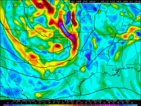
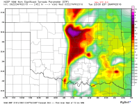
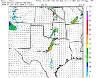
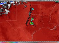
It's been hard to get a handle on this setup. It seems as though there has been inertia for a high-end event forecast owing to the early "doomsday" scenario that the GFS and ECMWF were indicating last week. However, there are certainly many signs that this event may not be the particularly robust severe weather outbreak earlier progs indicated. It doesn't look like LCLs or MLCAPE will be issues for a significant severe weather threat, as all models continue to paint a picture supportive of tornadic supercells in that regard. Most of what I'll say will only be meaningful is convection occurs -- I'll leave CI to someone else. ;P
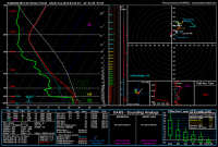
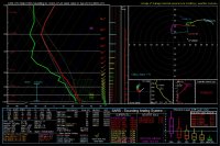
The kinematic side of the equation is much less certain, in my opinion. Some people like to poke around their preferred model forecast site for soundings that look bonkers, and it can be easy to find the "perfect" gridpoint that shows high-end conditions sometimes. However, most soundings I looked at along the dryline in OK and KS (south of I70) from the 12z NAM didn't look particularly supportive of strong/violent tornadoes. At 0z, it looks like 0-1 km SRH may be in the 100-175 m2/s2 range, with very little 1-3 km SRH as a result of a slight S shape to the hodograph (associated with some backing of the winds in the ~800-600 mb layer). Note the forecasts of 700 mb cold air advection at 0z... By 3z, 0-1 km SRH takes off further, but I'm still not seeing some of the really high 0-3 km SRH values we often see with high-end tornado threats (that is, >500 m2/s2). Research has shown that the 0-1 km SRH is often a better predictor of tornadic development than 0-3 km SRH, but I generally don't find it particularly optimal for tornadic occurrence to see near zero or even negative SRH just above the 0-1 km layer (that is, 0-1 km SRH > 0-3 km SRH). I'd imagine that this would be more relevant for storms that have deeper effective inflow layers -- e.g., for those storms in environments that have some CAPE and little/no CINH above 1 km, for which some of the "negative SRH air" will end up in the updraft. Of course, the shear profile / hodograph shape and length can be extremely sensitive to minor changes in wind speed and direction, and SRH can be sensitive to an individual storm's motion (this is a storm-relative quantity by definition). As such, I'd eye the actual SRH values and hodograph shape issues with caution.
Overall, I'm not sure what my game plan may be for tomorrow (if I make one at all). The obvious target to me is the NE/KS border area and southern NE, where the southerly 500 mb winds will at least be atop easterly surface flow. I'm unsure what to think about KS, where nearly meridional mid-tropospheric flow may be above SSW 700 mb flow (leading to dreaded S-shaped hodograph and, always in my experience, some messy strong organization). As we get closer to the base of the trough axis, mid-level flow veers a bit, but the implication of 700 mb cold air advection remains in the hodographs. As Tom noted above, the hodographs in northern Texas (and maybe farther south -- I didn't look south of the DFW area) are back to looking more "classic" without weird looping or other weird shapes. I don't really want to end up feeling like I'm one of 500 chasers watching a storm romp through the northern KS / southern NE area, so I'm inclined to target another area that may not be such a huge magnet for chasers. On the other hand, it's really hard to ignore a broad zone of moist easterlies with substantial CAPE...
This forecast looks like it'll lie in the part of the CAPE and bulk shear parameter space supportive of a widespread severe threat. The threat for long-lived, intense tornadoes remains uncertain in my eyes. Of course, this isn't particularly uncommon -- there are very often caveats preceding severe weather events, even up through the morning of some high-end events.

