Winter Storm Series 11/26-11/30 High Plains/Great Lakes

Joined
Nov 23, 2019
Messages
39
Location
Baltimore
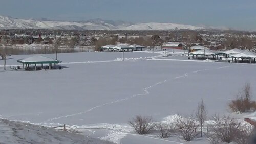
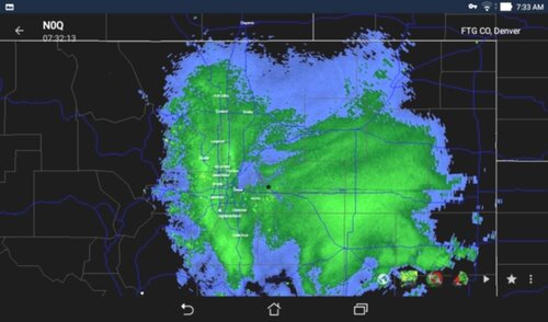
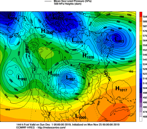
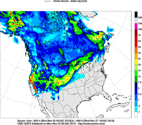
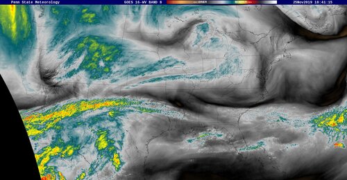
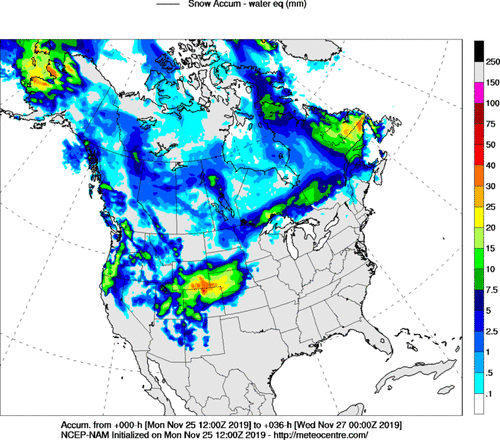
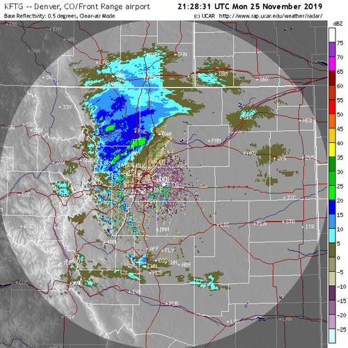
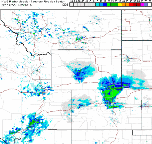
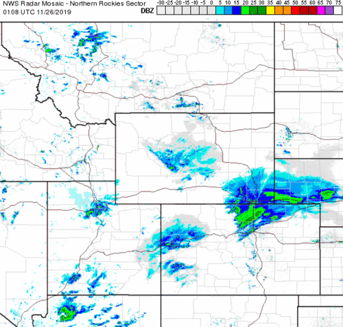
First storm is developing in Colorado and will track NE. The second storm follows close behind and has the potential to develope into a "Fresh water fury."
I will be tracking these storms. All surface observations welcome.
 

Attachments

  • GZ_PN_144_0000.gif
    GZ_PN_144_0000.gif
    181.4 KB · Views: 0
  • SN_000-060_0000.gif
    SN_000-060_0000.gif
    154.3 KB · Views: 0
Storm continues to develope, no anomalies. Vortmax moving along the Idaho and Utah border. (WV image below) Snowfall at Teton Pass continues.(image below)

NAM 36 hr snowfall below.
 

Attachments

  • IMGw_0.jpg
    IMGw_0.jpg
    228.8 KB · Views: 0
  • WYO22TetonPassEast.jpg
    WYO22TetonPassEast.jpg
    82.9 KB · Views: 0
  • SN_000-036_0000.gif
    SN_000-036_0000.gif
    153.1 KB · Views: 0
Precipitation developing along the front range. Denver looks to be near a precipmaximum. The show begins....
 

Attachments

  • 20191125_212831_BREF1_gray.png
    20191125_212831_BREF1_gray.png
    323.7 KB · Views: 0
Pretty classic midlatitude winter storm, complete with convective severe on the warm side. Lots of interesting things happening. Thundersnow potential will likely be fairly high once the surface low starts deepening tomorrow morning.
 
Snow begins in Denver. Cyclonic surface votex just south. The Gulf of Mexico will be open with this event. Subtropical air will try to enter Missouri.
 

Attachments

  • 2019112523_metars_den.gif
    2019112523_metars_den.gif
    35.4 KB · Views: 0
Moderate to heavy snow developing. This is my favorite part. Can 12 inches of snow fall in three hours in Baltimore. Yes it can.
 

Attachments

  • northrockies_loop (1).gif
    northrockies_loop (1).gif
    598.5 KB · Views: 0
There has already been a fair amount of thundersnow in west-central NM around Gallup and nearby parts of eastern AZ. Lightning strikes seem to be on the decrease now, however.
 
There was no thundersnow in my area, but the snow has been & still is coming down good, & with the wind at times it looked like a blizzard.
I've taken some video clips & grabbed some radar screenshots. Might try to post a couple pic's on here later.
(and a YouTube vid might be in order)
 
I'd planned to get this posted earlier, but was busy in general, and wasted a fair bit of spare time last week on getting the controllers for my Christmas lights working right. Evenings this week I was messing with video.

(Considering its now a week later, I almost didn't bother posting a reply...but I did say I might, so:)
Where I'm at in CO we had 12" of snow on the ground when it was over.
Main roads are all clear, but even now neighborhood streets are still a mess due to their crap-poor job of plowing (or really lack thereof)

Pic's below are: A park covered in snow/mountains in background (taken Nov 27), Radar from Nov 26 7:33am while the storm was still going good, Sounding from Nov26.
 

Attachments

  • cp1.jpg
    cp1.jpg
    57.3 KB · Views: 0
  • cp2.jpg
    cp2.jpg
    120.6 KB · Views: 0
  • cp3.jpg
    cp3.jpg
    541.3 KB · Views: 0
We seldom think of death tolls. I remember in Western NC we always seem to lose a few kids every year to black ice. Sad.

It was indeed a potent winter storm series. A potential storm 5-7 days out as the storm track moves further east. Will continue to monitor. GFS further south. ECMWF blinking......
 

Attachments

  • SN_120-240_0000.gif
    SN_120-240_0000.gif
    158.6 KB · Views: 0
Interesting (and sad) report @Dan Robinson .
Ofcourse what news/accident public-records/etc reports don't show is the all injuries with long term effects.

I'm kinda surprised CO only shows 1 death, and not even on the height to the storm (Nov 25/26)
 
Also thinking back on that storm, and being in the mountains...
I was up in the mountains (not that far from Fairplay actually) on the Sunday before the storm (Nov 24), at one point I noticed the clouds had what I can only best describe as 'almost a purple tint' to them. Its not something I've seen before, and looked a bit weird.
 
Back
Top