Parameters start to look good in the southern plains starting next Tuesday. The big issue is the cap and the SPC mentions that in their 4-8 day discussion. Seems like models have a lower likelihood of the cap messing things up as the week goes on.
-
While Stormtrack has discontinued its hosting of SpotterNetwork support on the forums, keep in mind that support for SpotterNetwork issues is available by emailing [email protected].
You are using an out of date browser. It may not display this or other websites correctly.
You should upgrade or use an alternative browser.
You should upgrade or use an alternative browser.
State of the Chase Season 2025
- Thread starter Dan Robinson
- Start date
Matthew Crowther
EF4
Looking like the first wave next week will be mostly capped except way up north, so we will likely have to rely on the trailing front lighting up about Friday into the weekend. Then the next front pushes south, cutting things off for a while, and after that, ensembles and weeklies suggest the southern plains may have a "death ridge," but flow hopefully will be OK at least in the northern areas. I have to have car work done, so if chasing holds off until Friday of next week, that is fine.
Jason N
EF5
Based on my previous post a few days ago, I think 13-15th opens up some sporadic chase days, and the 15-20th has continued to look like a pretty good stretch of days, even from 2 to 3 days ago, trend wise, strictly looking at the 5-wave pattern. I think the other factors are just too far out to really resolve until those days are sitting inside of 60hrs out and the meso gets ahold of it.
William Monfredo
EF4
Jason, I think you are barking up the right tree. A lot can change in 7 to 10 days, but this morning I reminded myself how moisture continued to surprise this year. For example, the pushes that included the western Gulf into TX and beyond. It's not unthinkable to chase next weekend.and the 15-20th has continued to look like a pretty good stretch of days
Warren Faidley
Supporter
I believe middle-to-late next week has some promise, but not for large scale outbreaks with a three day SPC advanced notice, or ground-hugging, rain-wrapped wedges if that is what you are seeking. Those long range, somewhat obvious forecasts tend to bring HP cells or MCS blobs this time of year, or wide spread grunge when the CAP is weak. My rule remains the same after all these years of chasing: In mid-to-late May, you set-up shop in the Texas Panhandle when there is at least 30kts. upper level flow and DP's of 55ºf or higher. The EML be dammed as it's always a wild card.
Jason N
EF5
Agreed that patterns can shift, without question, and I want to be clear that for now, I am not saying where the chase is MOST likely, because I think that's too premature for the moment, I just think the pattern for periods between those dates could present some opportunities. The trends I have seen for the last couple days have suggested a teeter totter loosely between OK/MO/AR where the best crossover between Moisture., Instability, Lift, and Exhaust appear to continue to be.Jason, I think you are barking up the right tree. A lot can change in 7 to 10 days, but this morning I reminded myself how moisture continued to surprise this year. For example, the pushes that included the western Gulf into TX and beyond. It's not unthinkable to chase next weekend.
Anal Na Drack, Uth Vus Be Thud, Doth Veil Deinde!
Jeff House
Supporter
For next week the SPC text from Day 4-8 pretty much has the Upper Midwest and Ohio Valley covered as a lead wave comes out of the Rockies. The weekend immediately following (days 9-10) models have been consistent with the main trough pushing through the Central Plains.
Last third of May is on everyone's minds. AN heights are common on weekly forecasts but it still sloshes around - so not an anchored ridge. Long as systems can slide through the season will continue, though perhaps in smaller mesoscale servings.
CFS introduces a new West trough after May 20 but it's a minority report. Other weeklies hang it up at the Pac-NW Coast which is just climo. Euro Op has the CFS look its EPS mainly rejects the solution. About a third of the EPS members hint at it, but the majority do not.
Enough splitting hairs. Think like Warren above. If modest flow is over the Panhandle and points north like Colorado, in late May mesoscale opportunities come up. The week leading into Memorial Day weekend may be a repeat of a Tennessee Valley low* early. Once it kicks out Plains moisture should return faster the last third of May.
*Note that's a pretty specific scenario in the 11-15 day period, so I wouldn't really consider it a forecast. Consider it a conceptual option.
Greg McLaughlin
EF5
I just finished some maintenance of my chase vehicle, and am trying to get some issues at work resolved before I go neck deep into chasing. As of now, my confidence isn't very high on mid week chasing prospects next week. We just have to wait and see how the moisture return looks as we get closer. Pesky Dixie low! I do think evapotranspiration will help us out some due to the recent excessive rainfall. Once we get the annoying southeast trough out of the way and tap into the real nader juice, I think we will have some solid chasing right through the peak of the season. As others have noted, you don't need a ton of flow on the high plains to get quality tornado events. While Kansas is dead (RIP), the Texas panhandle has been quite active the past couple of years and again this spring. I think we see more tornado events in the southern high plains.
Eric Webb is a great follow on X, and he talks a lot about the Indian Ocean monsoon, and how that can develop into a Rossby wave that translates east across the Pacific Ocean, leading to western CONUS troughing. This is a common player in late spring tornado activity in the U.S. He is one of the best long range forecasters out there, and he has been talking about positive signs for the traditional late May peak for over a month now.
Jim Tang has shown how 1996 has been a good analog for this year so far with the background state of the northern hemispheric patterns (-ENSO/+PDO/-NAO) and the early onset of the IO monsoonal season. At first, hearing 1996 as the analog, I was a bit dismayed, because 1996 was known for the movie Twister, and not any classic plains outbreaks. I did some digging into that year, specifically late May through June, and I was pleasantly surprised to discover that the end of May and early June was quite active in the southern and central high plains with some impressive, and somewhat forgotten tornado events. The Elba, CO wedge/structure combo on May 30th was about as top shelf of a tornado with structure as it gets. There was another nice tornado event near Sublette, KS and several mesoscale days from the Texas panhandle north to South Dakota. May 22-June 6 featured almost non-stop action:
5/22 CO/KS/NE
5/23 WY
5/24 TX/KS
5/25 NM/OK/TX
5/26 KS
5/27 AR/IA/IL
5/28 KY
5/30 TX/NM/CO/NE/SD
5/31 TX/OK/KS/CO/SD
6/2 TX/NM
6/3 CO/NM/OK/TX
6/5 NE/KS/OK
6/6 OK
I had no idea 1996 "went so hard in the paint" during the peak of the season. While none of these events were high-end tornado outbreaks, there were several local and regional tornado outbreaks that produced highly photogenic tornadoes across some of the best chasing real estate.
The upcoming pattern does seem to support the idea of a parade of troughs into the plains, though there are a few potential caveats, namely a tendency for systems to linger over the eastern CONUS too long, delaying moisture return for the next incoming system. Still, local evap processes and the time of year make it easier for moisture to return over the high plains than early season. The idea of persistent moderate southwest or west-southwest flow aloft over the high plains is music to my ears. I am pretty stoked for the overall prospects, especially about a week+ from now.
Warren Faidley
Supporter
Jim Tang has shown how 1996 has been a good analog for this year so far with the background state of the northern hemispheric patterns (-ENSO/+PDO/-NAO) and the early onset of the IO monsoonal season. At first, hearing 1996 as the analog, I was a bit dismayed, because 1996 was known for the movie Twister, and not any classic plains outbreaks. I did some digging into that year, specifically late May through June, and I was pleasantly surprised to discover that the end of May and early June was quite active in the southern and central high plains with some impressive, and somewhat forgotten tornado events. The Elba, CO wedge/structure combo on May 30th was about as top shelf of a tornado with structure as it gets. There was another nice tornado event near Sublette, KS and several mesoscale days from the Texas panhandle north to South Dakota. May 22-June 6 featured almost non-stop action:
Great work by Jim. The only potential question might be the difference in CAP strength in 1996 vs. now. It would be interesting to see averages of 700mb temps in 1996 (for noted event days) vs. this year so far or the last ten years for reference. I'll bet the drought and shifting climate patterns might have more of an impact now days. Some of the 700mb temps forecast for the next two weeks are directly from hell.

Looking like RH recovery will begin as early as next Tuesday. That is a start.
Attachments
Last edited:
JamesCaruso
Staff member
Well I’m finally pulling the trigger. Got through a few Family Events this past week - one twin daughter’s high school show, my son’s birthday, my twin daughters’ last dance recital before they go off to college in the fall ( ), Mother’s Day today. Next up in this “Swiss cheese calendar” I am faced with for the 2025 storm chasing season is my son’s college graduation on the 22nd. So i have about a week. But I’m not heading out until Wednesday night. Based on what I can see, there’s not likely to be much Plains action before Friday. In fact, I’m going to squeeze in another quick business trip to Boston; I have a new employee on my team starting there, so although I was prepared to get him up to speed remotely, it will be better if I can be there on-site. I’m flying straight from there to OKC on Wednesday night so I can still work a full day. I’ll work remotely Thursday and if there’s a target for Friday I’ll try to make progress in that direction on Thursday night so I can work half a day Friday. Having some weekend action works out great. It’s all about conserving PTO time!
I’ll fly home next Wednesday night 5/21 at the latest. From what I can see now, I might as well fly home on Tuesday 5/20 instead of cutting it too close for the graduation. But the Euro and GFS are pretty far apart by then. I’ll head back out with my son on Friday 5/23, unless it looks dead in which case I’d rather enjoy Memorial Day weekend at home and head out later.
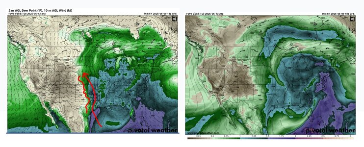
Normally when making a longer-range forecast for chase vacation planning, I keep it simple and just look at surface dewpoints and 500mb. But with this lackluster moisture return, surface dewpoints look decent but very, very shallow. Even 925mb stays bone dry, let alone 850. So keep an eye on that and some forecast soundings in this scenario, not just surface!
), Mother’s Day today. Next up in this “Swiss cheese calendar” I am faced with for the 2025 storm chasing season is my son’s college graduation on the 22nd. So i have about a week. But I’m not heading out until Wednesday night. Based on what I can see, there’s not likely to be much Plains action before Friday. In fact, I’m going to squeeze in another quick business trip to Boston; I have a new employee on my team starting there, so although I was prepared to get him up to speed remotely, it will be better if I can be there on-site. I’m flying straight from there to OKC on Wednesday night so I can still work a full day. I’ll work remotely Thursday and if there’s a target for Friday I’ll try to make progress in that direction on Thursday night so I can work half a day Friday. Having some weekend action works out great. It’s all about conserving PTO time!I’ll fly home next Wednesday night 5/21 at the latest. From what I can see now, I might as well fly home on Tuesday 5/20 instead of cutting it too close for the graduation. But the Euro and GFS are pretty far apart by then. I’ll head back out with my son on Friday 5/23, unless it looks dead in which case I’d rather enjoy Memorial Day weekend at home and head out later.
Normally when making a longer-range forecast for chase vacation planning, I keep it simple and just look at surface dewpoints and 500mb. But with this lackluster moisture return, surface dewpoints look decent but very, very shallow. Even 925mb stays bone dry, let alone 850. So keep an eye on that and some forecast soundings in this scenario, not just surface!
Matthew Crowther
EF4
The only thing I am still not sure about is when exactly to head out; Thursday seems like the most likely. I am not thrilled about the prospect of a relatively small target area over the weekend, centered on OK. Talk about a recipe for mass chaser convergence. Yuck. Then it seems likely that a few down days may ensue mid-late the following week. But that is OK, I really want my favorite chase area, the central and northern High Plains to light up late May into the middle of June.
Zack Ruddle
Enthusiast
- Joined
- Apr 27, 2025
- Messages
- 5
CSU-MLP has the target area for Thursday over Wisconsin at the moment. Will be interesting to see things shake out as it gets closer.
Welcome news so far for those of us up North.

Welcome news so far for those of us up North.
JamesCaruso
Staff member
Then it seems likely that a few down days may ensue mid-late the following week
That’s what I’m hoping for to be honest. I can be on the Plains from now through June 8, *except* for 5/21-5/23. It would be the ultimate indignity if those lousy three days ended up being good! Sorry, I generally wish the best for all chasers, but I have had *WAY* more than my share of bad luck and slaps in the face over my 25 year chasing career. I’ve paid my dues, and then some. Missing something good those three days would be more than I could stand!
EDIT: Incredibly, at least in the most recent run, the three days I can’t be on the Plains align perfectly as the three days without “X’s” between more active periods. CFS Severe Weather Guidance Dashboard
Warren Faidley
Supporter
Don't see anything I'd want to chase until later this month if the models are on the right path. Matt is correct about a few, possible set-ups in Central / N-Central OK and the ICT areas that will draw trillions of chasers. The action could also be too close to the great wall of I-35 for me to pursue. I also sense messy, HP modes if the upper-air models are correct. I'll keep my fingers crossed for some 2% days further west or northwest.
Dan Robinson
EF5
Saturday-Tuesday looks like a pretty solid "When it's May, you chase" period. Strangely enough, many of those days have decent simultaneous open warm sector/warm front components in the Midwest. If that holds, I may be tempted with an "at home" expedition with secondary/tertiary (maybe some primary) targets within a 3-hour radius (not counting this Thursday and Friday), especially if all of the dryline days end up in the OKC metro. I can't remember seeing a pattern with this type of potential for 6 days straight of solid Midwest chase options. Of course, the Midwest is well-known for synoptic days going to trash at the last minute.
Last edited:
Similar threads
- Replies
- 39
- Views
- 4K
- Replies
- 12
- Views
- 2K
- Replies
- 18
- Views
- 3K