William Monfredo
EF4
It's official, NOAA's calling it, the end of this La Niña..."Collectively, the coupled ocean-atmosphere system reflected ENSO-neutral conditions."
Indications are currently that the Plains may get better beginning about April 21.

Forecast Summary:
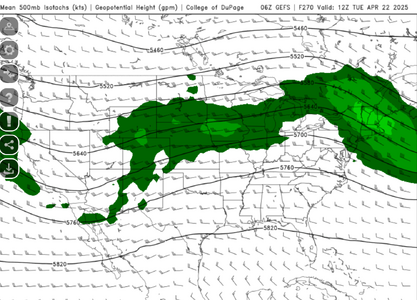
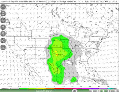
With the GWO cycling toward Phase 8, a modestly enhanced subtropical jet, and AAM positive anomalies in critical latitudes, the stage is set for a potential uptick in severe weather across the Central U.S. between April 22–May 2. The signal favors storm system ejection into the Plains, particularly if future mountain torques or MJO support aligns. While amplitude remains modest, forecasters should stay alert for short-range triggers within this favorable large-scale pattern.

Thursday 4/17 could be interesting in extreme SE NEB / NE KS / NW MO / SW IA. SPC has put up a Day 5 15% risk. There should be a surface low / triple point and favorable shear. Potential negatives are a narrow moisture / instability axis and possible displacement between the best hodographs and the best thermodynamic profile. Good to having something to watch though, especially since many were considering writing off the rest of April, and even most recently thinking it was dead until the week of the 21st.


- but as of yet not Plains trip-worthy IMO.