Active Pattern Re-emerging?

Joined
May 31, 2004
Messages
1,895
Location
Paxton, IL
Hello ladies and gents. I thought it may be worthwhile to discuss a changing of the guard that I have noticed over the past several cycles of the medium range guidance. My area (specifically) has been bone dry for the betterment of the last couple of months. With the remnants of Patricia phasing with a northern stream, a deepening low is bound to take off over the lakes tomorrow into Thursday. Some rain is finally going to happen! I am not talking about that though, I am referencing the pattern beyond this week. Several disturbances look to impact the Central US from now through mid November. Most notably the EURO and GFS both hint at "something" in the Nov 4th through 6th timeframe that catches my attention. It is way too early to make a forecast based on the guidance, but I think it will offer a decent chance at some convection "somewhere" across the Central US. If nothing else it will give us something to talk about for the next week or so.

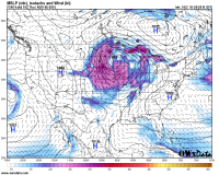
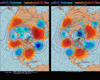
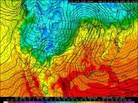
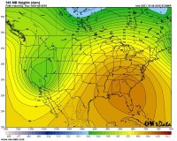
The 0z Euro last night had a 597 ridge at 500mb over the southeast early to mid next week, and the 12z Euro had a still impressive 594 ridge over/just off the southeast coast with 580+ heights up to northern IL. 12z EPS is very similar, which is notable considering it's an ensemble mean, and with a deep trough digging into the southwest, certainly a warm and active look for the first week of November. Had a very "Springlike" feel to it. Feel free to discuss or ignore. Maps below.image.jpeg image.png image.gif
 
Been watching for this as I for one would love to see another late season set up like what we had back in 2013 (10/4, 11/17). Learned a lot on both those days about forecasting and chasing in general..
 
Also i am noticing that the twisterdata's gfs is showing a few disturbances that according to the gfs will bring some higher lobes of relative vorticity
 
We've actually got a lead impulse progged to eject from the main longwave that's currently centered over the Bay of Alaska and dig into the Four Corners and then into Texas with some pretty insane kinematic environments heading into the weekend. Issue is that the rapid WAA out of Mexico and the degree of moisture return might limit instability in the sweetspot just away from the effective warm front near the Metroplex.
 
Might be active even further east. Tomorrow might see a few tornadoes with huge hodographs in the mid-atlantic to Carolinas.
 
30d8ffcbb403b1f3f9aec42e4eea4e84.jpgbdbc8a100e4c419b117f861e3f7c76d5.jpg

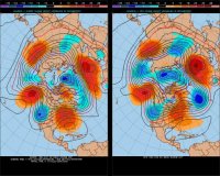
I'm impressed at the overall consistency in the models, even at this range. If we can stay in this pattern for a good part of the winter, it would really impact the "typical" El Niño outcome.

Sent from my SM-G925V using Tapatalk
 
View attachment 10507View attachment 10508

I'm impressed at the overall consistency in the models, even at this range. If we can stay in this pattern for a good part of the winter, it would really impact the "typical" El Niño outcome.

Sent from my SM-G925V using Tapatalk


Wow, that first graphic isn't too different from November 17th. The surface low is like in the same position as 11/17/2013! However, that low's at ~1006 mb while 11/17/2013 was at ~992 mb so the 11/4 scenario looks to be weaker.
 
FWIW, the CFSv2 shows a tendency for negative 500 mb height anomalies across the eastern Pacific (centered around 25 deg. N) by week 3 and persisting throughout the 3-6 week period. However, it also shows cold anomalies at 850 mb across the southern and central Plains during the same time period.

It certainly appears there may be more western US troughing coming along soon, but it's hard to tell at this point if any of those troughs are going to result in any sort of significant severe weather potential. It's been a very quiet fall so far. The ingredients just haven't been coming together. From what I have seen, it appears poor lapse rates may be the leading cause of many failed setups. I can live without another chaseable setup this year. It'd be nice to get back on the rain train, though. Here in Oklahoma we were well on our way to setting the record for annual rainfall in the state until about August, when it basically completely stopped raining and flash drought popped up. Only in the last two or three weeks have we finally started getting some rain again, but it's not enough. We've fell behind the record setting rain pace here. We'd need a very wet remainder of the year to set the record now.
 
Hey, Danny. Since you mentioned the first inkling of this, I've been poring over the models and trying to make sense of it all. And for comparison's sake, I reviewed 11/17/13. While doing this, I came upon your analysis of that event, in which you talked about it being a negatively tilted trough. While looking at the models for the 11/5-11/6 timeframe, this one looks to be positively tilted...but I have very little experience with this, so I'm asking you...is this is correct? Could this change? Does it make or break the possibility of severe activity? The temps, dew point, shear seem good at this point. Instability does not. What do I make of this? Do you think this will turn out to be something? Sorry for the inane questions, but I'm just trying to learn the ropes of this stuff and am using this as a learning experience. And I'm getting depressed by the possibility of not having another storm until spring...I don't know how I'll handle that. I'd be grateful if you could give me your take on this now that we're getting closer and have a bit more data to work with, and maybe offer suggestions of a few factors for me to watch for in the models over the next week. Thanks!!
 
Nina: not only is there weak instability (though that's normal for this time of year) but lapse rates are weak as well. The severe threat seems to be limited to the southern plains, especially parts of texas.
 
How likely is it that will change between now and then? And there will at least be some storms in Illinois, though, right? Can't imagine 70+ degrees in Nov without storms occuring.
 
Not sure I've ever seen a year with such poor mid level lapse rate/EML development consistently throughout the entire annual span.

I wonder how this year looks compared to 1997 in that department. I know Jarrell was that year, but I can't recall any other significant events. We have so few years to compare very strong Nino's with, but 1997 keeps getting thrown around.
 
I wonder how this year looks compared to 1997 in that department. I know Jarrell was that year, but I can't recall any other significant events. We have so few years to compare very strong Nino's with, but 1997 keeps getting thrown around.

Haven't had an event comparable to 3/1/1997 this year, although that was obviously early in the Nino's development.
 
Back
Top