• While Stormtrack has discontinued its hosting of SpotterNetwork support on the forums, keep in mind that support for SpotterNetwork issues is available by emailing [email protected].

2016-04-29 EVENT: TX/OK/KS

Joined
May 6, 2005
Messages
292
Location
Moore, OK
Figured i would start the thread for Friday. Last 3 runs of the NAM are promising. 12z GFS is coming into alignment with NAM.

Negative tilt trough at 500mb. Tds > 65 all the way up to I-40 and maybe southern KS. GFS is not bullish on 850 winds but the NAM is lighting up like a christmas tree. Don't want to get too excited after tuesday, but the potential is there and bears watching.

Looks like we will have some better directional shear and less meridional flow like tuesday. I did see some vbv in a few soundings.

All said... I will be watching this one.

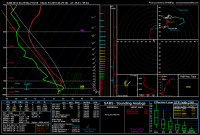
OKC sounding for friday.
019657f0df9a05c54aefeac196b69310.png
 
Not sure I'd say GFS is coming into agreement but the forecast has opened up some in terms of potential. NAM is very consistent and lifts warm front farther north, while keeping steep lapse rates and staying dry. This would be a pretty bad situation even given VBV. Note: VBV is evident and in some locations towards the east it is just as significant as yesterday.


This bears monitoring going forward. I haven't dug too deep into the details, but it looks like a significantly more tornado favorable environment than Tuesday, and would likely feature a more discrete case. However, there's a lot left to be seen. Potential is pretty good for sure
 
NAM always overdoes the CAPE, yesterday showed 6000+ cape when there was only about 4500. With Friday, the NAM shows 5500 CAPE at 00z for Norman/OKC area. It also has a storm just north of OKC at 18z but finds a way to get OKC area almost to 80 degrees to go with that high CAPE. Just seems off IMO. GFS has much lower CAPE, only around 2000 in the OKC area, and 3000 in SW OK. Temps only get to the low 70's for the OKC area, so warm front lagging. Some VBV is present, which obviously is a concern. We'll have to see Friday morning if the warm front will actually move northward or stay mainly near the Red River. I haven't seen much luck with morning convection and depending on a warm front to lift far enough north to get over excited about this setup.
 
Seeing disturbingly similar disagreement between the 12Z NAM and GFS as I did for forecasts leading up to Tuesday (26 April 2016 for posterity), although the specific aspects of the disagreement are different. Now it's the GFS showing ugly wind profiles in the low levels compared to the NAM, which is spitting out some pretty sweet looking curved hodographs nearer to the warm front. The 4 km NAM reaches out to 00Z and contains what appears to be yet another ridiculous overforecast of moisture, progging mid-70s dewpoints near OKC. I highly doubt that will verify. Not sure what will happen with the dryline.

One true signal that I think will end up being the failure mode if this event turns out not to be a severe weather event is persistent convection/precipitation forced by ascent over the warm front which could limit destabilization or pinch off the warm sector by shunting the warm front so far south that warm sector deep shear is too low. Such an event occurred last year on May 9 (the Cisco, TX EF3). Mid- and upper-level flow appear to be really strong for this case, which is great for keeping storms ventilated and non-HP.

The 09Z SREF is on board with high uncertainty on whether significant instability will materialize. It forecasts A LOT of precipitation across OK and neighboring states pretty much all day Friday. Just about the only other aspect of this forecast that seems pretty certain right now is that deep layer shear and anvil relative flow will be pretty high.

On a personal/wishcasting note, I'd love to see this event verify about 100 km to the west, leaving more room for chasing in really good terrain in W OK/NW TX before threatening the OKC area. There has been some noticeable longitudinal movement of the dryline in some recent runs. 00Z NAM forecasts from last night basically wanted to "kill" the OKC metro area with ridiculous levels of shear and instability. Since May 2013 I can't help feeling anxiety when a model projection places high values of composite parameters over the OKC area. I've had too damn many tornadoes strike within 30 miles of me in the last 4 years to be able to fully relax. Also, logistically, chasing within about 50 miles of the center of Oklahoma County is just no fun. Too many locals that join the typical chaser crowd.
 
This event has a 2015 vibe to it. The biggest caveat is going to be morning/ongoing convection and that likely won't be resolved until Friday. I actually somewhat like this setup because it really comes down to getting enough instability, and if that comes to fruition then it could be a decent chase day. For me, this is a tough one because making the long trip with ongoing precip concerns is a big risk, but the reward at the end of the day could be a good one.
 
Similar to what @Jeff Duda noted, it seems like the model discrepancies haven't gotten better as Friday has approached. The GFS and NAM both to seem be riding hot on this being an event that could threaten the the OKC Metro if the wind profiles manage to improve. The GFS progging that distinct weakness in the mid-levels is horribly discouraging after yesterday, along with the aforementioned morning convection in the area of steep isentropic ascent along the edge of the warm front shunting the best target south with shades of 2015. Like most others, I'm highly suspicious of even low-70s materializing ahead of the dryline and the bonkers MLCAPE values the NAM has been spitting out on the order of 4500 j/kg or greater likely won't be accurate even with only minor issues with morning precip/cloud debris.

Even with all the negatives, I feel we might have a window further down the dryline across the Red River and further west given the GFS' tendency to mix the dryline further east than might actually occur given the lower sensible heat flux we will likely have throughout the day with lots of crapvection present. At this point, I'd gladly take a 2015-esque day I know how to forecast for over what we've been seeing so far.
 
Pretty much everything seems to be on track from the previous model cycle. NAM forecasts are still placing a Significant Tornado Parameter right over the OKC metro in the evening, as it seems to be the model the most aggressive with moisture return, northward advancement of the warm front, and least precipitation coverage during the afternoon. Really an ideal scenario for a major tornado event in a major metropolitan area. But given it seems so perfect, I am skeptical on that actually occurring. The NCAR ensemble puts the dryline rather far east in most members, and also forecasts widespread development along the dryline in almost every member. The I-35 corridor between OKC and DFW appears to have a high chance of seeing discrete storms, but storm coverage is forecast to be pretty high, so storm interaction appears to cause many storms not to persist very long. It seems the longest lived storms all occur around the Waco-Austin-San Antonio latitudes. BTW, the eastward dryline placement in the UCAR ensemble seems to match up better with the GFS. The SREF appears to have the most westward placement of the dryline anymore, but it's still farther east than I care for.
 
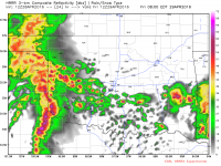
Personally, I'm watching the HRRRX model to see what it's doing with storms tomorrow morning. Right now it only runs to 7 am but this is what it's outputting
View attachment 13128
With the NAM and 4K NAM looking more aggressive for tomorrow it's making me consider a chase. But I'm worried about exactly what you've depicted, ongoing convection overturning the atmosphere...potential for tomorrow seems to be upticking slightly though...
 
The NAM is very aggressive with airmass destabilization across Oklahoma. It along with the GFS show an uncapped warm sector throughout the day. With the trough ejecting, this type of environment would likely lead to persistent convective development throughout the day. It is possible that there may be subsidence in wake of morning storms which could allow for a few hours of insolation. Given the sun angle this time of year and the continued advection of very humid air in from the south it wouldn't take but a couple of hours to boost CAPE values. Shear profiles along the warm front/outflow boundaries look really solid. If we don't have too many storms and get enough heating, tomorrow looks to hold serious tornado potential.
 
The NAM is very aggressive with airmass destabilization across Oklahoma. It along with the GFS show an uncapped warm sector throughout the day. With the trough ejecting, this type of environment would likely lead to persistent convective development throughout the day. It is possible that there may be subsidence in wake of morning storms which could allow for a few hours of insolation. Given the sun angle this time of year and the continued advection of very humid air in from the south it wouldn't take but a couple of hours to boost CAPE values. Shear profiles along the warm front/outflow boundaries look really solid. If we don't have too many storms and get enough heating, tomorrow looks to hold serious tornado potential.
Models are showing a lot of convection though. So I'm thinking could be junk...we'll know by 10 or 11am I suppose.
I'd like to get out tomorrow but not sure it'll be worth it, especially if there's convection hanging around till lunch or 1pm. Additionally the uncapped environment, if it actually turns out that way, will likely result in constant convection.
 
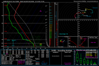
I have to say, I'm not very optimistic about convection clearing out tomorrow. I see lots of profiles in western OK in the 12km NAM that will convect given any lift whatsoever. Like this one, for instance, which was taken from a precip bullseye at 18Z:
upload_2016-4-28_22-28-1.png
As for lift, pick your source. Warm-air advection is in progress at that location and that point (both inferred from the profile and by actually looking at the 850mb temperature map), and mid-level height falls commence in western OK at about 15Z. Both those should result in more than enough lift for those profiles to convect.

As a side note, I don't see much response from the convective scheme here, so that means the NAM isn't actually convecting. That makes sense, because the NAM's convective scheme does not handle elevated convection well. Instead, it's producing grid-scale precipitation, which doesn't involve any overturning of the environment. I think that's why it's able to destabilize so much in the afternoon.

As being in central OK tomorrow kinda constitutes a chase, I'll pick a target: the observation deck of the NWC.
 
I am probably going to play tomorrow like I did March 30th. That day we had multiple rounds of storms including convection in Tulsa between noon and 2pm. The storms cleared out and we had good heating through the afternoon. A new round of cells formed along the dryline and one interacted with an OFB and produced two long track significant tornadoes. Considering the mid-level dry slot will be overhead combined with very rich moisture advecting north and the high sun angle, the atmosphere may not need very long to recover. The GFS is now depicting a more unstable solution and has the warm front lifting to the 412 corridor. The short range models show similar solutions to the NAM. Forecasting isn't always a strength for me, but I believe tomorrow is going to surprise a few people.
 
A lot of uncertainty with this forecast. I think the best bet will be to look at the radar, DL, and Visible Satellite tomorrow at 9-10 am. If the storms can clear the warm sector then we could be in business. After perusing all of the 00z models, my confidence is low. On the plus side look at all that moisture in TX. Southern half of TX has >70 Tds.

The 12z 4km WRF did a pretty good job with the Thursday storm out in the TX panhandle up through 02z. So I will give that model a good look tomorrow after it is complete.

http://www.emc.ncep.noaa.gov/mmb/mpyle/spcprod/12/

the 12z 4km NAM did a pretty good job too.

So with some of these models performing well Thursday, if they do well on Friday we could be hosed based on 00z runs.

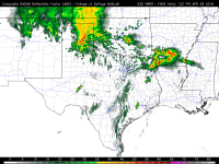
HRRR breaks out a lot of precip tomorrow morning as the trough approaches.

Time will tell.

511c835333fba9def2548278203df6a7.png
 
Back
Top