Marcus Diaz
EF5
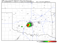
So let's jinx this now. Monday has all the potential to be a big day...if it wasn't for the cap. Also, we have a case of "just-in-time" moisture. Although not deep moisture, it looks to be adequate for good supercell potential. But like I said, THE CAP, BRUH. The only good news is the NAM has been trending down on the cap along the dryline around the 21z time frame, as depicted in this graph of MLCAPE and MLCIN. Also this sounding from around El Reno shows a stout, but breakable cap.


The area south of I-40 has my eye the most since the deeper moisture will be down there. Some of the stronger mid level shear will be down that way as well. Although so far non of the models fire precip, that could always change come morning of. Aside from Wednesday, this day has the best looking dynamics for a classic dryline day in western OK. But if the cap holds, a lot of us will be getting sunburned more than likely. I might nose my way into Elk City to see if the cap breaks. If not, dinner at Carl's Jr before getting home at a reasonable hour.


The area south of I-40 has my eye the most since the deeper moisture will be down there. Some of the stronger mid level shear will be down that way as well. Although so far non of the models fire precip, that could always change come morning of. Aside from Wednesday, this day has the best looking dynamics for a classic dryline day in western OK. But if the cap holds, a lot of us will be getting sunburned more than likely. I might nose my way into Elk City to see if the cap breaks. If not, dinner at Carl's Jr before getting home at a reasonable hour.


