2015-04-06 EVENT: KS/OK/TX

So HRRR you're saying there is a chance!? The lingering clouds east of the dryline I don't think hurt us too much as it will only sharpen up the dryline as it mixes east. Thinking positive here as that lone t'storm is less than an hour away. =) Cap & lack of convergence still has me pretty pessimistic with the overall storm threat today.

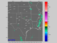
Wow. Until I saw that graphic I had all but written off today. Of all the things on my mental checklist that have to go right for me to think something my pop today, moisture had been the only thing to "pass". However, the 14Z and 15Z HRRR are the first two model forecasts that I've seen leading up to this event (aside from SREF members) that have anything at all going up. It's gotta be a trick...

I see the cloud layer is burning off fairly quickly now, but is it going to be enough? In May there would certainly be enough strong heating in the afternoon to get storms to pop after morning cloudiness, but this is early April, and h7 temps are 6 C (although SPC mesoanalyses point to some slightly cooler temps moving in from the west).

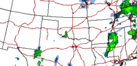
About the only thing I can hope for is to see that upward trend in convective activity in the HRRR continue throughout the afternoon. If it does, I'm in.

Fingers crossed.
 
Target: SW OK

Storm Initiation: 4-7 p.m.

Impacts: Large hail and damaging winds from Supercells. Perhaps a fluke tornado.

Discussion: Expecting storms to potentially initiate off of the dryline thanks to strong heating, moistening of the boundary layer, and a shortwave timed in the late afternoon. Not that high on initiation chances, but target is about an hour away at the present time, so will probably roll the dice. Everything points in one direction today, and given a storm which can sustain for more than an hour, you could even see a rogue tornado threat ramp up quickly in the evening. At the very least, isolated storms with good directional shear is a good combo for pretty pictures. We’ll see, as I think any storms which can form will struggle with sustenance thanks to the strong cap. Worth watching though.
 
Cant chase any day of the week except for today, so I'm going to pull the trigger. Looking at everything, I think I may play my odds at Seymour, TX. Good clearing in that area, along with Td's in the low 60's should yield some high CAPE. Also, the HRRR and the NAM 4km have signals in that area that something might form. It's going to be hard to get a storm to fire, but I at least have to try. Good luck to everyone going out today!

Latest HRRR run at 18Z has some initiation right around that particular location from 23Z-00Z. Hope it works out.
 
Here is the latest 18z RPM that is generally pretty conservative and generally good at these bust situations. Nice lone t'storm at 7pm and continues it east for a couple hours this evening. I may be packing up and heading towards southwest in the next 2 hrs. The high clouds filtering in from the west are scaring me but it is 95 in Hollis with the dryline pressing east.
 

Attachments

  • rpm.png
    rpm.png
    33.7 KB · Views: 227
I was really hesitating on heading out today but the RAP also has a storm popping up in SW Oklahoma with a break in the cap for a couple of hours so that makes me feel a little better about it. Not a long ways to drive, so not much to lose.
 

Attachments

  • 04-06-15.PNG
    04-06-15.PNG
    10.3 KB · Views: 206
Personally I think the HRRR is flat wrong. The 21Z HRRR showed several storms already in progress by 22Z/5PM CT. We have a cirrus shield overhead which probably helped kill any remote chance of initation today. Oh well - uninterrupted moisture transport for the next event!
 
Yeah I'm thinking the HRRR is off its rocker with the latest run. The dryline or what's left of it is still hanging around near the OK/TX border. No visible signs of any forcing at all and cloud cover is prevalent. Like I said before, nothing lost. I'll hang out a couple more hours to see if anything develops. If not, I'll be ready for Weds.
 
Back
Top