• A friendly and periodic reminder of the rules we use for fostering high SNR and quality conversation and interaction at Stormtrack: Forum rules

    P.S. - Nothing specific happened to prompt this message! No one is in trouble, there are no flame wars in effect, nor any inappropriate conversation ongoing. This is being posted sitewide as a casual refresher.

Total Solar Eclipse April 8, 2024 weather prospects

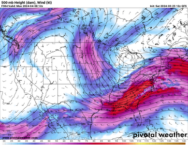
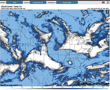
GFS is sending everyone to Ohio at the moment. It will be fun to see how this evolves.
 

Attachments

  • clouds.JPG
    clouds.JPG
    370.2 KB · Views: 8
I'm beginning to agree with Dan's pessimism, looking at ensemble output. It's early yet, but broad trends suggest a major trough over or near the Rockies next weekend -- meaning it's likely clouds will be an issue over large portions of the TX-OH segment of the path, at minimum.

That isn't to say clouds will actually block the eclipse everywhere along that path, but that isn't the issue. The issue is that the hundreds of thousands of people traveling, or at least willing to be mobile for the eclipse (including the more enthusiastic locals in numerous large cities), will all be frantically trying to cram into the gaps -- whether by adjusting flights or long-distance driving plans 1-3 days out, or speeding around on every paved road the morning of April 8. That spells major traffic problems at minimum, and potentially even worse logistical problems (gas shortages, getting stuck for more than just an hour or two after it's over, highway patrol or local police intervening to block entry to overcrowded areas, etc.).

All I can say is that I'm very glad I caught the 2017 eclipse. As much as I want to see this one, I'm not willing to drive to NY or New England for it, if it turns out that's the only good option. I remember driving back from 2017 and talking about how climo was not friendly for the 2024 eclipse date, so it's not like the prospect of widespread clouds is surprising. But if it turns out that the Northeast U.S. (whose climo is the least friendly) is the only region to pull this off, as early ensemble trends hint at, that's an extra kick in the junk.
 
All I can say is that I'm very glad I caught the 2017 eclipse. As much as I want to see this one, I'm not willing to drive to NY or New England for it, if it turns out that's the only good option.

100% this as far as I'm concerned. I caught the 2017 eclipse as well and have the luxury to be able to get a little creative with this one. But, there's no way I'm traveling to the northeast to catch it so if it doesn't happen in NE Texas or Arkansas it's a no for me (dawg).
 
If that forecast verifies, i will still be driving from Kansas to the New York or Ohio area. I also got to witness the 2017 one and to me, it is worth the drive. However, i am concerned with a lot of what was brought up in the above comments. Given the population on the east coast and New England area, as well as the amount of people traveling to a relatively small area, could cause major problems. I plan on leaving on Friday and being in position well before the event. I also will be carrying additional fuel and will have the tank topped off every chance i get before the event. I have not been to that area of the northeast but i can only imagine the road network isnt as detour friendly as the roads in Texas which could result in a traffic nightmare in the New York area.
 
Last edited:
if it turns out that the Northeast U.S. (whose climo is the least friendly) is the only region to pull this off, as early ensemble trends hint at, that's an extra kick in the junk.

Think how I feel, I live in the northeast and booked flights for a family of five to go to TX and reserved two hotel rooms in each of three different spots from Austin to Arkansas šŸ˜”
 
Think how I feel, I live in the northeast and booked flights for a family of five to go to TX and reserved two hotel rooms in each of three different spots from Austin to Arkansas šŸ˜”
Hopefully you can cancel one or more of those hotel bookings and get a refund (this is often the case for me). And hopefully you purchased flight insurance (this is never the case for me)! If you're no longer going that is. Still a ways to go though
 
Like the rest of you, I'm feeling an impulse to get despondent or down about the persistent high cloud cover forecasts from many of the deterministic (and ensemble) G(E)FS cycles coming through. However, here is an example of why I'm not sold on a cloud cover bust.

Here is the comparison between the Canadian and GFS models for the upper-air pattern that day:
loop.gif

Fairly similar at this range (at least with showing a substantial mid-level jet and trough over the SW and a broad ridge axis over the Appalachians/Dixie Alley region. They even also both have the northward departing previous shortwave over the northern Plains.

And now for the parameterized cloud cover forecast comparison:
cloud_GEFS_GDPS.gif

That is almost night-and-day different between them. The model physics differ, and that is probably the difference between these. Not sure how that will translate to verification, however. My inclination is that the GFS is overdone whereas the GDPS is underdone, so that the truth lies in between.
 
I've been seeing some talk about the Euro and Canadian (RDPS/GDPS) being the better cloud cover models and the GFS far over-doing cloud cover plots. That seems to be the case from what I can tell. I have very little experience with forecasting cloud cover, so I'm relying on others to get up to speed on that.

That being said, the latest plots from those models for 1pm CDT on the 8th are just troll-level comical.
 
I had OH to TX covered. Worried we will have to go to NY/ME to see it. If so, I'll have to get out of town Friday. I hope a lot of people just say screw it and it ends up not being a big deal to get up there to some place clear.
 
I had OH to TX covered. Worried we will have to go to NY/ME to see it. If so, I'll have to get out of town Friday. I hope a lot of people just say screw it and it ends up not being a big deal to get up there to some place clear.
One of a few reasons I'll pass on anything NE of Columbus is imagining the road options in Appalachia intersecting with multiple mega-cities nearby AND eclipse travelers worldwide, who are already vaguely aware that the northeast looks better.

Hopefully I'm being paranoid, but I'd plan on staying put there for an extra day, possibly two in the worst case. I'm just recalling the Wyoming I-25 debacle in 2017... and thinking about how much worse something like that could get if an area <6 hours from NYC, Philly, and Boston were the obvious target with a week's lead time with only a few non-interstate exit routes, all of which wind through dense forests, mountains, and small towns every 5 miles.
 
I have not canceled my TX plans yet, but made alternative plans this morning. Now we fly to Boston on Saturday, stay one night there, then rent a car to drive to Bangor on Sunday. I was unable to get a hotel in Bangor on Saturday night, but was able to for Sunday and Monday. It works out better to fly to Boston anyway - the flights are much cheaper and more plentiful from Philadelphia to Boston, than to Bangor or to Portland. And Iā€™d rather spend a night in Boston than a third night in Bangor.

This is still not a great arrangement compared to TX. I had three different hotels in or near the path in the TX scenario, within driving distance to each other. It is not practical to do the same in this new scenario. Bangor is the only decent-sized city up that far north in New England. This means fighting traffic the morning of the eclipse. I-95 is the only major road up there. The other potential target would be Watertown NY (north of Syracuse) but that would require separate flight arrangements and an earlier commitment, too far to adjust same-day. I also worry about lake effect clouds in the NY target - isnā€™t that a concern, regardless of what the cloud models say?

Maybe we should go to Mazatlan Mexico! šŸ˜
 
This morningā€™s runs look better for TX. Letā€™s see if it continues trending in that direction on the runs this evening and tomorrow morningā€¦

Although I have to ask a stupid question - the yellow on the Euro map indicates clear skies, correct? Thatā€™s what the legend says, yet itā€™s so hard to visualize it that way; even the way the edges are drawn makes it look opposite, and in some areas itā€™s completely opposite to the Canadian if you interpret the yellow as clear skiesā€¦


IMG_2074.jpegIMG_2075.jpeg
 
Comparing your image to RH plots on COD's page for the same forecast suggests that "yellow" means "clear skies", Jim.

What I'm seeing consistenly among models is a big moisture surge going on during the day in S TX. So low clouds move in quickly from S to north through the midday/afternoon. A matter of a few hours could end up making a huge difference on this one. Today's ECMWF forecasts are the first I've seen in several days that actually leave S/C TX mostly clear.
 
Hopefully I'm being paranoid, but I'd plan on staying put there for an extra day, possibly two in the worst case.

Yeah, was kind of something I would expect. At least I work remotely, so I can afford the extra time to get home. Getting there is a little more challenging and I will have to make a decision in the next few days to head to the northeast. I'm hoping most people just say 'screw it' if it becomes that difficult to see it.
 
FWIW the extended forecast for the general area I'm targeting in IL calls for a 20% chance of showers and thunderstorms with a high in the lower 70s. Farther north, where we live, the forecast is mostly sunny and about 70 for a high. There is about a 50% chance of showers on Sunday (4/7) in the extended forecasts so I'm hoping whatever is causing that rain will move out of IL before eclipse time on Monday. We will be going nonetheless and will only call it off if there is solid cloud cover/all day rain or a significant risk of severe weather. (Mama kitty and kittens are doing well and kittens are getting more independent, looks like they should be OK for 10-12 hours.)

With regard to my previous question as to whether there was less public interest in this eclipse than in the 2017 one, I don't think that's the case anymore, there have been lots of news stories about it -- the majority of them, however, seeming to emphasize the negative aspects such as disaster declarations, school closings, potential for traffic accidents, human sacrifice, dogs and cats living together, mass hysteria, etc. etc.
 
Last night's (0Z April 2) Canadian looks much better for TX and continues the improving trend from the 12Z run. It's not visible yet on Pivotal's eclipse page because that is showing a 4-run mean. Euro is also improving as Jeff noted above, but now shows some clouds over Maine, where I made alternate plans yesterday. I am keeping travel plans to both places for as long as I can. The flights I can cancel for credit and I know I will have occasion to use the credits. Hotels are the bigger problem - I now have a total of 4 reservations, and one of them has a cancellation deadline of 11:59pm tomorrow.
 
Last night's (0Z April 2) Canadian looks much better for TX and continues the improving trend from the 12Z run. It's not visible yet on Pivotal's eclipse page because that is showing a 4-run mean. Euro is also improving as Jeff noted above, but now shows some clouds over Maine, where I made alternate plans yesterday. I am keeping travel plans to both places for as long as I can. The flights I can cancel for credit and I know I will have occasion to use the credits. Hotels are the bigger problem - I now have a total of 4 reservations, and one of them has a cancellation deadline of 11:59pm tomorrow.
Time to become a gamblin' man!

I wish I had the resources to afford making multiple bets on such an event, but alas, I do not. For me it's S Texas/N Mexico or bust.
 
Canadian 12Z this morning continues to improve, but the Euro is still completely different and even shows some cloud potential in my secondary Maine target too. The Euro is generally the better model, but my understanding is that the Canadian may be better specifically for cloud cover, is that right?


IMG_2078.pngIMG_2079.jpeg
 
So Relative Humidity is not something I look at much for chase forecastsā€¦ What is the right way to interpret RH models for the likelihood of clouds? What levels should I look at? For example in Maine the 925 and 825 levels look dry, but 500 has higher RH, should that be a concern?
 
Very broadly, I would consider RH >= 70% as troubling as far as cloud obscuration goes. But the depth over which RH > 70% matters. A thin layer with that high of RH (surrounded above and below by much lower values) may not be so big a deal. But even a thick layer of RH > 60% could be sufficient to completely block out the sun when you add all the individual cloud pieces together vertically.

RH >= 90% suggests precipitation is likely forming in clouds and may actively be falling as well.
 
I know I mentioned the eclipse-nado but I was kind of hoping for a spatial separation. Todays 12Z GFS popping tornado soundings at 18Z right in southeast Oklahoma/Western Arkansas. Really disliking the possible/probable clouds at 300mb that have been showing. Texas seems pretty consistently screwed the past few days. It's almost go time fellas
 
At this point I am 65% likely to commit to Maine and bail on TX. Between the cloud forecast, the RH at 300mb (I assume correlating with cirrus from the strong jet) and the AFDs for the area, TX is rapidly falling away as a target. I will make a final decision tomorrow.

Apparently I donā€™t have much luck with climatology, whether itā€™s eclipse chasing or storm chasing.
 
Unfortunately there is still not great agreement in models on the cloud situation. The Euro has been consistent with a near-worst case pattern with clouds along the entire path except for Maine. Meanwhile, the Canadian models and now the NAM seem to agree on a slug of arcing clouds ahead of the system potentially impacting almost the inverse of that, with clearing from Ohio to Arkansas. The supposedly-overdone GFS also shows that hole in the Midwest. That leading arc of clouds looks to be moving fast enough that predicting where it will be will be nearly impossible until the morning of the eclipse. If it moves faster than expected, it could impact the entire New England segments. That is not to mention that high thick cirrus tends to not show well on these plots (based on my brief looks at it this week).

Adding to the complication of the northeastern target is a significant winter storm impacting the eclipse path up there today. Temps will rise above freezing during the day this weekend, then drop well below at night each day until the eclipse. That scenario following a big snowstorm often leads to icy roads from refreezing snowmelt during the early morning hours, adding another potential aggravating factor to traffic Monday morning.

Iā€™m not optimistic on being able to nail down the cloud situation until the morning of. We all have plenty of experience with seeing how cloud cover can change a severe weather setup overnight, clear skies even at the 0600 Day 1 outlook time canā€™t be declared with any degree of certainty.
 
Back
Top