I was initially quite worried about this season, but things seem to be going well at the moment and there appears to be hope for the rest of the season. I chase exclusively in Colorado so early season stuff (really anything before ~May 1 with regard to Colorado climatology) is of little concern to me personally. I'm banking on the climatologically likely activity in late May and throughout June. Colorado can also provide legitimate mesoscale days well through July and August.
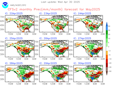
The CFS precipitation anomaly forecast for this month was quite dry throughout much of March and early April, but has totally flipped to a wetter pattern across most of the southern plains and Colorado/New Mexico. This is good news for all of us in my opinion, but the moisture is especially needed here in Colorado and New Mexico after a fairly poor mountain snow season.
View attachment 27231
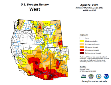
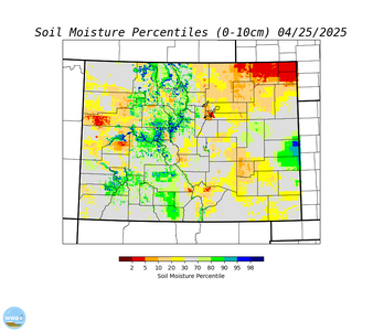
Low soil moisture and drought conditions remain entrenched across most of the southwest, and their removal seems unlikely. Eastern Colorado did have an above-average snow year (mainly thanks to that huge November snowstorm) and positive soil moisture anomalies linger in some areas. However, the rest of the winter after November was fairly dry and drought conditions aren't looking so good right now.
View attachment 27232
View attachment 27233
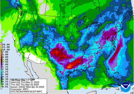
Another round of soaking rain is expected next week for the southern plains, notably across eastern New Mexico and Colorado. Models have been consistently showing widespread ~1" total QPF amounts for eastern Colorado and New Mexico for the 200-hour forecast period. There are some individual runs with ludicrous amounts of rain but we'll have to see about that.
View attachment 27234
I'm thinking that this next round of rain may have the potential to improve drought/soil moisture conditions across the EML source region and surrounding areas to the east, including my home region of eastern Colorado. I think that this kind of moisture can really only be a positive thing for the chase season. It's better than drought at any rate. Would appreciate any of your opinions on the matter.


