Appreciate the heads-up on this. Sunday is my travel day out to the Plains, so I had not been paying attention to it as a potential chase day. I hadn't done any analysis for Sunday, and as of yesterday evening nothing had grabbed my attention in SPC or any of the Plains NWS offices' AFDs.
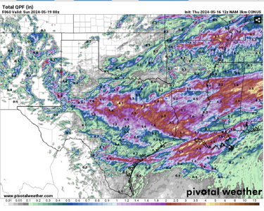
Capping looks really strong on both GFS and Euro. The dryline is much sharper on the Euro near the OK/KS border, but the cap seems unbreakable there. The GFS shows a much more diffuse dryline. But both suggest surface low pressure in west-central KS and backed winds along the KS/NE border, where the cap is weaker. Surface convergence and perturbations in the mid-level flow would have to be the triggers to break the cap.
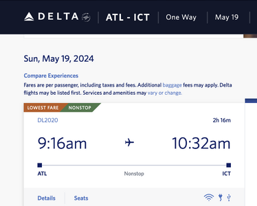
I made flight reservations that will give me at least a chance of making it on time. I land in Kansas City at 1pm. I also considered Wichita, but I cannot get in there until 3:30 (well, there is a way to get in earlier, but I'm not willing to leave the house at 4am for a 6:20am flight and it requires a connection

) . If the target ends up being north-central KS closer to the NE border it will turn out to be the right move, but obviously not if the target is more southern KS. Hopefully the cap holds off initiation until later in the day. I'm also pretty paranoid about rental cars; I've had too many times when I got a vehicle with the oil life down near zero, or tires with insufficient tread, or a tire that was lower pressure than the others. (This happened to me again recently in Boston for my eclipse chase). At the Kansas City airport there should be a bigger selection in case I have an issue with the vehicle they want to give me and need to swap it out.