Warren Faidley
Supporter
Wise decisions by everyone. If I lived within a few hundred miles, I would go for it, but a long drive or flight from Tucson is not justified. As a long-shot chaser, I might focus a little further south, maybe CDS or even further south / southwest and hope for a cap-cracking, Panahdle magic event near the dryline right before sunset.
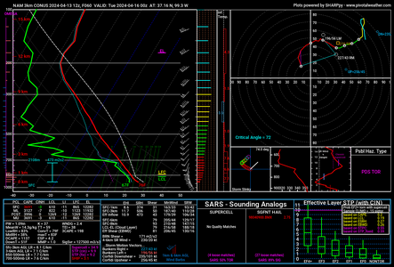
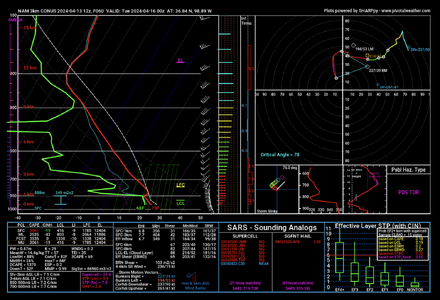
Interestingly, the GFS had wonky hodographs for days, not worthy of a "major" event. I figured this would change as the trough approached, but it never did.
There is still plenty of time for things to change. I've seen seesaw patterns like this actully contribute to a bigger day than expected. I believe there will be at least one isolated event, or multiple events after dark.
 . I find that experience very useful as a check for when the models' forecasts look wonky. So, I thought I'd pass along some old time info on the upcoming situation.