2016-03-15 EVENT: MO/IL/IN/MI/OH

Joined
May 18, 2012
Messages
292
Location
Gaines, MI
A potent upper level level system with short wave trough will eject out of the four corners region tonight and advect into the Northern Plains/Upper MS Valley tomorrow. Trough progged to take on a negative tilt with a 90-100 kt jet core as the system moves into IL by 3Z Wednesday. Divergence in the mid levels will cause elongated surface low to develop out ahead of the system near the Twin Cities to Madison with a warm front oriented from the NW to SE.

I could be completely off base with this, but I expect storms to fire out ahead of the trailing CF from N to SE sometime in the mid to later afternoon (17-21Z) in the warm sector where surface dews are progged to reach the mid 50s to low 60s, and SBCAPE is 2-2,000 J/kg per the 0Z NAM (about twice the 0Z GFS). There will be plenty of LL shear and lapse rates at the low and mid levels will be sufficient enough to support updrafts for supercells capable of all storm modes.

SPC has given a SLGT Risk for the area with a MRGL extending from the lower Great lakes unto the mid TN Valley.

For now my trget area is Normal, IL.

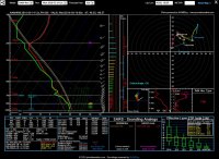
Sounding is for Normal at 21Z 3/15
3-15-a.PNG

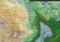
Surface Dews at 21Z 3/15
3-15-b.PNG

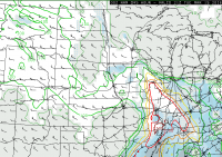
Surface Based CAPE/CIN at 21Z 3/15
3-15-c.PNG

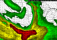
500 Mb Winds at 0Z 3/16
3-15-e.PNG

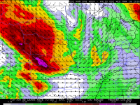
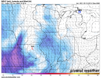
Mid Level Lapse Rates at 0Z 3/16
3-15-d.PNG
 
I've been encouraged by how models have been slowing this system (namely the cold front) down with each run, along with bumping sbCAPE up to 2500 and a much stronger convective precip signal. Not much to dislike about the area under the left exit of that jet streak - looks like quite the sweet spot, with great diffluence right overtop of all of that juice. The only concern would be storm speeds at this point.
 
My biggest concern with the 12z NAMs right now is the weakness above 850 and the VBV that's snuck in with most of the runs in the last 24 hours. This weakness is less pronounced to the south, but depending on the model, there may not be enough backing winds at the surface. My best guess right now is along I-39, Hard to choose anything more specific than that yet with the various discrepancies.

~Peoria, right up next to possible convection.

vbv.JPG
 
As is the case a lot of the time this early in the season, my biggest concern right now would have to be instability. I know that the NAM is forecasting some pretty good CAPE values for March, between 1500-2500 j/kg... but there should be a lot of cloudiness tomorrow out in the warm sector with all of the WAA and it seems that just yesterday the NAM was a bit high with its forecast dew points down in AR. I do think that if the forecast dew points into the 60s can verify and storms are able to remain discrete and not interfere with each other, tomorrow could be a pretty good tornado day. If I decide to chase this day, I will likely target somewhere along the warm front that should setup somewhere in northern IL.
 
Last edited:
I plan to chase this event, since its pretty much in my backyard. Right now planning on getting up and looking at things tomorrow morning. 12z NAM looked pretty good for a starting point in Western IL. SPC WRF showed some pretty good helicity tracks with initiating convection in this area as well. So my starting point will probably be my house (ha!). And then I can adjust from there. Lapse rates look really good tomorrow which is one thing I've continued to like, shouldn't be tough getting moderate amounts of instability, even if moisture only holds in the upper 50s. Good luck everyone!

I should also note that this event is somewhat reminiscent to me of the December 23rd setup we had. I was able to score a nice tornado that day, hopefully results bear the same tomorrow :)
 
NAM seems to be a lot more generous with moisture than the GFS, I wonder if it'll end up being down to who's lucky enough to get on the right storm. Seems to me that a lot of storms will go up; but with storm mode being up in the air, there may only be a couple that actually produce. I'm going to head that way towards Peoria and then figure things out in the morning. Probably my last good chance to chase before I report for CDL training.
 
I'm on the fence about chasing this event, but it's hard to ignore that left exit region, as Dan said. Right now the northern part of central IL (Mendota-Normal-Peoria) looks good, just hoping NAM CAPE verifies. One positive is that even if dewpoints only make it into the upper 50s, forecast temps are only in the upper 60s/low 70s so LCL heights shouldn't be a game breaker.
 
It looks like I won't have to go very far at all for this event. This EHI bullseye is pretty much directly over my house. I would actually prefer to drive a bit further. But at least I'll be very familiar with the road options.

full


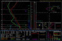
The 18z NAM shows surface winds from the SE gusting to 20 knots at 21z but beginning to weaken by 00z as shown in this sounding.

full


This will be my first time chasing in March. The last few years have been rather quiet in this area.
 
The NAM and its obvious moisture bias are of course a concern with respect to the instability being progged. Frankly, I don't buy it. That said, I don't think it will be an issue. While 2000 j/kg is unlikely IMO, steep lapse rates should make up for it. This time of year, you don't need super rich moisture as the surface temperatures should keep the T/Td spread low enough to where the LCLs shouldn't be an issue. The diffluence aloft certainly helps, and the shear profiles are pretty magnificent in both the deep layer and lower levels. As has been noted, there is a touch of weakness between ~850-700, and some of the soundings show a hint of veer-back by 00z (however that could be convectively contaminated).

All in all, with relatively good moisture already in place as well as the slowing trend shown in several of the models, I'm honestly surprised at how little this system has been hyped. With convection acting to re-enforce the WF early in the period, I think its decently possible we see a couple of more intense tornadoes tomorrow. The setup tomorrow is definitely good enough to get me out the door. It actually reminds me quite a bit of April 9th of last year. Lets hope for similar, albeit less destructive results.
 
I've noticed a slight difference in 500 mb vorticity and jet streak speeds between current obs on water vapor compared to the NAM and GFS. Only marginal differences exist, but it makes me wonder if the vorticity advection and jet speeds will amplify enough to place the negatively tilted trough with at least +50 knot winds in time for an event tomorrow. With the jet just coming in off the west coast now, 22Z WV/Vorticity has 80 knot winds in CA while the NAM and GFS put those speeds in CO and UT respectively. It seems like a lot is riding on that trough arriving with associated lift/divergence and upper level winds/vorticity at the right time.

It appears that another factor that's highly dependent on the timely arrival of the trough and attendant surface low is moisture. 850 mb winds and dews show moisture advecting out of IL and pushing off to the east. Even lower levels barely recover a moderate amount of moisture in time. It appears that it's getting a lot of the moisture from the wrapping low to the north. Even with that moisture, the quantity isn't exactly overwhelming. I just don't like the fact that we're waiting for everything to arrive at the perfect time.
 
Last edited:
It appears that the trends continue to slow this system down and move things back further and further to the southwest. The 0z NAM has really moved things back to the southwest and at 21z tomorrow all of the CAPE has fallen back towards central/eastern areas of MO and far western parts of IL. The RAP is now in range and it does look like at least low 60s Td are attainable. Even the party pooper GFS has started to ramp up its CAPE values a bit on tonight's run. My biggest fear right now is the cap. Also, the stronger 500s seem to be lagging behind now as well. This may end up being a strongly forced cold frontal situation around 6 pm. The NAM-4km hints at this... I am still up in the air on using a vacation day to chase this setup, I will wait until early this morning to decide. I think that if I do pull the trigger, I will target somewhere near the IA/MO/IL border intersection where there may be somewhat of a triple point setting up, but overall I am not overly optimistic at this point.

e1ac0a97ac58ff7fd8959808b1542d10.png
 
Last edited:
While certainly rosy, I'm not sure I buy the HRRR's take on this afternoon. The 4KM NAM/WRF solution seems more reasonable given current obs. Of interest is the RAP bringing the jet streak in farther south, and the current WV loop has me thinking it might be on to something.
 
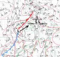
Doing a little sketching on the 13Z surface observations to get a feel for things. Then dropping options on how NAM, RAP and HRRR want to handle placement of the surface low by 21Z. I'm feeling like I will want to set up on the east side of the river. Which is good—as in not worrying over crossing locations takes one element off my mind. Moisture quality still weighs a bit—how badly dew points will mix out plus shallowness further south.
Screen Shot 2016-03-15 at 8.10.53 AM.png
 
Yeah, obviously my target shifted westward after last nights 0Z Nam run. Agree with Dan on the trajectory of that jet streak. Not sure we'll cross into MO, but will probably set up near Carthage. Dews are rising but looks like it's overcast and a little foggy last check (a good thing).


Sent from my iPhone using Stormtrack mobile app
 
I agree with Jeremy. East side of the river is the way to go. Both HRRR and NAM 4K have the placement of the compact low centered over the river with a better backed wind field on the east side of the river. If moisture is going to advect northward, it will do it on the southeastern and eastern side of the low. RAP also placing a dryslot at 925 mb just on the west side of the river at 22Z.
 
Strongly recommend east of the Mississippi River for a couple reasons. First the logistics is better. Who wants to worry about a river crossing during the chase? One could lose the storm, or worse run out of escape routes. Also believe the meteorology will be better east anyway.

Pre-frontal trough is forecast ahead of the cold front. I would chase the intersection of the prefrontal trough and warm front / outflow boundary. The WF/OFB may merge or become hard to discern from one another, as is sometimes the case in the Midwest. Regardless, I would look for the cell closest to the intersection with the prefrontal trough. I would not bite on any early cold front cells. Wait for 1-2 to go on the prefrontal trough farther east. HRRR suggests a right moving beast on the prefrontal trough and warm front intersection, well into central Illinois and way east of the River.

Maybe this is not a travel day but it is definitely a local chase day if one live in Illinois, southeastern Iowa or eastern Missouri. From the latter two states still get into Illinois.
 
Back
Top