• While Stormtrack has discontinued its hosting of SpotterNetwork support on the forums, keep in mind that support for SpotterNetwork issues is available by emailing [email protected].

2015-11-16 EVENT: TX/OK/KS

Kismet/Plains tornado confirmed as an EF3 with a max width of 2000 yards and path length of 51 miles via PNS statement from DDC. Likely one of the furthest west tornadoes to have a >50 mile path length on record in the fall. 9 tornadoes confirmed in total in DDC's CWA.

6 tornadoes confirmed in the GLD CWA as well.
 
Last edited:
Copied from my blog. These are all the photos I put together to help prove the NWS employee's theory that this was actually 2 different tornadoes, as this is what the radar showed.

I talked with Amarillo NWS throughout the week, while they tried to figure out what all exactly happened. The overlapping paths caused all sorts of problems in determining which tornado did what damage and the correct times for each. I was sitting about 2 miles south of Miami for 7:05pm to 8pm. From there I saw the end of Pampa wedge #1 from 7:08 to 7:18. Next I thought I saw one continuous wedge from 7:23pm (on going before this, but I couldn't see it) to 7:53pm from storm #2. Through what the NWS saw in the archived radar and my pictures, we determined that storm # 2 actually created 2 wedges within 10 minutes of each other. Around 7:28 wedge number 2 (on storm 2) faded fast with a new wedge forming in close proximity. My view was slightly obstructed from 7:30 to 7:34, but as the area emerged from behind the radio tower that blinded my view the new wedge was on going. That bumped my total for the evening to 6 tornadoes (3 different wedges), from 3 different storms. All that with me ending my chase at 8 and being home by 9:30 on only 1 tank of gas ($22).

Here is a photo analysis of the "wedge hand off" NE of Pampa at ~7:25pm to 7:35.


c18ce2f9ac736a97b8896eb6b9b5f714.jpg
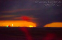
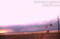
My first view of Pampa storm number 2 to my SW as the wedge leaves the SE part of town near the Halliburton plant at 7:23pm. First few of these shots are out of focus. The orange glow is from a nearby prison. All pictures are clickable for larger size.
ca15d3aaa240426c28db531097a95aa3.jpg
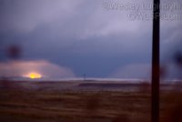
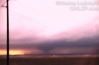
7:24pm the wedge is quickly moving away from the city. Looking WSW.

cfa65968467c72f697bd25ec3e0ffce3.jpg
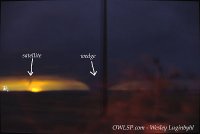
7:25pm. Looking WSW at the wedge and a possible satellite tornado.
eac501b27bfd7e3c0f6e729c30393a81.jpg
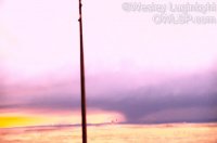
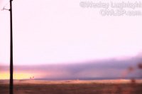
7:28pm the size is shrinking fast as it moves NE.
9b34f364fd05718526351371fe714a26.jpg
7:29pm. Still looking WSW, tornado losing ground connection
3f4166414cbe6b6317adce900cff5e3b.jpg
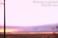
7:29pm looking WSW still. Size decreasing even more and wrapping rain more present.
db9ec841bfe079938c28c2eb3bb11bb9.jpg
7:29pm even further disconnect with the ground.
72d6cee7e5fbbc668773ae20a2d8a37d.jpg
7:30pm hard to tell if it is even still on the ground. Though not evident from this photo another tornado is forming to the right.

To see the rest, visit my blog here: http://owlsp.blogspot.com/2015/11/nov-16-2015-pampa-tornado-2-analysis.html (ST limits the number of photos I can attach, so I could not include the entire analysis)
 
Back
Top