2015-04-08 EVENT: KS/OK/TX/MO/AR

Today has a lot of question marks still in my mind, none of which were resolved by a good night of sleep.

The biggest concern is still at 850mb where mesoanalysis shows SW to even westerly 850s in the target area with a large dry punch. We're going to need things to turn soon or today, in my opinion, is going to be a big ol bust along I-35.

850mb.gif
 
Today has a lot of question marks still in my mind, none of which were resolved by a good night of sleep.

The biggest concern is still at 850mb where mesoanalysis shows SW to even westerly 850s in the target area with a large dry punch. We're going to need things to turn soon or today, in my opinion, is going to be a big ol bust along I-35.

The very veered 850 mb winds are moving that sweet EML over the Plains at the expense of putting a formidable cap in place. Morning visible satellite data indicate rather widespread cloud cover over the southern Plains, which will reduce insolation and heating rates over much of the warm sector. 12z soundings from OUN and FWD show slightly lower boundary layer moisture than I was hoping for, with mainly 10.5-11.5 g/kg over the lowest 100 mb. There may be some better moisture sneaking up between the MAF and FWD sounding sites across central Texas. The cloud cover is preventing the GOES sounder from giving us precipitable water (PW) estimates. GPS-derived PW estimates through the Suominet (http://www.suominet.ucar.edu/) provides more data, but it's not any better. In fact, PW is actually a little lower between MAF and FWD unless one gets into southern Texas. As noted before, PW isn't necessarily a good indicator of boundary layer moisture since PW is integrated through the troposphere (which means that mid-level cloud cover contributes to PW, even though it doesn't tell us about that moisture available for surface-based convection). However, it is another quantity we can use in the absence of denser moisture observations.

Despite all of this, some high-res NWP runs (and operational NAM) don't seem to indicate problems with the cap near the front by mid afternoon and near the dryline around 0z. The 12z NAM at least does show high RH at 250 mb and 500 mb today, so it is picking up on some of the cloud cover currently out there. I'm not sure what the best plan is, though I'm eyeing western OK to stay away from crowds up closer to the OK/KS border. Then again, depending upon how the sfc T field shapes up through the day, CI near the dryline may not occur (if the PBL doesn't deepen/warm sufficiently).
 
The Lamont sounding today is going to be interesting to say the least. How strong that cap is after more dry, hot air being pulled across the dryline is in place is probably going to determine whether or not I head up to the border. I'm not overly concerned by the frontal position and the cloud cover over most of Oklahoma seems to be burning off, similar to the last two days. The main forcing mechanisms is still chilling just NW of Baja right now which bodes well for the "main show" not being before 20Z hopefully. Just time to sit and watch the surface observations/satellite.

Initial Target: South Haven, Kansas
 
It seems the target area has shifted slightly, from just west of Wichita to just east of Wichita. Anywhere from Winfield to Eureka would be a good starting point. Don't be afraid of the flint hills. There is no forest there and viewing conditions are excellent.
 
It seems the target area has shifted slightly, from just west of Wichita to just east of Wichita. Anywhere from Winfield to Eureka would be a good starting point. Don't be afraid of the flint hills. There is no forest there and viewing conditions are excellent.

I agree. The "crap"vection in western OK currently is eliminating the dryline for me. The placement of the WF and moisture depth has shifted the target to south and east of Wichita.
 
tripoint.jpg

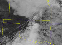
You know you have a well-defined triple point when you can pretty much eye-ball it on satellite! I would think initiation should come
sooner rather than later (20Zish a la HRRR?) Should be a good early season test of chaser convergence.
 
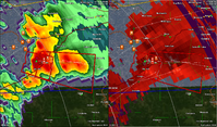
Watching things unfold in MO and southern IL, I think what Andrew said above is shaping up pretty well. The cell southwest of Union, MO, which now has a 3-inch hail marker, is pretty close to the warm front, and if this or another cell can ride the boundary, tornadoes are a good possibility. SPC seems to be thinking this way as well, mentioning the possibility of a tornado or two in the severe watch now out for parts of MO, IL, and IN as well as the possibility of an eventual upgrade to a tornado watch in western and southern portions of the watch. The terrain is not great, but the Union storm could be pretty chaseable as it is moving more or less parallel to and not too far north of I-44.

If, as predicted, the warm front eventually lifts north, then the tornado threat could also increase in the immediate St. Louis area.
 
Well I think this convection in Oklahoma is going to kill it for the day. Convection went too early and is going to sap the energy I am afraid.
 
Andrew and John essentially covered the reasons I stayed home this morning and am just now heading out, so I won't go into detail, except to say that upper support is stronger currently than previous NAM/GFS runs had indicated. We're pretty solidly within a belt of 40kt southwesterly 500s and the storms appear to be finally tapping surface-based instability. I expect the storm west of St. Louis to be the play of the day in the Midwest as it deviates and begins to head east-southeast. I expect it will pass south of the STL metro, though it still bears watching.
 
FWIW the earlier runs of the hrrr were showing the strongest updraft rotation of the day for that St Louis cell. It definitely has isolation on its side.
 
The cell SW of STL has turned right and crossed I-44 - likely beginning to ride the boundary. And it has produced baseball and larger hail around Sullivan, MO.
 
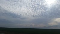
Had to head up to Enid to visit some family. Some great pictures up this way. Was hoping to get to Missouri today, but the family would have been pretty upset. Best of luck to everyone out there tonight and as always stay safe! uploadfromtaptalk1428531585988.jpguploadfromtaptalk1428531632442.jpguploadfromtaptalk1428531698967.jpg
 
Well aside from a few sparse cells, today was pretty much a bust in the Kansas/Oklahoma area. The evening storms developed further north and west than expected and there were only really 2 cells. Color me disappointed but glad I didn't take off work today to chase.
 
Back
Top