2015-04-08 EVENT: KS/OK/TX/MO/AR

I'm still not sold 100% on Wednesday. Plenty of flies in the ointment still to appear. I have been glad to see that we're sitting under mid level lapse rates in the plains right now of around 7-7.5 and mid 60s surface dews and 70's sitting along the gulf coast.

With that said, as Kelton mentioned above, moisture depth may be an issue. I hope it isn't, but it doesn't seem like a slam dunk.

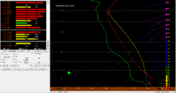
The 12Z NAM doesn't orient the dryline nearly as much N/S as it the previous runs had done, and even seems to have some S shaped hodographs along the dryline. The 12Z NAM has also trended CAPE values downwards compared to previous runs.
 
Pretty unbelievable difference between the NAM and GFS as far as positioning goes. TP nearly has a 200 mile difference between the models. GFS puts in SE NE while NAM is still sliding it slowly SE deeper into SC KS. Step right up and take your bets! Who is it going to win?!
 
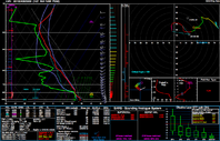
I have to agree with my colleagues here regarding the setup for this day. I have been looking at forecasted soundings in Bufkit. It does have the look and feel of the typical Plains setup.


SREF_OUN_0408_22z_.PNG SREF sounding at 22Z
 
Well, I was pretty excited about this day 24-36 hours ago. However, I am having serious doubts about the extent/degree of severe weather that will occur. As mentioned above, there is a slowly growing problem of moisture depth, which may be trying to manifest itself in the models now. The 12z GFS is taming CAPE down along the DL. The orientation is no longer sharply defined as N-S in Oklahoma but more SW/NE with weaker convergence. The surface winds are no longer as strongly backed as they were in yesterday's model guidance. Another concern of mine is the 500 mb flow. Coming into Wednesday, it appears a maximum at 500 from the sub-tropical jet moves into the plains. At 21z, flow looks great, but it doesn't last. From 21z-03z, it completely collapses. Perhaps the approaching wave from the desert southwest will help mitigate this, but its still something worth considering.

Even worse, the target area seems to be shrinking to the triple point and about 100 miles or so south of it. This could make chaser convergence unbearable given it's the first potentially major event of the year.
 
Despite the moisture concerns, one thing Wednesday does have going for it is the fact that the models are picking up on the moisture depth being observed in the Gulf. I pulled this sounding from he 12Z NAM4km run near Lamont, at which point the next sounding becomes convectively contaminated by thunderstorm initiation. I'm not sure that I buy the 70S dewpoints making it this far north, but I won't be surprised if we get close given that we have 3 days of moisture return taking place. I'm not a huge fan of the backing between 3 and 6km, but it could be worse (i.e. lower to the ground). Again, while this setup has some concerns, I still think that there is a severe threat given the overall setup. It may not be the slam dunk that everyone initially thought it was, but a couple of tornadoes, and especially some large hail, are still on the table for Wednesday. The purple lines in the background are one of the SARS analogues, which is relatively similar both thermodynamically and kinematically to this particular sounding. Keep in mind that I'm not claiming it's the same or will turn out the same, or that the atmosphere will even resemble this once 22Z rolls around on Wednesday, but rather claiming that it's still worth keeping an eye on given the ingredients in place. LMN_20150408_22.png
 
I think it's important to remember that we're still looking at 60-hour forecasts at this point (12z model forecasts 2 day before the event). As such, the details *will* change. Heck, even the not-so-detailed environmental setup may change between now and the event. For example, will that part of the front in south-central KS northeastward towards Topeka be structured like a warm front slowly lifting northward (with ENE or NE winds to its north), like a cold front that's nearly stationary (with N winds to its north), or something in between? Some of the model runs have shown a nearly perfect setup for tornadic supercells in KS and OK, and those types of events don't happen very often. When the model is showing the "best", the only place for it to go is down, if you can excuse the modified trite expression.

The forecast hodographs aren't really "textbook", per se, but I'm not sure I should spend much time looking at forecast hodographs 60 hours out given that hodographs can be extremely sensitive to relatively small changes in wind speed or direction at times. However, as Kelton has shown, there are indications of suboptimal hodograph shapes -- namely, the dreaded S-shaped hodograph -- showing up in the NAM and GFS forecasts. YMMV, of course, but I have not seen a significant tornadic supercell in environments associated with S-shaped (or N-shaped) hodographs. In this particular case, the counterclockwise rotation of the local shear vector begins higher up in the troposphere than I've seen in other situations, so it's not quite as concerning. If the 700 mb flow weakens a bit more, however, we'll see hodographs more into the unfavorably-shaped regime (with negative streamwise vorticity between ~850 mb and 700 mb), which detrimentally changes the configuration of the linear dynamic component of the vertical perturbation pressure gradient field (i.e., that associated with the rotation of the shear vector with height) that can directly affect anomalous storm propagation.

Before most big tornadic supercell events, even the "best" chase days on the Plains, there are almost always some question marks and "fly in the ointment" elements. How a potential event plays out can depends upon an extremely delicate balance between highly nonlinear processes that are all but impossible to predict before the event (e.g., 6 hrs before, much less 60 hours before). At this point, the obvious signal seems to be the quasi-stationary or warm front in central and northeastern Kansas. That fact alone makes me hesitant to consider seriously that as a target area. I'm more inclined to stay ahead of the dryline in Oklahoma on the assumption that chaser convergence may be ridiculous near the front and triple point. The 12z 4 km NAM indicated a ripple on the dryline moving northward from western north TX into Oklahoma southwest and west of OKC Wednesday afternoon, which may be an interesting possibility. Of course, as noted, it's impossible to know whether such a mesoscale detail really will play out like a 54-60 hr forecast shows.
 
Concerning the quality of the deep moisture, what I seem to be seeing on the models is that the main source region for the dewpoints above the surface (particularly around 850 mb) is actually somewhat inland over eastern Mexico. The background flow out of the Caribbean at this level has penetrated west and brought this moisture over that area. There are currently 12-14˚C H85 Tds over this region northward to Central TX.
 
I think it's important to remember that we're still looking at 60-hour forecasts at this point (12z model forecasts 2 day before the event). As such, the details *will* change. Heck, even the not-so-detailed environmental setup may change between now and the event. For example, will that part of the front in south-central KS northeastward towards Topeka be structured like a warm front slowly lifting northward (with ENE or NE winds to its north), like a cold front that's nearly stationary (with N winds to its north), or something in between? Some of the model runs have shown a nearly perfect setup for tornadic supercells in KS and OK, and those types of events don't happen very often. When the model is showing the "best", the only place for it to go is down, if you can excuse the modified trite expression.

I have to totally agree with Jeff here, conditions may look good, bad, neutral. Get the picture. Still have to keep our collective eyes on this, as this has so telltale signs but need to remain objective and wait until the models narrow the goalposts so-to-speak.
 
We chasers sure are a panicky bunch, aren't we? I think people flippin their minds over 1 model run is ridiculous. Trend is your friend. And although there's some trends of less moisture and what not, the setup has consistently looked good. Y'all listen to Jeff here. The setup was looking perfect yesterday, so of course it's not going to look any better. Hell, the system isn't even onshore yet and we're losing our minds. Be patient, and wait for the 12z tomorrow when the low makes it onshore. THEN you can proceed to lose your minds, for better or for worse.
 
As others have said we're talking about a potential event 60 hours out. I don't really start taking model output seriously until we're inside 36-48 hours. Let's see what the 0Z model suite shows tonight. The EURO seems to have the most consistent scenario at this time. As for capping concerns on the dryline lets not forget April 14, 2012. Models were a big troll on that day as well.
 
Great discussion, here! After a long hiatus from ST, it's great to see such high-quality comments.

I think the main issue will be how the northern and southern jet streams interact over the next 48 hours. Both the GFS and the NAM show a lead wave entering the Plains early in the day on Wednesday (the GFS is somewhat slower), which veers the low-level flow and creates the less-than-desirable hodos that Jeff mentioned. Should the streams phase a bit more (slowing down the progression of the lead wave), I think there's a chance that we could get the more-optimal continually-veering wind profiles. Of course, this is very contingent. We should know a whole lot more by tomorrow (when this system is sampled a bit more).

Regardless, I think there will be tornadoes somewhere. It's hard to get this kind of setup without tornadoes. To me, the questions are: how many will there be and how strong?
 
LCLs may also be a concern before 0Z for the dryline play - especially if we end up with a more southwesterly flow at 850 millibars. We'll see how things look later tonight. With the system still offshore it's important to note models may have a quick shift once we get upper air data of the system. Either way it's good to have mid 60 dews already in Norman two days before the possible event.
 
Of course lots can change between now and Wed. morning but the differences in the models are great enough that we need that time to get some resolution to the solutions they are throwing out there. As of right now I would be looking at targeting the Hutchinson area but I'm glad I don't have to make that decision today. Although I have to say I'm routing for the NAM with the more abundant moisture, less capping and the lid doesn't shut as quickly as per the GFS.
 
Trough timing really is the biggest issue here. The Euro seems to be moving it even slower than the NAM, with that lead impulse not shifting through and preventing that dreaded veer-back-veer profile from materializing. The April 14 comparisons are actually pretty interesting since the circumstances here are extraordinarily similar. I don't know if this ends up being a major Plains setup, but having more than 48 hours until the afternoon of the 8th makes forecasting this harder considering most of the useful obs of this system won't be integrated into any of the models until probably 12Z tomrrow.

As for my own thoughts, the moisture quality at least through the lowest 1 km is excellent, regardless of a lack of depth through 1.5 and up. The source region for that low-level moisture actually looks to be from SW of Del Rio and this morning's sounding from DRT definitely gave me a bit of hope. The cap is stout but given the time of year, a 9C cap is not insurmountable in the face of rather impressive forcing for ascent and vorticity lobes advecting ahead of the main jet max. As of right now, if everything stayed the same and the NAM/Euro ended up being the correct solution, i'd definitely play the border a bit down the dryline.
 
Back
Top