• While Stormtrack has discontinued its hosting of SpotterNetwork support on the forums, keep in mind that support for SpotterNetwork issues is available by emailing [email protected].

Southwestern US Monsoon 2025

...but it is just early July...
...chasing in that region...
I lived in AZ for eight years, and the monsoons provided the singular opportunity for storms w/ lightning with often good clarity. While Warren shot in the Tucson area, I focused on Grand Canyon & Flagstaff in the north.

The freezing level as it relates to lightning production’s seemingly lower compared to where the photographer stands when you’re already at 6000-7000 feet, so lightning appears to happen quickly from smaller-looking storms.

I believe there’s time for rebounds and reboots for a couple of months still.

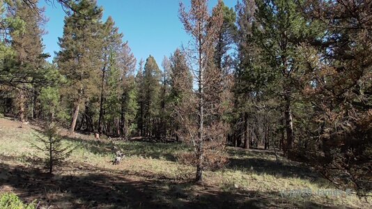
One of my favorite things, the anvils from the North Rim of the Grand Canyon would blow off a dozen miles to the South Rim and create a steely gray-blue look to the sky. I also particularly remember the flash floods at the Park would spill out over the sides of the Canyon rim.

When the storms evaporated, they left behind orphan anvils: Cirrus spissatus cumulonimbogenitus. I learned that Latin phrase just because it sounds so dorky. 🤣 But, it's not entirely necessary to do the Southwest if you already know where and when to get other lightning storms.
 
Last edited:
William Monfredo said:
I also particularly remember the flash floods at the Park would spill out over the sides of the Canyon rim.
Oooh I bet that would be a sight to see! (and deff would need videoing !)


Cirrus spissatus cumulonimbogenitus.
sounds like some sorta disease (especially the last word) or something .lol.
I'm gonna have to put that into an AI image generator & see what it comes up with.....
 
Well, well, well..... was going to write something about how next week was looking, but the NWS did a much more professional job, so I'll post their comments:

NEXT WEEK IS SHAPING UP TO BE AN ACTIVE MONSOON WEEK RIGHT AS WE GET
INTO THE HEART OF THE MONSOON FROM A CLIMATOLOGICAL PERSPECTIVE. THE
MID-UPPER LEVEL HIGH WILL GRADUALLY SHIFT TOWARDS THE FOUR CORNERS
WITH NE FLOW OVER SE ARIZONA EARLY IN THE WEEK, WHICH WILL THEN
TRANSITION TO EAST TO SOUTHEAST FLOW WITH THE HIGH TO OUR NORTHEAST
AND A MID LEVEL DISTURBANCE TO OUR SOUTH AND WEST HELPING TO PUMP IN
ADDITIONAL MOISTURE WITH ELEVATED STORM CHANCES. THIS TYPE OF SETUP
WOULD YIELD STORM IMPACTS LEANING TOWARDS A SEVERE THREAT AT THE
BEGINNING OF THE WEEK WITH A TRANSITION TO BOTH A SEVERE AND FLASH
FLOOD THREAT AS THE WEEK PROGRESSES.
 
It's that time of year to start the annual monsoon thread. ⛈️⚡

Still too early to make a reliable forecast, but current trends suggest the usual start in about three weeks.

Some early wild cards this year include tropical activity near the Baja Peninsula that could cause early RH surges and the effect of recent rains
on stabilizing dust beds. I have not had time yet to inspect the dust beds, but it only takes a few weeks of 110º F+ to bake them properly
for haboob production. In fact, sometimes, early rains can produce small plant blooms that dies in the heat, becoming potential airborne particles
during dust storms.

I will be going live this year on YouTube during the BIG monsoon / haboob days, so stay tuned.
Hey Warren! Well, like you.....I've lived in Tucson for many decades....64 years actually, and just like last monsoon season.....I don't think that it's gonna be much of a monsoon at all. And oh man.....we're in such a horrific draught now.....I've NEVER seen this Sonoran Desert in as bad a shape as it is now......EVER. I live in the desert.....not in town. Always lived in the desert, really. Older readers may remember the old cowboy trick of when cattle were in near-dead condition from draught conditions, they would take burners and light various cacti on fire....so it would burn off all the thorns, then the cattle would eat the cacti...usually prickly-pear....and get the moisture out of it. But even the prickly-pears are so dried up, they are dying too. This is getting REAL OLD. Please keep a good thought for us down here. Respects, joel ewing
 
Please keep a good thought...
Thanks for the anecdote.
I would not advocate for a persistence forecast. (The first two weeks of July is not a predictor of a season that runs until October 1.)
The North American "monsoon" from Mexico into the Southwest produces highly-variable rain totals across extremely short distances.
Regardless, I hope you get some in your bucket, too.:)
 
Last edited:
So far, for those of you who have mentioned not chasing/experiencing the monsoon, you certainly haven't missed much this season. Still a dud in the Four Corners and following a sub-par winter. So far this year in Pagosa Springs, CO, every month except May has had below-average precipitation, with the annual total so far (average of area COCORAHS measurements) only 7.49″ – 65% of the average of 11.45″ for this point of the year, according to pagosaweather.org. It has been better on the eastern plains of CO and NM, but from the mountains west, pretty much a dud. And now this week a string of hot dry days, with only signs of a modest push at best next week. Fire danger is high and reservoir levels are falling. And I have yet to even attempt lightning photography.
 
One of the worse monsoons I can remember, and that goes way back. Very little in the way of lightning. A few bolts here and there, but astonishingly little (to none) of the typical monsoon lightning storms that crank bolts for hours. I noticed some of the tour groups that cover the monsoon have departed to Colorado. Ouch!

Low, warm cloud tops, generally sustained below 30k feet, and lack of storm movement is evidence of poor ridge placement and crappy RH levels. I don't think we've had a single easterly wave event. It sucks to experience the final years of the mini ice age.

Some RH will creep in late this week, but I don't trust the models given the total fail mode so far of predicting RH return, including CPC outlooks.

There is a moderate to high risk of more haboobs this season if the storms return, given the ground has lost almost 100% of the meager RH it gained in July. Baked, dead plant particles are also abundant and have been a factor in previous monster haboobs.
 
Monsoon season has been a complete dud here too.

There've been a few days where it looked like we might get something, but at most its been little thundershowers...providing only small amounts of rain & a few lightnings. Overall its been pretty 'desert' here.
No "storms" at all (I don't count those few little short-lived thundershowers as being a 'storm'), really disappointing season so far...still a few weeks left in Aug, but I don't hold out much hope of getting any good lightning shows during those.
 
This is always the thing that worries me about planning a big monsoon trip (which I hope to do someday), it seems even more bust-prone than Plains tornado setups.
 
Also adding to my previous post since its related...
I was up in the mountains camping a couple weekends ago (near Trout Creek Pass), and though it had rained recently at that point(multiple afternoon rains the previous week - monsoon actually kicked in some for them - I'd been watching the forecast & checked radar in afternoons to see if it verified (as we'd delayed camping due to the threat of rain))...the overall dryness/drought was pretty evident/obvious all around there.

But the thing I noticed most was the trees - so many looking so bad! It was shocking. Looking at some up close (only certain types were affected), you could tell all the new growth was gone - bare twigs with stubs of needles or no needles at all. I've seen it to a lesser degree in previous years, but nothing to the level of this year, and seen the cause - there's little caterpillars/worms eating the needles.
It took some searching to find the info I wanted(was surprized it was a bit hard to find & there was little mention of it in media), but I eventually did get it:
Looks like the insect is "western spruce budworm", the description of that particular bug & what it does fits exactlty what I've seen. Small worms eat the needles on just that year's new growth (and can strip it completely to bare twigs). Normally it won't kill trees, but if the same trees are hit year after year (which has happened for atleast a few now), it can/will. (it ofcourse weakens them too which makes them more susceptible to bark beetles)
Well, it also turns out there's a western spruce budworm outbreak of going on up there. One of the causes being drought-stressed trees.
All I can say is it looks bad, there's gonna be a whole lot of dead trees - if they aren't already, I'd give them *no more* than one more year of being hit before they're gone.
Only real chance those trees have (and its a minor one at that) is if (a)the budworm outbreak ends, and (b)we get some good rain(and snow) up there - a couple drought-busting years!
The Trees I noticed being most affected are "rocky mountain subalpine fir". Nice trees & native to the area, going to be sad to see so many gone, maybe even to the point of wiping them all out in that particular area...

(in a way I feel like grabbing a couple subalpine fir sprouts if there are any & still alive, bringing them home & trying to save them, then growing them out for a few years & if all the parent trees do die(which is likely) eventually bringing them back to hopefully have a couple)
(notes: It would be on private property if any trees were moved. There's no chance of transferring the insects(if done at the right time & preventive treatment)). Don't know if they could take the summer heat down here (and don't want any more trees in the yard(though they would be kept in pots to grow out..))

Attached image: Note the tree front & center.
Subalpine Fir in very poor condition after being hit by spruce budworm multiple years in a row.
(plus just look at the forest health overall...)
 

Attachments

  • 0727tree.jpg
    0727tree.jpg
    534.7 KB · Views: 1
This is always the thing that worries me about planning a big monsoon trip (which I hope to do someday), it seems even more bust-prone than Plains tornado setups.
There's the risk of a seasonal or sub-seasonal bust, as appears to be happening this year... and then there's the almost inevitable poor decisions and self-inflicted busts awaiting anyone who blunders into the monsoon without significant experience and/or very extensive research (e.g., watching daily activity on radar from afar for at least a full season before you go).

Take it from me. I made two 3-5 day trips out to AZ, one in 2021 and another in 2022. Both were decent years for the monsoon overall, IIRC. I captured zero legitimately good photos on either trip. I don't want to say it put me off trying again, but I certainly learned that I need not apply for more atmospheric beatdowns until I educate and calibrate myself properly on how various patterns interact with AZ topography. All I can say is that the whole gamut of NWP guidance was shockingly bad at guiding a naive CG chaser to areas likely to see evening convection. Even the best ensembles -- HREF, SREF, EPS -- would suggest high confidence in one area of the state... only for me to sit there empty handed at 10pm as locals posted Grand Canyon bolts, where the ensembles had zero or near-zero QPF probs. I can't stress enough how miraculously amazing NWP looks for Plains severe storm forecasting after spending a few days in the desert monsoon.
 
During a "normal" year, a lot of things can also go wrong. With lots of RH comes days of heavy cloud cover which kills instability. The main factor in seeing good storms (e.g. lightning), is to watch for easterly waves in the 500mb flow and hope the timing is right.
 
Back
Top