Mike Peregrine
EF5
Anyone up for another round?
1. This day resulted in a possible well-known event, or a possible well-known bust.
2. The possible target(s) for this day may have been in the plains, or may have been deeper in the Midwest.
3. This event/non-event may have occurred during 2005, or it may have occurred during another year.
We'll start with just three basic maps - which have enough information to give you some idea of where to start. Forecast times are noted on the maps, so you should be able to figure out time frames here. More clues will be given later, as I have time to post.
The first person who comes up with either a target that produced a tornado, or the conclusion that the day was a bust have first option at running the next round if they want.
Start naming your targets:
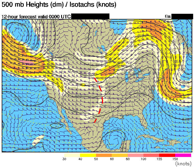
500mb -
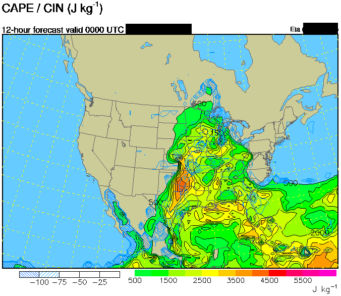
CAPE -
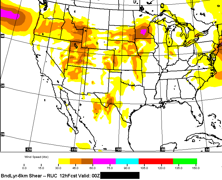
Bndry - 6km Shear -
Hopefully I don't screw this up too bad ... it's definitely not as easy as it looks.
1. This day resulted in a possible well-known event, or a possible well-known bust.
2. The possible target(s) for this day may have been in the plains, or may have been deeper in the Midwest.
3. This event/non-event may have occurred during 2005, or it may have occurred during another year.
We'll start with just three basic maps - which have enough information to give you some idea of where to start. Forecast times are noted on the maps, so you should be able to figure out time frames here. More clues will be given later, as I have time to post.
The first person who comes up with either a target that produced a tornado, or the conclusion that the day was a bust have first option at running the next round if they want.
Start naming your targets:
500mb -
CAPE -
Bndry - 6km Shear -
Hopefully I don't screw this up too bad ... it's definitely not as easy as it looks.
")

