7/12/06 DISC: NJ / NY / CT

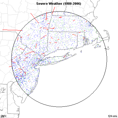
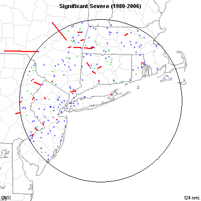
Yes, although this isn't "typical" weather for the area, we've had our share of tornadic activity. And also after looking at the video again i'm leaning more towards what Dan said and that the video shows more rain/debris than actual funnel on the ground.
 
I can't figure out why this is being downplayed by the local media. It's as if they're afraid to admit that yes, this was a tornado, right here in Westchester. The Westchester event is being ignored almost totally by the local newspaper (New Haven Register). They relegated it to a few brief lines buried in an article that's mainly about a local kid getting knocked unconscious by lightning. About the Westchester storm they say only "there were some reports of a tornado in Westchester." And that's it, there's nothing about collapsed buildings, or police cruisers being tossed - there's no mention of damage at all! Weird. Usually they tend to hype these things up until everyone's hysterical.
 
WHOA!!!! Path Length of 15 Miles and a width of 200-300 yards is very rare for the Northeast!!! Looks like we were right in calling this thing an F2 judging by the damage and images of the tornado on pics and video. SEE INITAL STORM SURVERY BELOW:

NOUS41 KOKX 132157
PNSOKX
CTZ005>012-NJZ002>006-011-NYZ067>081-141800-

PUBLIC INFORMATION STATEMENT
NATIONAL WEATHER SERVICE UPTON NY
557 PM EDT THU JUL 13 2006

...F2 TORNADO CONFIRMED IN WESTCHESTER COUNTY...

THE NATIONAL WEATHER SERVICE IN UPTON NEW YORK HAS CONFIRMED THAT A
TORNADO TOUCHED DOWN IN WESTCHESTER COUNTY ON WEDNESDAY JULY 12,
2006. THE TORNADO WAS RATED AS AN F1 IN THE TOWN OF SLEEPY HOLLOW IN
THE SOUTHWEST PORTION OF THE COUNTY...THEN MOVED THROUGH POCANTICO
HILLS WHERE...AT ITS STRONGEST POINT...IT WAS RATED AN F2. IT
CONTINUED MOVING IN AN EASTERLY DIRECTION AS AN F1 THROUGH THE TOWNS
OF HAWTHORNE AND MOUNT PLEASANT. THE TORNADO THEN MOVED INTO THE
KENSICO RESERVOIR...STILL AS AN F1...BEFORE IT MOVED INTO THE
GREENWICH AREA OF FAIRFIELD COUNTY. THE TOTAL PATH LENGTH OF THE
STORM WAS APPROXIMATELY 15 MILES LONG WITH A WIDTH OF 200 TO 300
YARDS.

THE INVESTIGATION IS STILL UNDERWAY IN CONNECTICUT AT THIS TIME.

$$[/b]
 
Yep, that's pretty impressive for these parts. But by no means unheard of, and really not even all that rare.
Here's a couple of maps from NWS Upton that help put this event into perspective:

Tri-State Area Severe Weather (1980-2004)
OKX6.gif


Tri-State Area Significant Severe (1980-2004)
OKX7.gif


And that's just since 1980. Historically we've definitely gotten our share of significant tornadoes.
 
WNBC-4 in New York City also mentioned that funnel clouds had been spotted in Bergen County NJ with some of yesterday's storms.
 
THE NATIONAL WEATHER SERVICE IN UPTON NEW YORK HAS CONFIRMED THAT A
TORNADO TOUCHED DOWN IN WESTCHESTER COUNTY ON WEDNESDAY JULY 12,
2006. THE TORNADO WAS RATED AS AN F1 IN THE TOWN OF SLEEPY HOLLOW IN
THE SOUTHWEST PORTION OF THE COUNTY...THEN MOVED THROUGH POCANTICO
HILLS WHERE...AT ITS STRONGEST POINT...IT WAS RATED AN F2.
[/b]

Question-did this tornado start out as a waterspout by the Tapanzee Bridge, or was the waterspout a separate funnel entirely?
 
Question-did this tornado start out as a waterspout by the Tapanzee Bridge, or was the waterspout a separate funnel entirely?
[/b]

Saul:

This tornado started out as a waterspout over the Hudson River (Tappan Zee Bridge). From everything I could tell, including watching the cell on radar live, it was definitely the same storm and likely the same waterspout that became a tornado as it moved onshore. The path length of the tornado was 15 miles, which is impressive since it did not skip. It certainly qualifies a long-lived tornado in my book...esp. for New York State.

PS: The NWS did mention in an LSR that funnel clouds were indeed observed yesterday in NJ also.

THE NATIONAL WEATHER SERVICE IN UPTON NEW YORK HAS ALSO CONFIRMED
THAT A TORNADO TOUCHED DOWN IN FAIRFIELD COUNTY ON WEDNESDAY JULY
12, 2006. THE TORNADO WAS RATED AS AN F1 IN NORTHERN GREENWICH. MORE
INFORMATION ON THIS TORNADO WILL BE AVAILABLE LATER.[/b]

An F1 in Fairfield County, CT. Interesting. This was definitely the same supercell that caused both tornadoes. If my memory serves me right, the supercell weakened as it entered CT and then restrengthened. That's when tornado #2 formed.
 
Saul:

This tornado started out as a waterspout over the Hudson River (Tappan Zee Bridge). From everything I could tell, including watching the cell on radar live, it was definitely the same storm and likely the same waterspout that became a tornado as it moved onshore. The path length of the tornado was 15 miles, which is impressive since it did not skip. It certainly qualifies a long-lived tornado in my book...esp. for New York State.

PS: The NWS did mention in an LSR that funnel clouds were indeed observed yesterday in NJ also.
An F1 in Fairfield County, CT. Interesting. This was definitely the same supercell that caused both tornadoes. If my memory serves me right, the supercell weakened as it entered CT and then restrengthened. That's when tornado #2 formed.
[/b]


Hmmm.

I wonder how big the parent thundercloud was for the Westchester/Greenwich twister. Any way of knowing?
 
...the same waterspout that became a tornado as it moved onshore[/b]
[emphasis mine]

Of course not. The tornado was always a tornado. It was just hitting different types of surfaces at different times in its lifecycle.
 
Of course not. The tornado was always a tornado. It was just hitting different types of surfaces at different times in its lifecycle.[/b]

With all due respect since to your expertise in the severe weather field, I'm not so sure the "tornado was always a tornado." I know what you are talking about but what is the texbook answer?

The vortex originally began as a waterspout over the Hudson River (the 1st location of the of vortex from what I have read). The river near the Tappan Zee Bridge is around 1-1.5 miles wide. This waterspout then became a tornado as it reached land on the East side of the Hudson River. At that point it technically becomes classified as a tornado by definition. Am I wrong or overlooking something?

Some questions....

Is there some minimum size of a body of water that distinguishes between a waterspout or tornado. In other words, is it a waterspout whether it is over a smaller Lake or only when it is over a larger body of water such as Lake Erie/Biscayne Bay/Lake Okeechobee?

I'm interested in everyone's thoughts and opinions......

I wonder how big the parent thundercloud was for the Westchester/Greenwich twister. Any way of knowing?[/b]

Saul...I'm not sure what you mean by this. If you get the archived doppler radar images you can find the cloud tops, size of the storm visually, etc... I imagine the NWS OKX will have some images on the webpage when they complete a storm summary report.
 
Actually, if you look at the PNS on the tornado, it started over land before it crossed the river:

THE TORNADO INITIALLY TOUCHED DOWN IN GRAND VIEW ON-THE-HUDSON IN ROCKLAND COUNTY AT APPROXIMATELY 330 PM. AFTER DAMAGING A DOCK ON THE ROCKLAND SIDE SHORELINE...THE TORNADO MOVED ACROSS THE HUDSON RIVER...OVERTURNING A BOAT ON THE RIVER NEAR THE TAPPEN ZEE BRIDGE BEFORE MOVING INTO THE TOWN OF SLEEPY HOLLOW IN WESTCHESTER COUNTY AT APPROXIMATELY 337 PM.[/b]

The full PNS is available at:

http://kamala.cod.edu/ny/latest.nous41.KOKX.html

As to the nomenclature, I suppose you could say it was a tornado while over land and a waterspout while over water, though being associated with a supercell, the process that produced it was one we would typically associate with tornadoes, different from that which produces most waterspouts.
 
I just did a rudimentary damage survey of the area for a few hours yesterday. I was able to confirm about 9 miles of the damage path (I stopped at the Kensico Reservoir, but there was probably more damage after that). I did not see any damage that I would estimate was more than F1. Actually, I was a little surprised to see tree damage listed in the NWS official F-scale estimate...isn't the F-scale technically reserved for man-made structures only? Anyway, I based my estimates from tree damage I've seen in known hurricane windspeeds.

Worst damage I saw was at the Summit corporate park, where the Fuji Building lost a lot of glass and some fascade. Surprisingly, I wasn't able to find much damage in Sleepy Hollow, where the tornado first came ashore from the Hudson River.

http://www.facethewind.com/chase2006/damage_survey
 
. Actually, I was a little surprised to see tree damage listed in the NWS official F-scale estimate...isn't the F-scale technically reserved for man-made structures only? Anyway, I based my estimates from tree damage I've seen in known hurricane windspeeds.

[/b]


Thanks for sharing those Dave! It's hard to say with tree damage...I would agree with your assessment of mainly F0-F1 damage in your shots, although the pictures of the snapped and uprooted pine trees was impressive.
A quick look in the back of Storm Data and the definition of the F-scale does include tree damage in the description..."...Large trees snapped or uprooted", so by that and your photos, the pine tree damage looks possibly low end F2 to me anyway...and I'll insert the usual blah blah blah about trying to rate damage from pictures here.

Rob
 
Back
Top